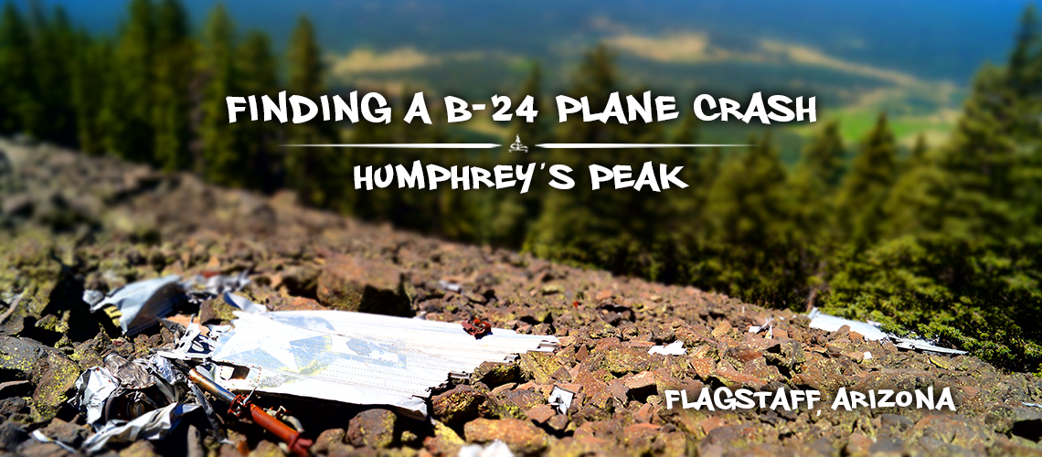
Plane Crash on Humphreys Peak Trail | B-24 Bomber
Humphreys Peak Trail is a very popular trail in the Flagstaff area. Not only does it provide gorgeous panoramic views but it is also notably the highest point in Arizona, at 12,633 feet. As I was looking for alternative, less popular routes for reaching the summit I stumbled upon some interesting history in the area about a plane crash on Humphreys Peak Trail. The more we looked into it, we found that there are still a lot of the planes remains on the mountainside. And we also found that people successfully hike to it. So after a little bit of research and assistance from Google Earth, we set out to find it!
History
The plane crash on Humphreys Peak Trail was actually a TB-24J Liberator from WWII. On September 15, 1944 eight US servicemen were on the B-24, cleared for a training night flight en route from Bakersfield, California to Kirtland Field, New Mexico. Story goes that the conditions were very cloudy and they misjudged where they were by 15 miles north of the airway. They then crashed into the west side of Humphreys Mountain. between 11,000 and 12,000 feet elevation. Unfortunately, all eight of the crew members died.
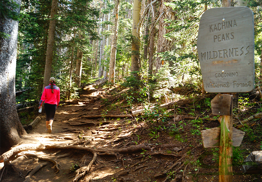
Basic Info: Finding the Plane Crash on Humphreys Peak Trail
Directions: From Flagstaff, follow the AZ-180 N for 6.6 miles before turning right onto Snowbowl Road. Follow Snowbowl Road for 6.5 miles before it ends at the Snowbowl Ski Area. The large parking area for Humphreys Peak Trail is on the left.
Difficulty: Moderately strenuous; steep and rocky
Distance: About 7 miles roundtrip
Our Experience Finding the B-24 Bomber
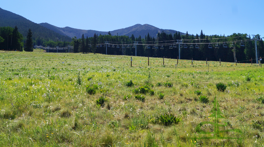
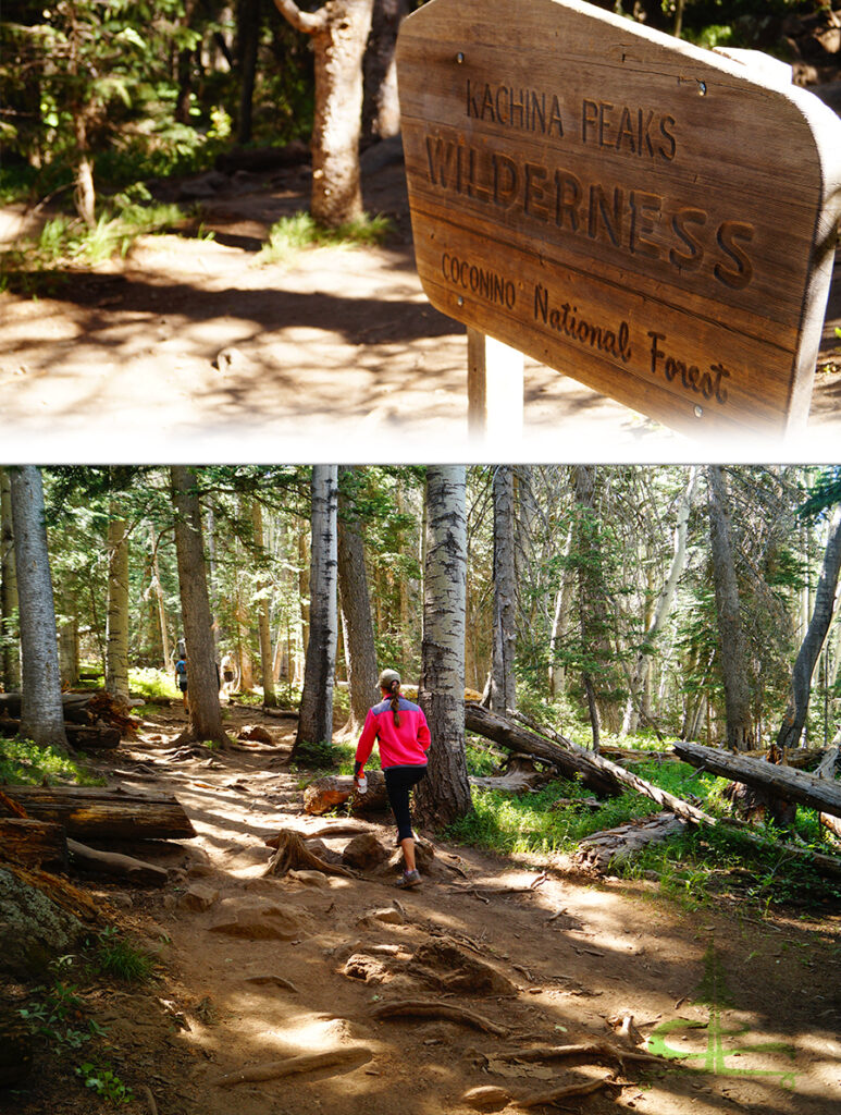
When we previously summited Humphreys Peak, we reached it via Inner Basin Trail. So beginning at Humphreys Peak Trail was all new to us. We started from the busy parking area and crossed the ski area, now filled with beautiful wildflowers. We followed the trail into the woods and that’s where the climbing begins.
To find the plane crash on Humphreys Peak Trail, we followed the main trail for just shy of three miles. This section of the trail is a beautiful trail through the woods with lots of rocks and roots underfoot. And it continuously climbs up numerous switchbacks. When we reached the curve of the switchback near the three mile mark, we left the main trail.
Liking this Article? Pin it!

First, we noticed a rocky section of loose rocks and then we noticed the faint trail and cairns leading away from the main trail. It lined up with our coordinates and the direction our compass was telling us to go so we set off on our adventure to find the plane crash!
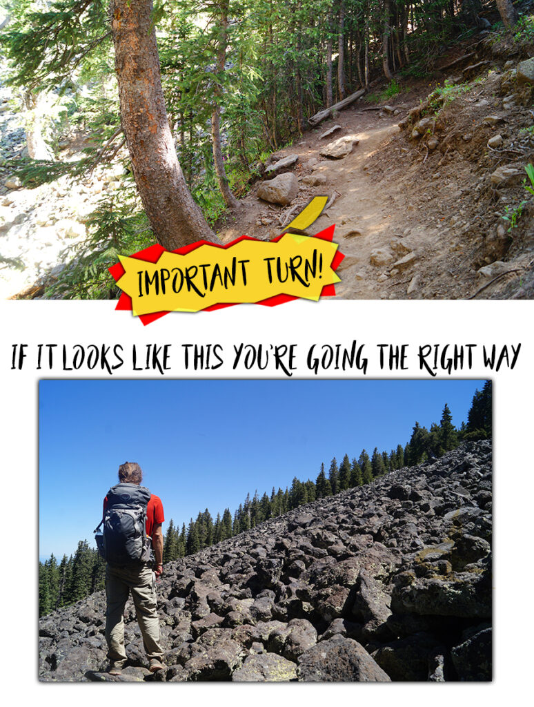
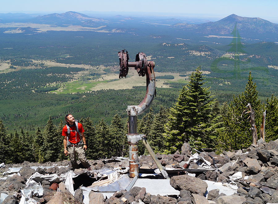
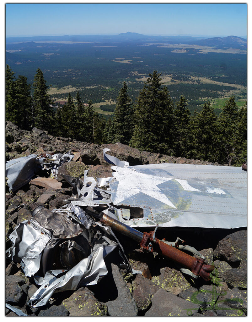
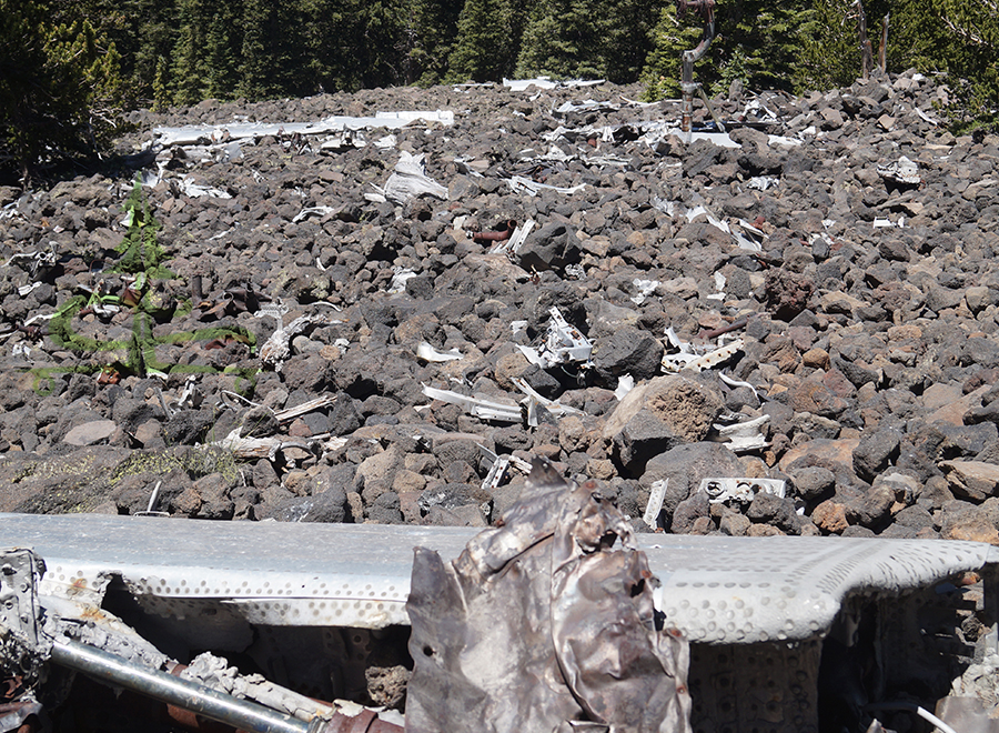
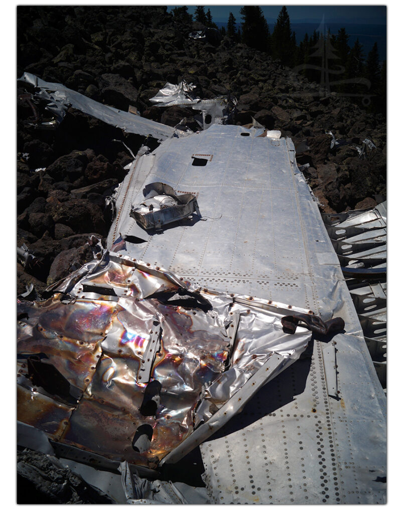
The faint trail crossed the rocks, passed through the woods on the steep hillside and was pretty consistently marked with cairns. After about 0.3 miles we reached another exposed area of steep rocky mountainside. In the distance, we noticed something shining in the sun. We said aloud, there’s no way we we made it to the plane already… But then we looked around and saw more and more pieces of the plane scattered about. We couldn’t believe how easy it was to find the plane crash on Humphreys Peak Trail!
Exploring the Plane Crash Remnants
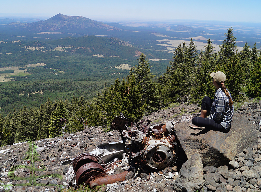
From here, we walked carefully on the loose, jagged rocks on the steep mountainside to the various pieces scattered around. We were surprised to find so many pieces and parts all over!
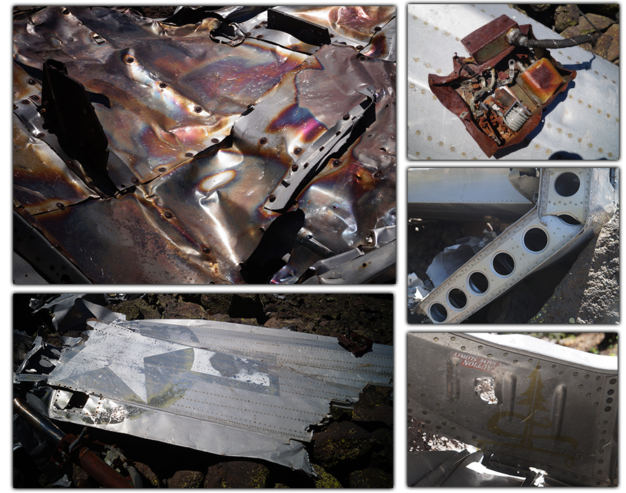
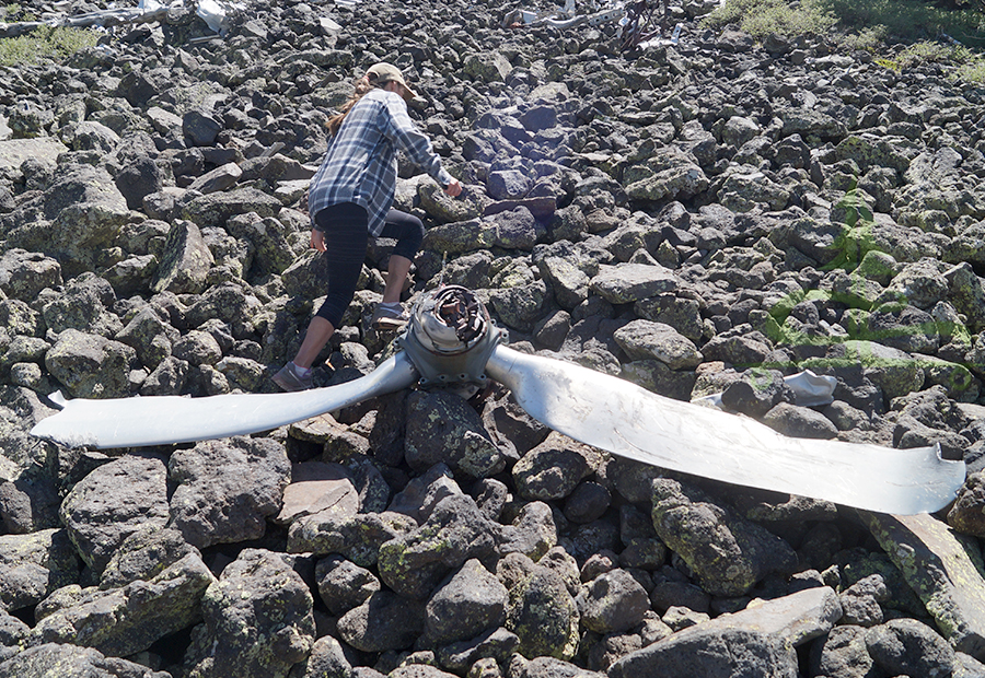
We found parts of the engines, fuselage pieces, propellers, aluminum with rivets, landing gear, wing with the USAAF star and bar insignia, and more.
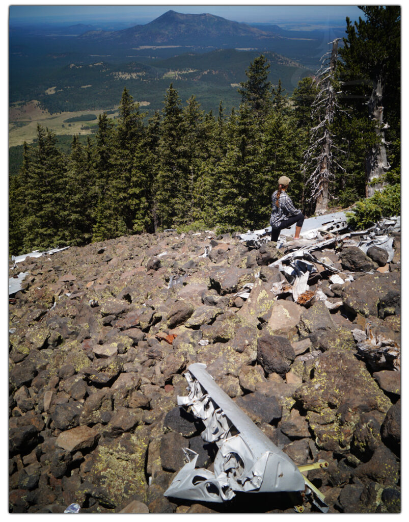
After we checked out the remains of the B-24 Bomber and took in the gorgeous vast scenery below, we headed back the way we came. We rejoined Humphreys Peak Trail and made our way down the switchbacks to the parking area.
All in all, this was a unique adventure! It had a mysterious element to it, wondering if we would even find what we were looking for. And it also had a somber element to it, remembering the men who lost their lives in that plane. Of course, it was very interesting as well to see the parts of a B-24 75 years after it hit the mountainside.
Thanks for Reading!
We hope you enjoyed this article about our unique adventure to the plane crash on Humphreys Peak! If you’d like to read about some of our other adventures, check out the articles below:
- Rattlesnake Canyon Hike in Joshua Tree
- Backpacking Lassen Volcanic National Park
- Hiking to Mystic Lake in Montana
While we are on the road we stay busy creating hand painted longboards! If you’d like to pick up a unique new longboard, head over to our Lost Coast Longboarding Shop to see our latest lineup. We also design and screen print our own t-shirts and long sleeve shirts.

Thank you for your support! If you shop on Amazon, you can help us out by using our link to get to Amazon. Then shop as you normally would! It won’t affect your shopping experience but it helps us out. Thank you!