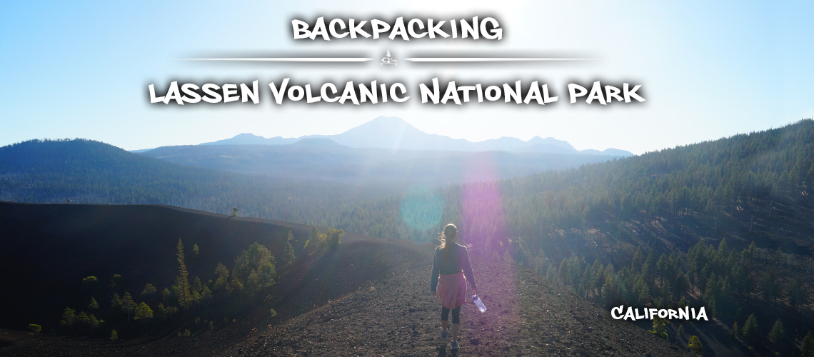
Backpacking Lassen Volcanic National Park
Lassen Volcanic National Park is full of beautiful, unique, and interesting sights, sounds, and features. As you look at the map of Lassen Volcanic National Park you’ll notice attention catching names such as Fantastic Lava Beds, Devil’s Kitchen, and Cold Boiling Lake that beckon to be seen. Backpacking Lassen Volcanic National Park is an amazing way to see some of these amazing park features!
Another thing that you may notice while looking over the map is the relatively manageable size of the national park. Though there are five different access points into the park, the distances via trails between points of interest can easily be combined and designed to see Lassen Volcanic National Park’s backcountry and some of its main features on foot!
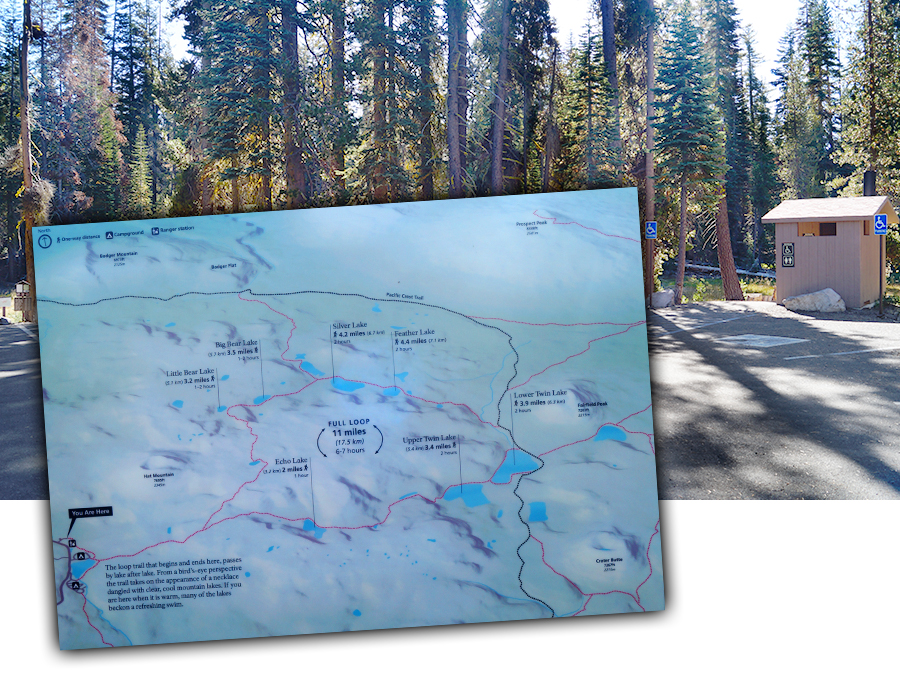
A really cool thing about the park map is that it’s the only one you’ll need to hit the trails. The map (given to you as you enter the national park) has all of the main trails and the back country trails as well as the distances from point to point along the trails. This is a very convenient feature and makes planning hikes and backpacking trips much easier. It also allows for manipulation of routes to ensure the best trails to take to see the parks features that interest you the most. And once you’re out on the trails you’ll find that the signs are plentiful and informative.
So grab a map, create your perfect volcanic backcountry adventure and start exploring! You’ll be glad that you did.
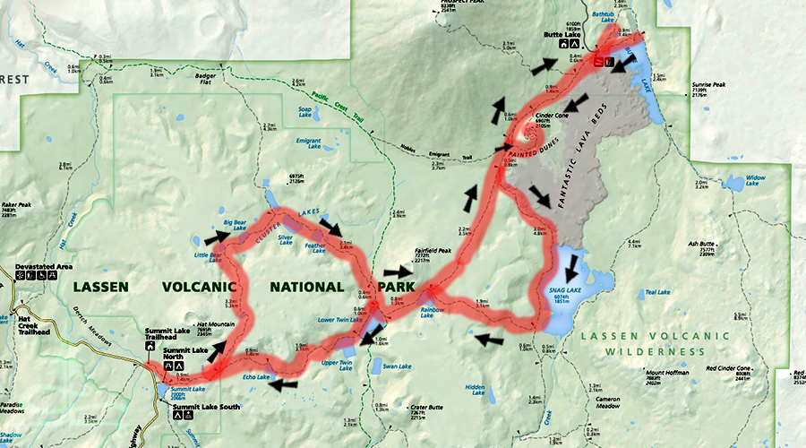
Taking into consideration the features of the park we’ve already seen as well as day hikes that we have planned for the future, this is the route we chose for backpacking Lassen Volcanic National Park.
Our Route for Backpacking Lassen
Highlights:
- 2 loops making for very little trail repetition
- so many lakes! (keep reading to see which were our favorites!)
- awesome volcanic features (Fantastic Lava Beds, Painted Dunes, Cinder Cone…)
- solitude
Distance: 35 miles roundtrip including side explorations
Difficulty: moderate; some sections were easy, some strenuous so overall moderate
Directions:
- From the Kohm Yah-mah-nee Visitor Center drive about 16 miles on Lassen Volcanic National Park Highway. Then turn east (right) at the signed Summit Lake Trailhead.
- From Manzanita Lake entrance station, follow Lassen Volcanic National Park Highway about 12 miles before turning west (left) towards Summit Lake Trailhead parking area.
Trailhead Amenities: trash can, vault toilets, ranger station, campground nearby
Permits: A backcountry permit is required for all overnight backcountry travel. The permit is free and can be obtained at the visitor centers and ranger stations. The permit process for backpacking Lassen is straightforward and hassle free.
Backpacking Lassen Daily Breakdown:
- Day 1:
-Summit Lake Trailhead to Campspot #1: 9.1 miles
-Camp to Cinder Cone Summit (without our packs): 4 miles roundtrip - Day 2:
-Campspot #1 to Butte Lake: 8.8 miles roundtrip (dropped our packs at intersection)
-Intersection to Campspot #2: 6.1 miles - Day 3:
-Campspot #2 to Swan Lake (and Crater Butte attempt): 2.4 roundtrip
-Campspot #2 to Summit Lake Trailhead: 4.6 miles
Our Experience Backpacking Across Lassen Volcanic National Park
Day One
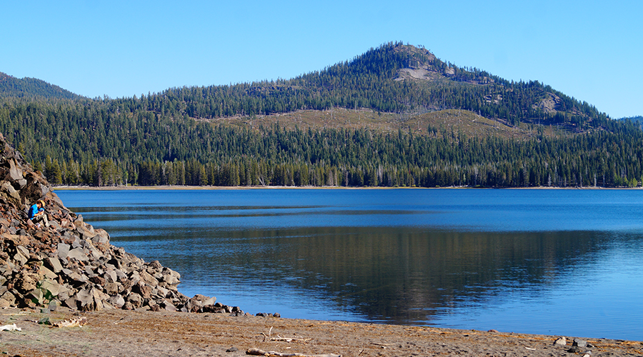
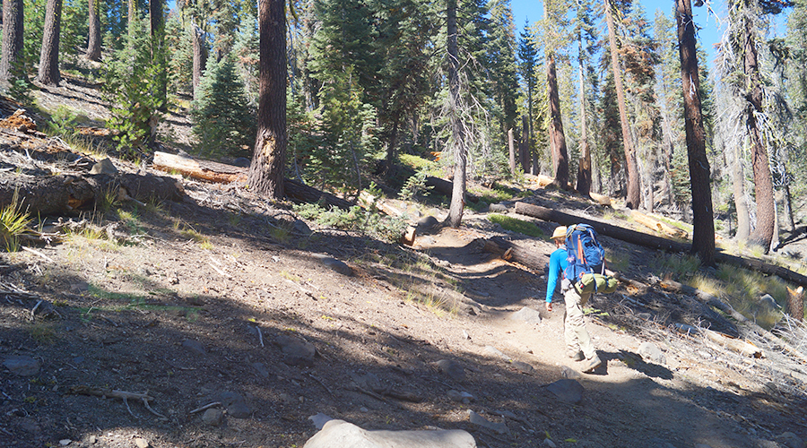
We began our backpacking Lassen adventure at Summit Lake Trailhead. And as we began, the trail crossed a boardwalk through the trees then within a half mile we arrived at the northeast shore of Summit Lake.
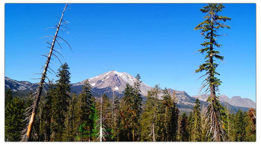
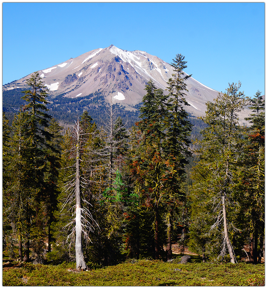
From here the trail climbed steeply to a beautiful manzanita and conifer covered hilltop. The views of Lassen Peak and Brokeoff Mountain from this point were beautiful!
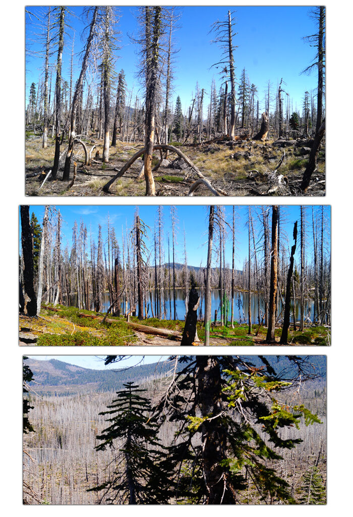
At the next intersection we made the decision to take the longer northern segment of Cluster Lakes Loop first, leaving the shorter portion for our return trip. We turned left here and followed the trail as it descended towards Little Bear Lake. Suddenly we realized that we had entered a section of forest that was affected by a recent wildfire. This gave the hike a fall-feel, being among the leafless trees.
About 3.7 miles from Summit Lake we arrived at Little Bear Lake. We stopped for a snack and skipped some rocks that Shane had been collecting along the way.
From here the trail remained mellow as it meandered through the recovering forest and passing a sequence of lakes: Big Bear, Cluster, Silver, and Feather.
The forest became greener and more alive as we neared the intersection with the PCT and arrived at the north shore of Lower Twin Lake.
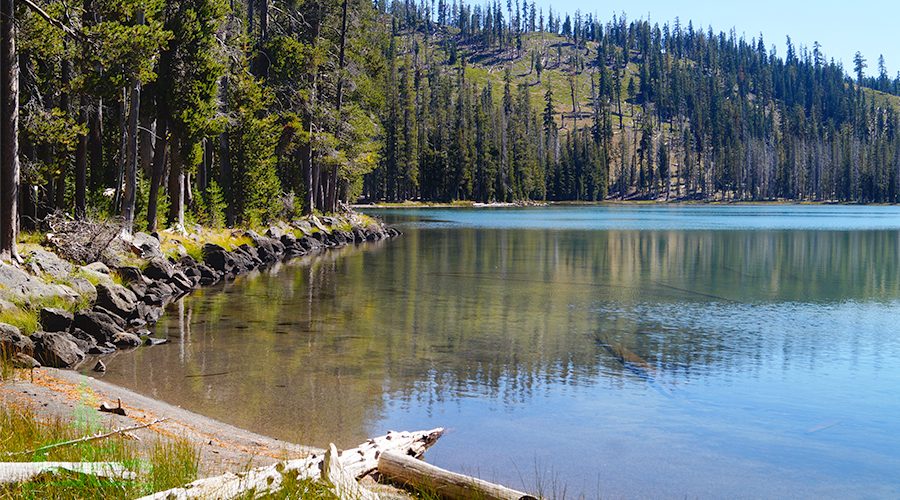
Lower Twin Lake was large and beautiful, our favorite up to this point of the trip. We ate lunch here and enjoyed the scenery and sunshine.
We followed the shore for a short time before we headed east at the next intersection toward Rainbow Lake. Rainbow Lake was pretty and we saw a good looking camp spot nearby but we kept on.
Liking this article? Pin it!
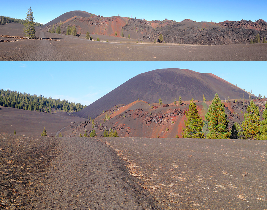
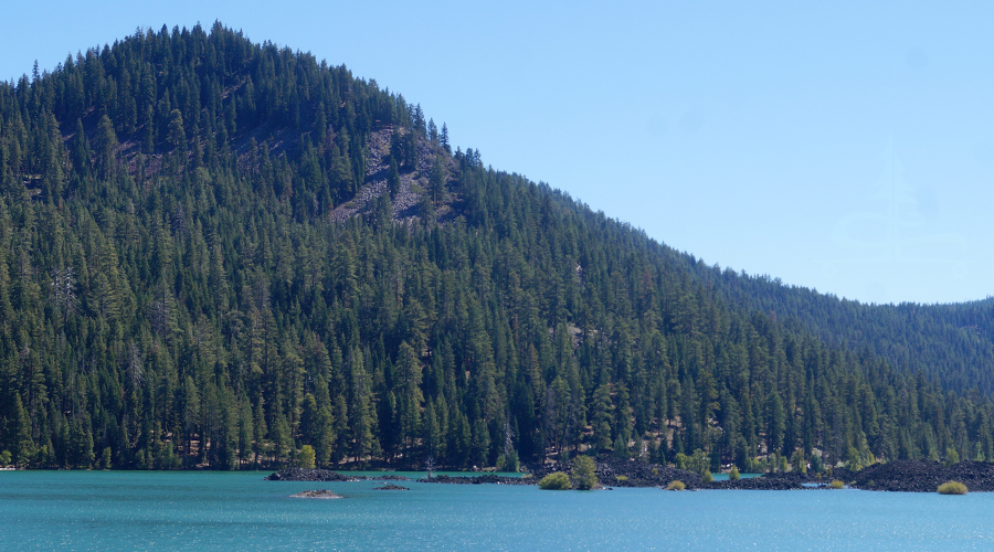
At the intersection on the northeast shore of Rainbow Lake we took a left toward Cinder Cone and Butte Lake. The trail returned to an area of recovering forest and suddenly there were black cinders underfoot! We knew then that we were getting closer to the volcanic features that we were so excited to check out.
Before we got too close to the restricted camping area near the Cinder Cone and Fantastic Lava Beds we chose a spot to set up camp, making sure we’d get early morning sun. We set up camp, snacked, and then left everything behind as we headed out to explore.
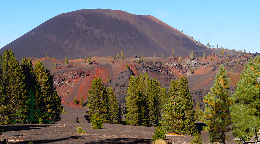
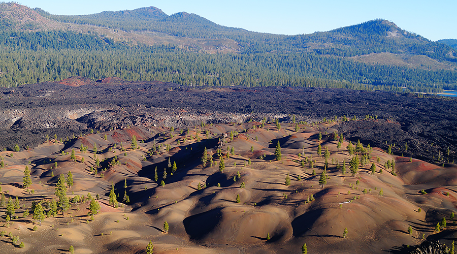
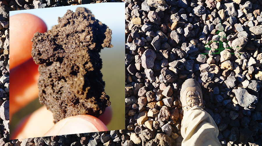
As we continued on we were amazed to see the red-orange and black lava rocks towering above the cinder trail below. We stared as we absorbed the beauty of the contrasting colors and the unique shapes of the rocks making up the Fantastic Lava Beds. The surrounding cinder fields were a sight to see as well!
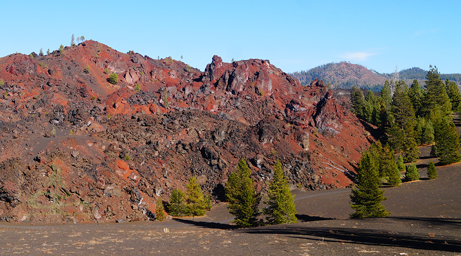
Towering over the Fantastic Lava Beds was Cinder Cone.
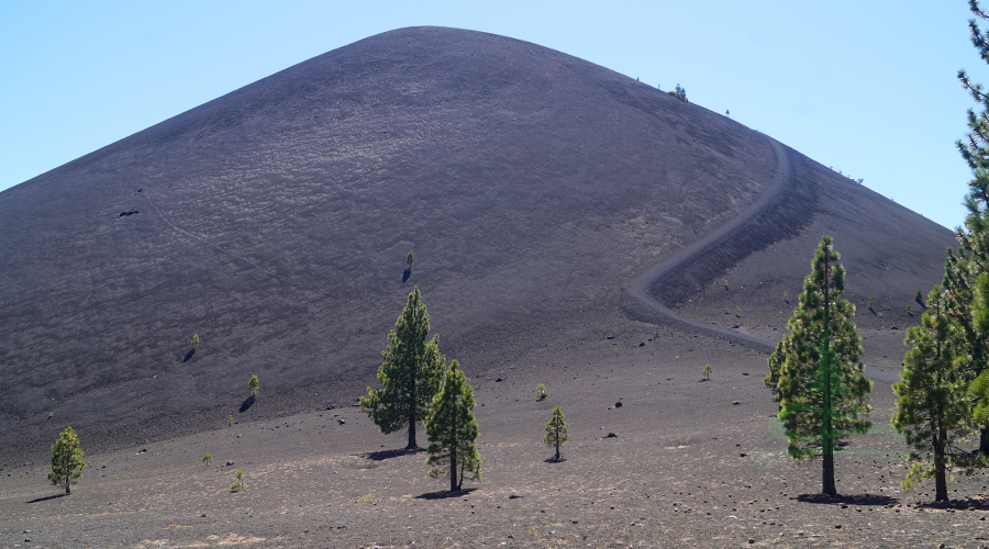
We followed the cinder path, each step crunched as we walked on the loose cinder, toward Cinder Cone Trail.
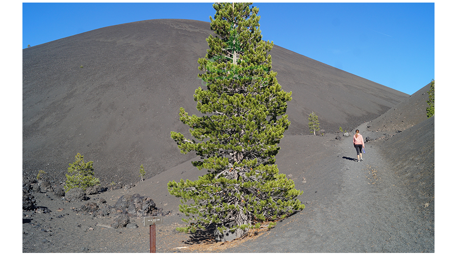
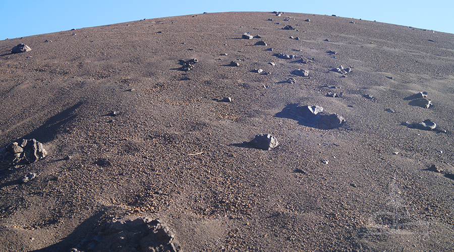
The trail quickly became steep and then became dramatically more steep!
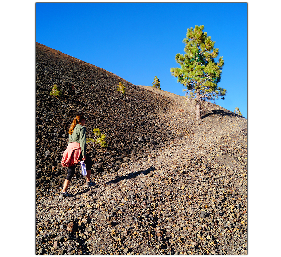
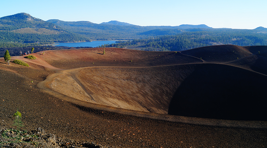
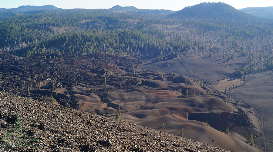
As we gained elevation we looked down on the Fantastic Lava Beds and the Painted Dunes. The colors and the expanse were stunning and appeared otherworldly.
We struggled up the steep cinder trail and finally reached the top. Whoa.
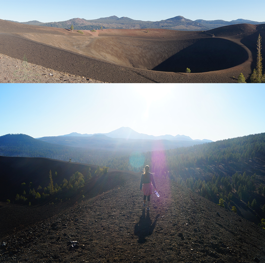
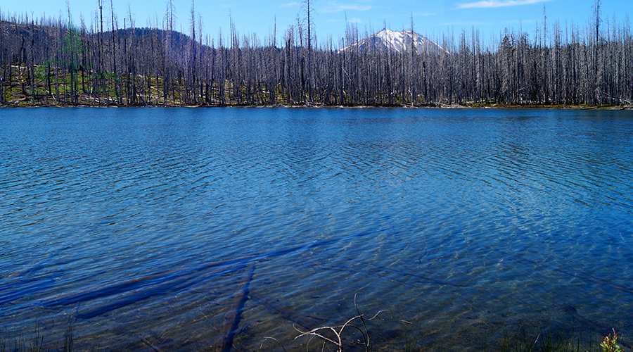
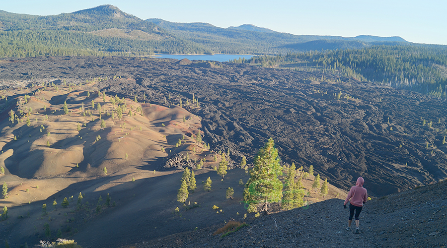
Cinder Cone has trails circumnavigating the rim and the inner sides and there is also a trail descending into the steep crater like depression. The view of Cinder Cone itself was enthralling plus it provided a vast panoramic vantage point where we overlooked the Fantastic Lava Beds, Painted Dunes, Butte Lake, Snag Lake and the green rolling forest. It was so cool seeing where the lava flow met the lake at both Butte and Snag Lakes as well as where the lava flow and forest had a dramatic meeting.
We explored the Cinder Cone and enjoyed the 360 degrees of captivating scenery before we descended. The descent was quiet an experience, half sliding half walking down the steep loose cinder path.
Once at the bottom we followed the trail back to camp and called it a day.
Day Two
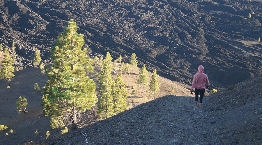
The morning of Day 2 on our backpacking Lassen adventure we ate breakfast and packed up camp. We walked to the intersection (highlight) near the Fantastic Lava Beds and dropped off our stuff. We packed up a day bag then followed the cinder path through the cinder fields past Cinder Cone towards Butte Lake.
The trail past Cinder Cone became a little more wooded, providing some shade though it was still cinders underfoot. It was a beautiful stroll. There are interpretive markers on the trail and the informative brochure can be picked up at the Cinder Cone Trailhead.
We made it to the shore of Butte Lake! There were vault toilets, picnic tables, a boat launch, and fire rings. Further up the road there is a campground and a ranger station. First, we followed the Bathtub Lake Trail (on the NE side of the large parking lot) for about 1/2 mile before heading back where we picked up the Butte Lake Trail.
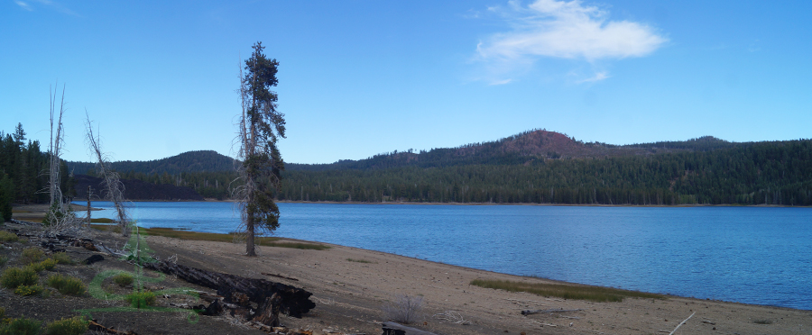
Butte Lake was awesome! We thought it was fascinating to see how the lava beds oozed to the lake and created a long lava shoreline along an already majestic lake. The lava shoreline was jagged and the black lava jutted out into the striking blue waters. There were also cool lava island out among the water and cool inlets along the lava shoreline. We ate lunch near the shore and Shane spotted a skinny snake swimming to the lakeside. Pretty neat.
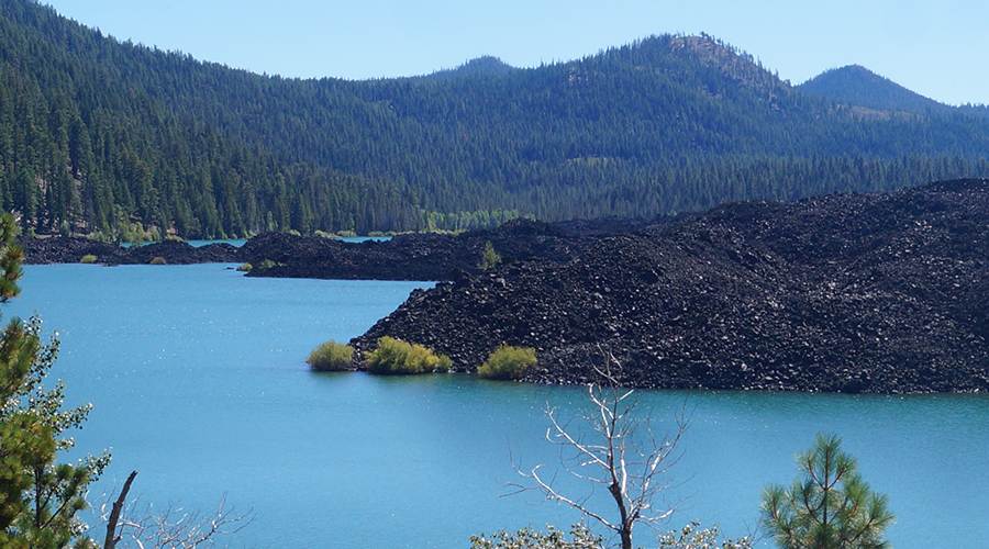
We headed back to the intersection where we left our packs. From the intersection we headed southeast towards Snag Lake. The trail followed the edge of the Fantastic Lava Beds. The path was still loose cinder but rose and fell as it meandered through the woods. The trail led us to where the lava bed met the clear blue waters of Snag Lake.
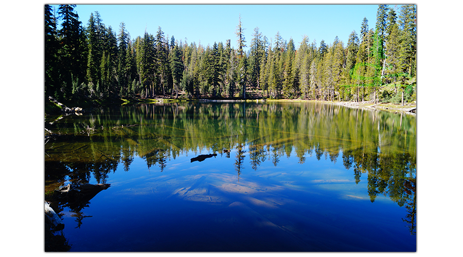
Snag Lake was huge and it was gorgeous! Part of the shore was made up of lava beds, some of the shoreline had quaint sandy beaches and the shoreline in the distance was beautifully forested. We stopped to enjoy the view of the lake and rejoined the trail.
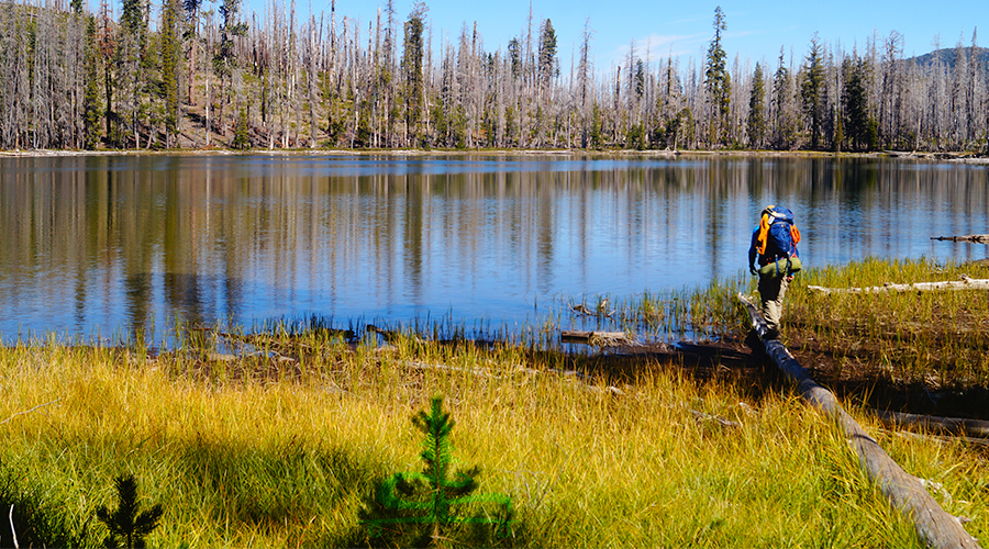
The trail followed the shoreline and was mellow. It granted us ever changing beautiful views of Snag Lake from multiple angles as we hiked. The forest around us turned back into a recovering forest as we reached out next intersection. Snag Lake was decidedly one of our favorite lakes on this trip and we noticed several good campsites here too. But at the next intersection we turned right in the direction of Rainbow Lake.
This part of the trail climbed steadily through the woods up and over a small ridge. We saw several deer here. We reached the shore of Rainbow Lake and followed it around. Rainbow Lake was also a notably pretty lake.
The trail climbed before reaching the intersection with the PCT. And then we found ourselves back to the beautiful Lower Twin Lake! From here, we continued about 0.4 miles before turning left at the intersection, as if we were following the PCT, and quickly found a camp spot. We saw a few more deer, set up camp, had dinner and played cards.
Day Three
That morning we packed up camp but left our bags behind and set off to attempt a side adventure. We followed the PCT up a few switchbacks and through the woods for about a half mile where we saw Swan Lake. At the intersection we followed the trail towards Horseshoe Lake for about 0.7 miles.
We were looking for a route up the nearby Crater Butte to see the lake/pool that is said to exist at the top. With no clear route, lots of downed trees, no food with us and only one water bottle we decided to turn back without summiting Crater Butte this time.
We collected our packs and picked up the trail along the south shore of Lower Twin Lakes. The trail stayed close to the shoreline and allowed us views of Lower Twin Lakes for many different points around the lake, and it is truly a beautiful lake!
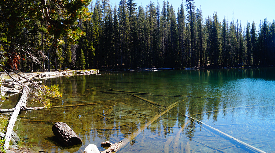
Almost immediately after leaving Lower Twin Lake, the trail reached Upper Twin Lake. Upper Twin Lake was gorgeous too! It seemed to be a little smaller but we enjoyed each angle of it as the trail paralleled the north shore. After Upper Twin Lake the trail climbed through the woods, up switchbacks, past two small lakes before we reached Echo Lake.
Echo Lake was also very beautiful and the waters inviting. Just something to note, there is no camping at Echo Lake. From Echo Lake the trail climbed some more before reaching the beautiful open expanse of trees, manzanitas, blue sky and the two familiar peaks: Lassen and Brokeoff. The trail then passed the intersection from which our loop began two days ago.
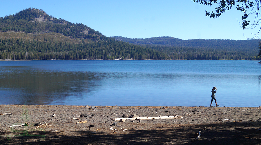
The trail descended steeply until we reached Summit Lake! We decided to go for a dip before making it back to the parking area.
What An Adventure!
We found this backpacking Lassen trip to be a great way to explore Lassen Volcanic National Park. There were so many lakes! And such few people, with the exception of at Cinder Cone. The diversity and the difficulties of this trip kept it very engaging and seeing the volcanic features along the way kept it interesting.
Shane really loved Cinder Cone and the view from Cinder Cone of the Fantastic Lava Beds and Painted Dunes down below.
I really enjoyed Butte, Snag, Upper and Lower Twin Lakes.
As I mentioned before, it is not necessary to backpack to see these awesome landmarks within the park. But it sure makes for an amazing adventure! If you’d like to see some more awesome day hikes in Lassen National Park, check out the articles below:
- Incredible Warner Valley Trails
- Summit Hike: Brokeoff Mountain
- Bumpass Hell + Cold Boiling Lake and Crumbaugh Lake
Thanks for Reading!
If you’d like to support The Lost Longboarder, head over to our Lost Coast Longboarding Shop to see our latest line up of hand painted longboards! We also design and screenprint our own t-shirts and longsleeves while living on the road full time.

And if you shop on Amazon, please use our link to get to Amazon. Then shop as you normally would! We appreciate it 🙂