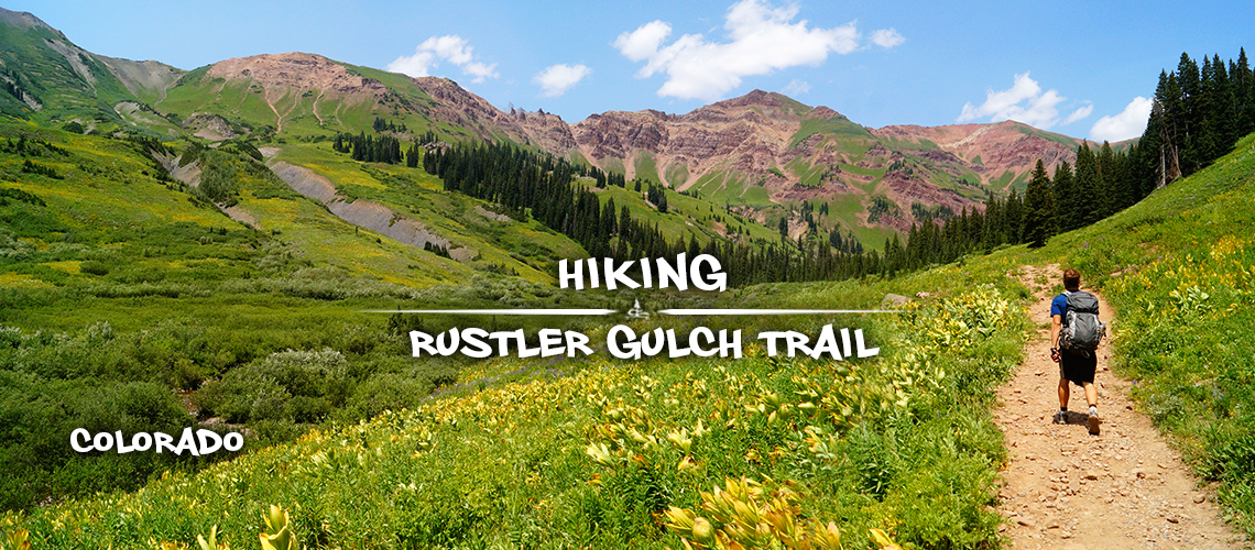
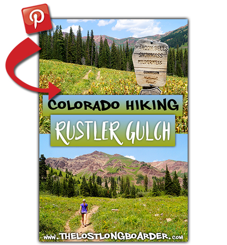
Rustler Gulch Trail | Hiking in Crested Butte
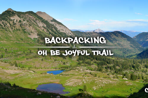
After backpacking Oh Be Joyful Trail, we couldn’t wait to see more of the gorgeous alpine scenery in the Crested Butte area! With so many trails to choose from we finally decided on hiking Rustler Gulch Trail. Rustler Gulch Trail is in the Maroon Bells – Snowmass Wilderness which we hadn’t visited yet. So we were super excited to experience and feast our eyes on a completely new area! And it didn’t let us down!
Quick Info: Hiking Rustler Gulch Trail
Directions: From Crested Butte, follow Co Rd 317/Gothic Rd N for 10.5 miles and turn right onto Rustler Gulch Road. Follow the access road for 0.1 miles to the East River. Small cars can park here before the river crossing. Otherwise, check the water level and then drive across the river. Park here or continue on the moderately steep, narrow road for another mile to the trailhead parking area and sign.
Parking Options: The road to the trailhead, Rustler Gulch Road, requires a high clearance/4WD vehicle. There is parking along Co Rd 317 before turning onto Rustler Gulch Road. Or there are also some parking spots just after turning onto Rustler Gulch Road. If you go a bit further and cross East River, there are a few spots here as well. Then there is a steep, winding hill with some relatively minor rocks and bumps. Just after the top of the hill, there are a few random campspots/pull offs. This is where we decided to park and then walked the final half mile or so to the trailhead. As we were walking, we found that this section of the road had some deep ruts! But we counted seven vehicles parked up at the actual trailhead so it’s definitely doable with the right vehicle.
Trailhead: Rustler Gulch Trail begins behind the metal gate. At the trailhead, there is parking for about 9 vehicles. There is also a overnight registration box. Also good to know, the trail to Bellview Mountain branches left just before the metal gate.
Distance: About 8 miles roundtrip; but mileage varies based on where you park and where you decide to turn around. If you park before the East River crossing, the walk on Rustler Gulch Road to the trailhead is about 1.1 additional miles one way.
From the Rustler Gulch Trailhead, our hike ended up being about 10 miles roundtrip.
– Parking Spot to Trailhead: 0.5 miles
– Trailhead to Waterfall Junction: 2.8 miles [3.3]
– Junction to Waterfall: 0.3 miles [3.6]
– Waterfall to Junction: 0.3 miles [3.9]
– Junction to Mining Site Remains: 0.5 miles [4.4]
– Trails End at The Upper Basin: 0.5 miles [4.9]
Difficulty: Easy to Moderate
Our Experience Hiking Rustler Gulch Trail
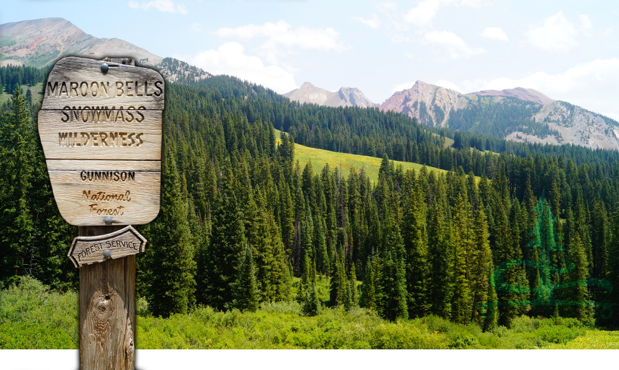
After an interesting drive on Rustler Gulch Road and the steep final walk to the reach the Rustler Gulch Trailhead we were ready to begin! We went around the metal gate and started off on Rustler Gulch Trail. Almost immediately we were greeted with the boundary sign for the Maroon Bells – Snowmass Wilderness.
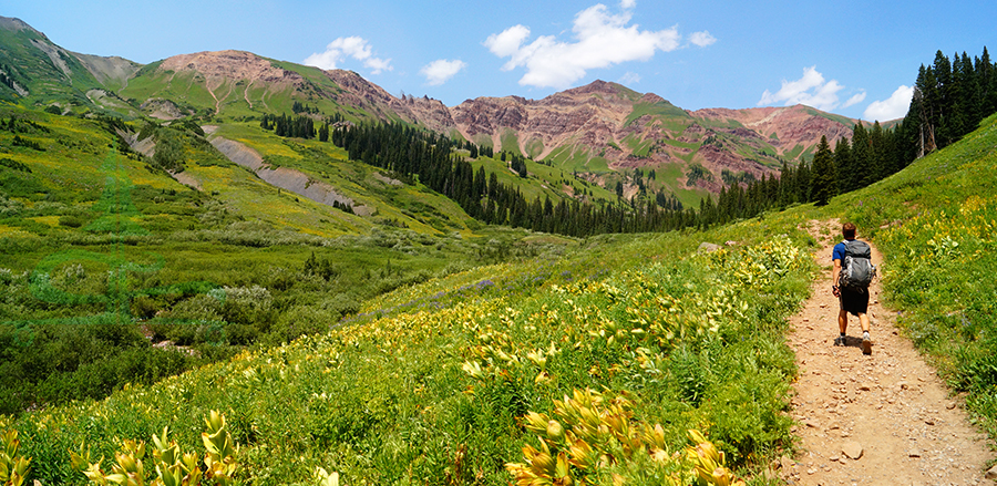
The trail was once an old road so most of the way to the waterfall, there are two dirt paths paralleling each other. But this old road is beautiful overgrown with lush tall plants and wildflowers making it feel more like a trail then an old road! It also made for convenient flow of two way traffic on the trail.
From the beginning, Rustler Gulch is full of gorgeous valley views and numerous peaks making an appearance. The trail is mellow, reaches a super muddy section with some serious opportunities to practice playing The Lava Game. 🙂 After a couple more river crossings the valley views open up again.
And the gorgeous maroon colored mountains contrasting with the vibrant green plant life blanketing the mountainside was enough to leave me speechless! I am literally amazed at just how beautiful the mountains in Colorado have been so far!! They’re like a dream, taking the scenery in almost feels unreal.
Liking this article? Pin it!
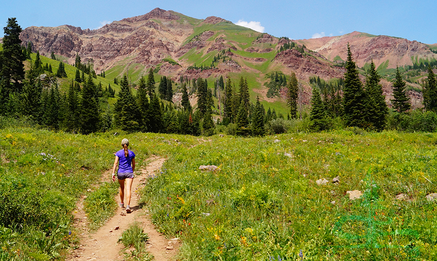
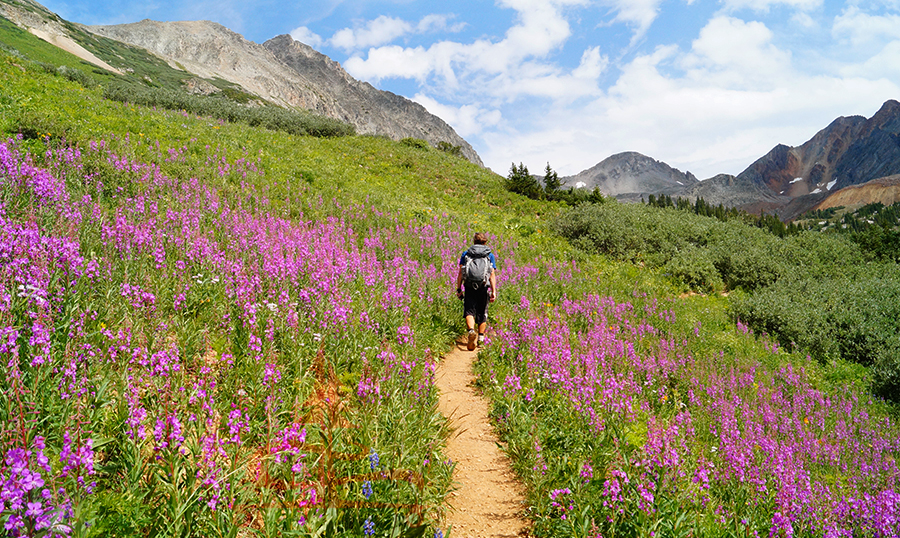
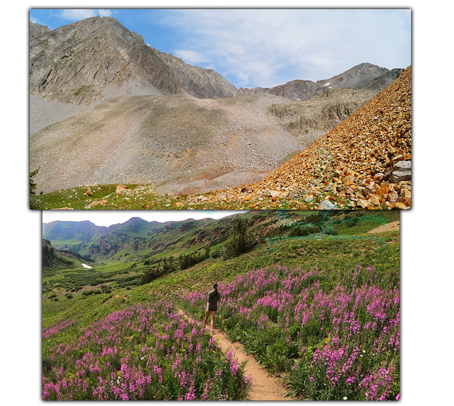
A little further along Rustler Gulch Trail, the pass crosses a wide and scenic section of Rustler Creek. Then the trail climbs moderately through the meadow, exposing new scenery as we headed further and further up into the valley. We were in amazement by all of the wildflowers along the trail. There were so many different kinds and colors! Some sections of the trail had so many vibrant flowers that walking through them literally felt good on the eyes. So beautiful.
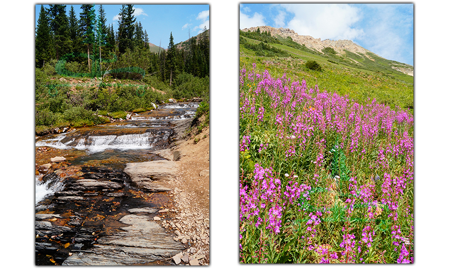
Up ahead in the distance we could see the waterfall. And there was a large mass of snow blanketing an area of Rustler Creek where we could see the water entering and running through it. Pretty neat.
Checking Out the Waterfall
After about 2.8 miles from start of Rustler Gulch Trail, there is a side trail branching off towards the waterfall. This spur trail is about a 0.3 mile descent to the base of the falls.
The waterfall was beautiful and we couldn’t help but climb around a bit. We found some shade from the walls of the falls and decided it was time for lunch. The view of the valley from up in the waterfall was beautiful too!
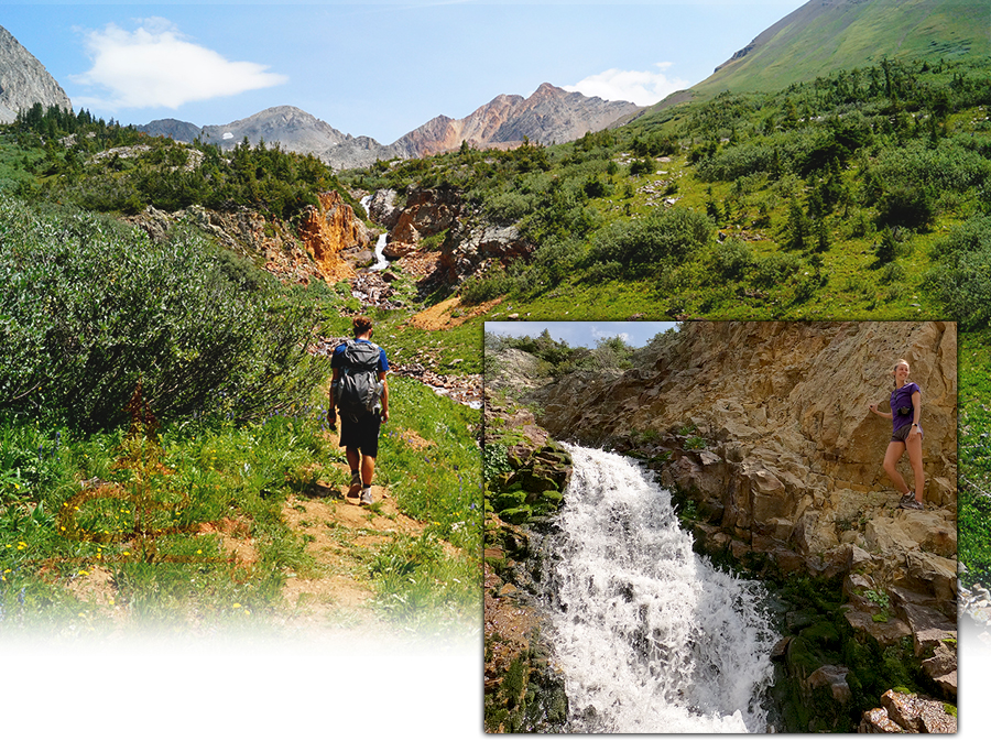
After lunch, we headed back along the spur trail and continued further along Rustler Gulch Trail to see what we could find. It didn’t take long to find another small but long waterfall running down the mountainside as well as more gorgeous flowers and great views of the peaks ahead.
Continuing to the Upper Basin
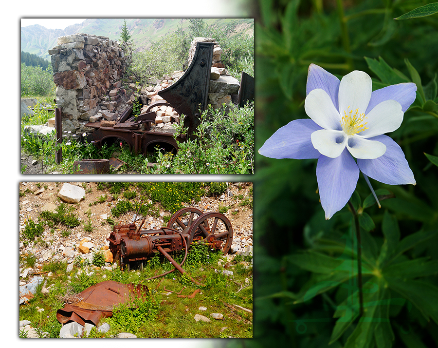
Then after about a half mile from the spur trail, we came upon an old mining site. We checked out the mining equipment and a stone building. Funny how they managed to transport all of that up into the mountains but somehow weren’t able to transport it back out…
We continued on Rustler Gulch Trail as it climbed, passed another small waterfall and followed the water. The trail got very faint before seeming to end completely. We found our way up to the talus slopes of Precarious and Cassi Peaks. There seemed to be nothing but rocks up here! Until we started hearing adorable squeaks of the playful Pika. We found a good spot to sit, took in the view and played a version of I Spy with the Pika among the similarly colored rocks. They seemed to be having fun and enjoying our company as much as we were enjoying theirs.
After taking in the views and accepting that we weren’t getting to the tops of any of these loose rock covered peaks today, we headed back the way we came. The views on the way back were beautiful and the hike itself was very enjoyable and rewarding.
Thanks for Reading!
We had another great adventure in the Crested Butte area! Rustler Gulch Trail has a lot to offer – incredible scenery, colorful mountains, wildflower galore, lots of fun water crossings, several waterfalls, a glimpse at some mining history and massive talus fields full of adorable furry squeaky Pika! We definitely enjoyed our adventure on Rustler’s Gulch Trail. Next up, we’re thinking it’s about time to summit a peak in the area. Stay tuned!
For more hiking and adventure articles, check out the links below:
To keep us on the road, we work hard creating our unique hand painted longboards. Check out our Lost Coast Longboarding Shop to see our latest lineup. We also design and screen print our own shirts!

If you want to help support The Lost Longboarder, please click the Amazon link to get to Amazon whenever you’re doing online shopping. It won’t change your shopping experience but you can feel good knowing it’s helping us out a bit!