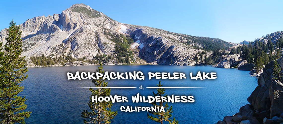
Backpacking Peeler Lake Loop | Hoover Wilderness
For our finale in the eastern Sierras for the season, we decided on backpacking Peeler Lake Loop. Peeler Lake is in the Hoover Wilderness of the eastern Sierras near Bridgeport, California. This Hoover Wilderness borders the Yosemite National Park and the elevation ranges from between 7,000-12,000 feet. We’ve never had the chance to explore the Hoover Wilderness so we were excited see a whole new beautiful area of the always stunning Sierra Nevadas.
When we were looking at the trails in the area, we were so excited to find a way to connect trails to make a backpacking loop! The Peeler Lake Loop adventure that we decided upon is actually more of a lollipop hike but we were still satisfied. And our itinerary for backpacking Peeler Lake loop included numerous high elevation lakes and those never seem to disappoint.
If you are looking for a backpacking adventure that has less crowds than the other nearby wilderness areas without sacrificing beauty and you love loops, then keep reading to find out more about backpacking Peeler Lake loop!
Permits for Backpacking Peeler Lake Loop
Day Use: No permit required
Overnight Use: Permit required year round
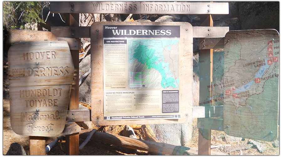
For certain trails in the Hoover Wilderness, overnight permits are limited by a trailhead quota. The trailhead quota season is from the last Friday in June through September 15th. During this quota period, half of the permits are able to be reserved ahead of time – up to six months in advance – on Recreation.gov. The other half of the permits are available at the Bridgeport Ranger Station, first-come first-served. Outside of this quota period, overnight permits are still required.
Fortunately, getting a permit for backpacking in the Hoover Wilderness is much less stressful than getting a permit to areas in the John Muir or Ansel Adams Wilderness!
To get a permit for backpacking in the Hoover Wilderness, go to the ranger station on the morning of your trip. We were at the ranger station a day before our trip and we inquired about just getting the permit then so we didn’t have to drive back into town the next day but we were told we had to come the day of. To get the permit, we spoke with a very friendly ranger. We told her our itinerary plans and she informed us about fire and camping restrictions then we were on our way.
Getting to the Trailhead for Backpacking Peeler Lake Loop
The trailhead for Peeler Lake is located just past Twin Lakes and the Mono Village Resort. To get there from Bridgeport, follow Twin Lakes Road south for 13.5 miles. The road will end at the Mono Village Resort and the trailhead is located at the back of the resorts campground.
Parking for Peeler Lake Trailhead
Short Answer: There is parking at the Mono Village Resort on Twin Lakes for $10.
Long Answer: As I mentioned, the trailhead for getting to Peeler Lake is located at the west end of Twin Lakes. And there is also a resort at the west end of Twin Lakes, Mono Village Resort. To get to the trailhead, you have to pass through the resort. So naturally, the Mono Village Resort provides trailhead parking. But it costs $10 which I thought pretty steep.
So we looked for free street parking around the Twin Lakes area. There were so many signs prohibiting parking or no parking within these hours. And since we were going to be leaving our vehicle for three days we figured we were safer just paying the $10 and not returning to find we were towed. But then on our way out of the resort after we finished our backpacking adventure, one of the resort workers mentioned that we could have just parked on the road. We’d already paid and hiked at this point so we didn’t inquire further but it may be worth asking some questions ahead of time if you want to avoid the $10 parking fee. We did ask the ranger the morning of our trip while we were getting the permit but she didn’t know specifics about other parking options.
Quick Stats for Backpacking Peeler Lake Loop
Total Distance: 22.5 miles
Itinerary Breakdown:
- Day 1: Twin Lakes Resort to Peeler Lake — 8 miles
- Day 2: Peeler Lake to Robinson Lake — 7.2 miles (+ side trip to top of Crown Point)
- Day 3: Robinson Lake to Twin Lakes Resort — 7.3 miles
Difficulty: Moderate; there are definitely big elevation gains and losses but trail is well marked and defined the entire way.
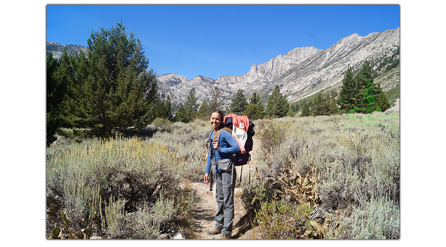
Our Experience Backpacking Peeler Lake Loop
Day One
On the morning of our Peeler Lake Lollipop adventure we got up early to get to the Ranger Station when they opened. We were first in line to get our Hoover Wilderness Backcountry Permit. Luckily, it was a much easier process than getting our permit for our backpacking trip to Ediza and Iceburg Lakes in the Ansel Adams Wilderness!
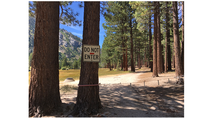
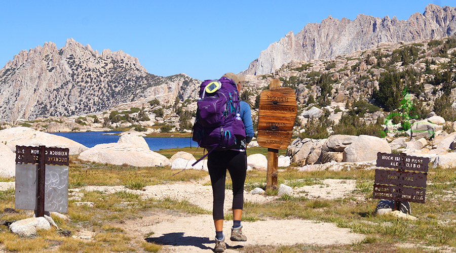
From the Ranger Station, we drove to Twin Lakes Resort. As I’ve mentioned, the Peeler Lake Trailhead is located at the back of the resort making it inevitable that you have to walk through the resort property. And that’s also why there is no free lot for trailhead parking. Finding the trailhead was a little tricky. We had to walk through the wooded campground for about a half mile to a DO NOT ENTER sign. Apparently, that was the start of our trail!
And finally, our adventure begins!
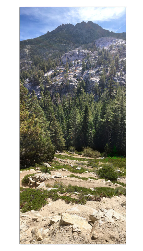
To start, the trail passes a beautiful meadow, then reenters the woods before opening up again.
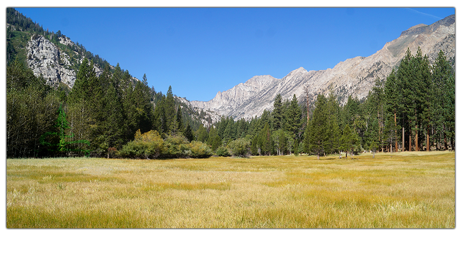
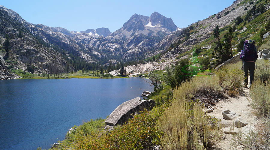
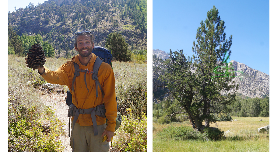
From here the trail climbs as it enters the beautiful granite basin passing conifers, shrubs, and aspens. The diversity of the trail is great already! The trail narrows through aspen groves, then gets dense, green and lush further on. It also climbs some granite sections near the creek.
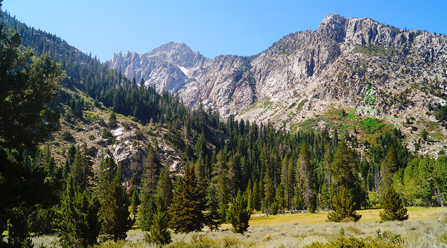
As the trail climbs, the granite mountains get closer and taller. After about 4 miles, we made it to Barney Lake! Barney Lake is beautiful, surrounded by massive granite mountains. And there’s a cute little sandy beach along the shoreline. We took in the scenery and then continued on the trail as it climbed up while paralleling the lake.
After Barney Lake, the trail enters a gorgeous green basin surrounded by granite. The views from the trail got even more breathtaking and the conditions got more rocky.
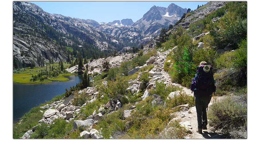
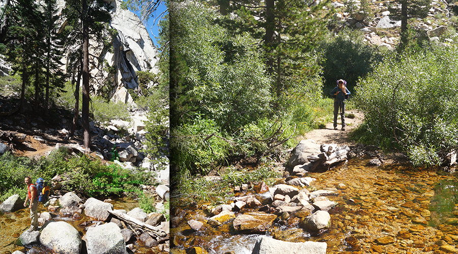
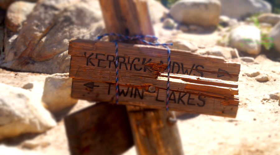
The trail crosses Robinson Creek, passes huge granite boulders and massive conifers as we continued to gain elevation. About 2.8 miles from Barney Lake we made it to the lollipops intersection. This is where the loop part of our backpacking adventure began.
At the intersection, we went right towards Kerrick Meadows. We followed the trail through a gorgeous mix of massive boulders and beautiful woods.
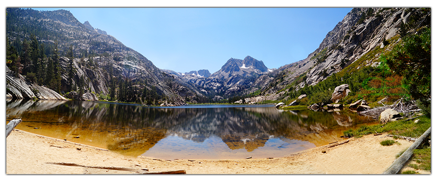
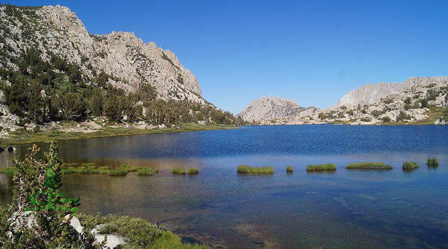
And after a beautiful 0.7 miles we made it to Peeler Lake! Wowwww.
Liking this adventure? Pin it!
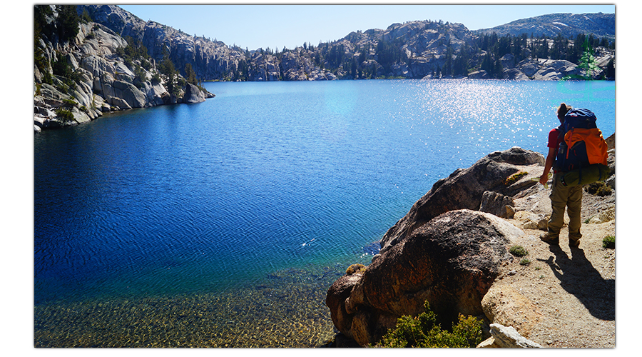
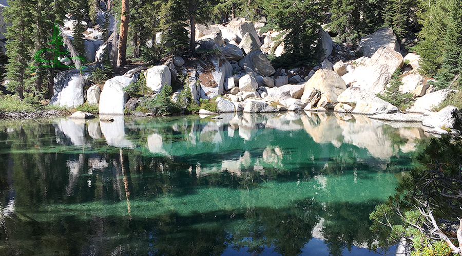
Peeler Lake is absolutely STUNNING. The water is a magical deep blue and the granite surrounding the entire lake is jaw dropping! The granite formations lining the lake are massive and impressive. And they contrast with the lake perfectly. The views were extremely mesmerizing and the trail follows along the perimeter of the lake. We loved this because we could see different views of Peeler Lake as we made our way along the shoreline.
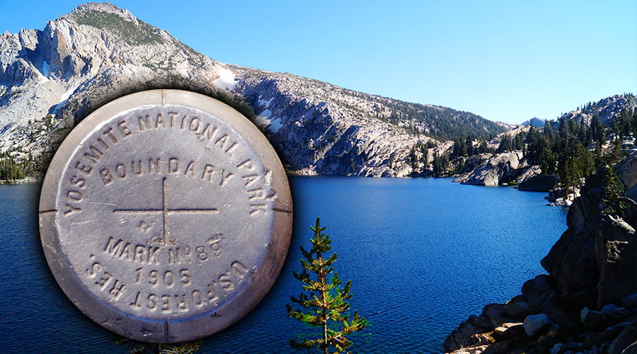
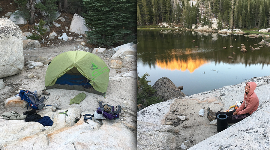
When we reached the northwest side of Peeler Lake, we started looking for a place to set up camp for the night. While we were exploring, we found the Yosemite National Park Boundary marker.
We climbed up the granite further up from the lakeside and found a flat spot for the tent. After we took our packs off and got set up we explored the area around the lake then had dinner. Then we got to watch the full moon rise up over the mountain, reflecting on Peeler Lake. It was an amazing day of hiking to and through an extremely beautiful area.

8 mile day; 2,400 feet elevation change
Twin Lakes: 7,095 feet
Peeler Lake: 9,489 feet
Day Two
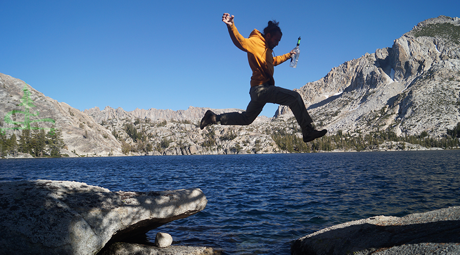
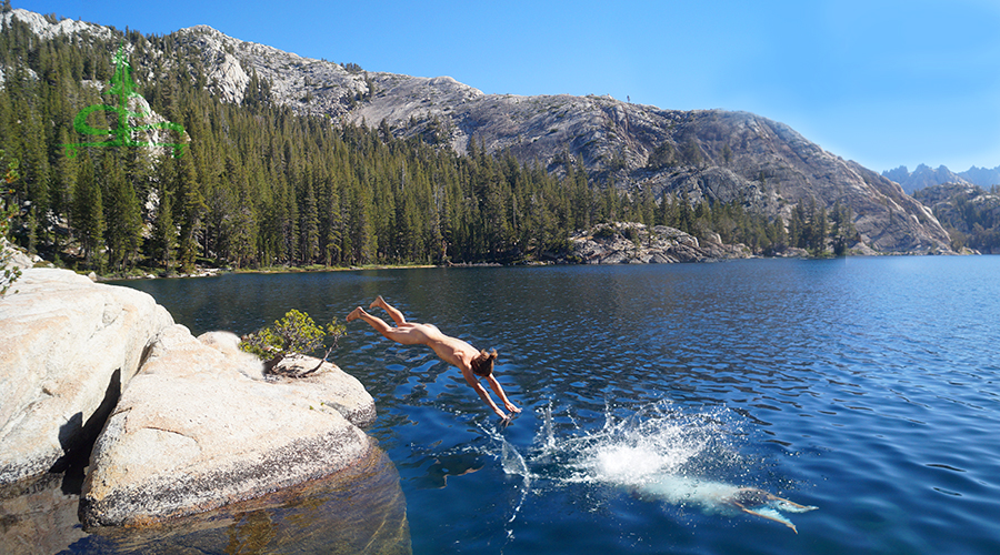
The next morning, it was a treat to wake up to our view of Peeler Lake. After breakfast, we packed up then went to the edge of the lake so Shane could dive in! Brrr! He jumped in east of the Yosemite National Park boundary marker and swam to the west side so he can say he swam to Yosemite. Whether that’s how the boundary line worked or not, he was brave for getting in the frigid water!
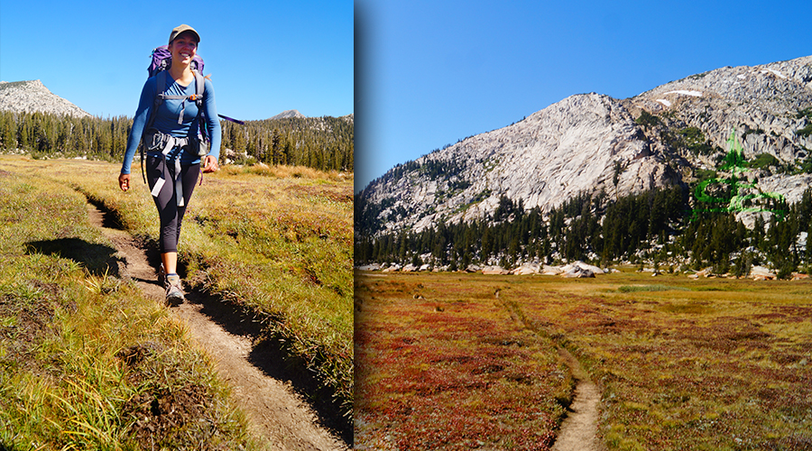
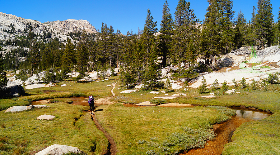
Then we hit the trail. From the north shore of Peeler Lake it was about a half mile to the Kerrick Meadows intersection. This section passed through the woods and then turned into a mix of grass, streams, and granite rocks. It was beautiful!
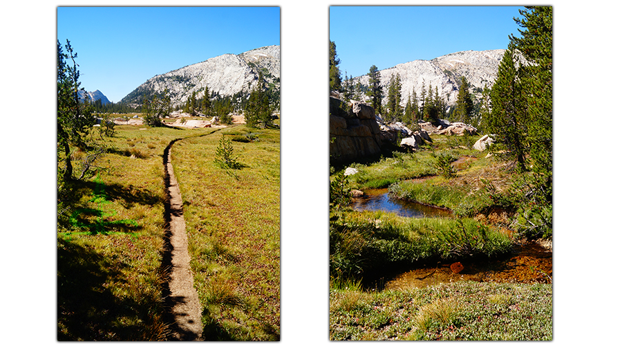
At the Kerrick Meadows intersection, we headed left towards Mule Pass. We really enjoyed this mellow section of the trail through the wide open, super scenic meadow environment. The scenery was so different from the rest and it really added to the diversity we experienced on our Peeler Lake lollipop adventure! After 1.4 miles we reached our next intersection where we branched left towards Burro Pass.
After the intersection, the trail started to return to woods and headed towards the granite mountains. And then the trail climbed and climbed up to Rock Island Pass. We saw a black bear in the woods here but he must have heard us because he was already running in the other direction. Shortly after making it up the pass, we were rewarded with the beautiful Snow Lake!
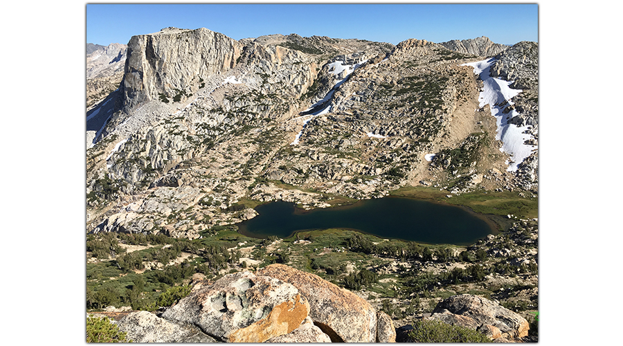
Snow Lake looked like a little oasis tucked in the rugged granitic surroundings. We took it all in while we had lunch. Then we decided to drop our backpacks and make our way to the top of Crown Point (11,346).
Crown Point Side Adventure
Summitting Crown Point was a fun and very worthwhile side trip. There was no trail but route finding was easy compared to the steep climb.
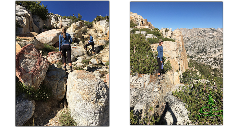
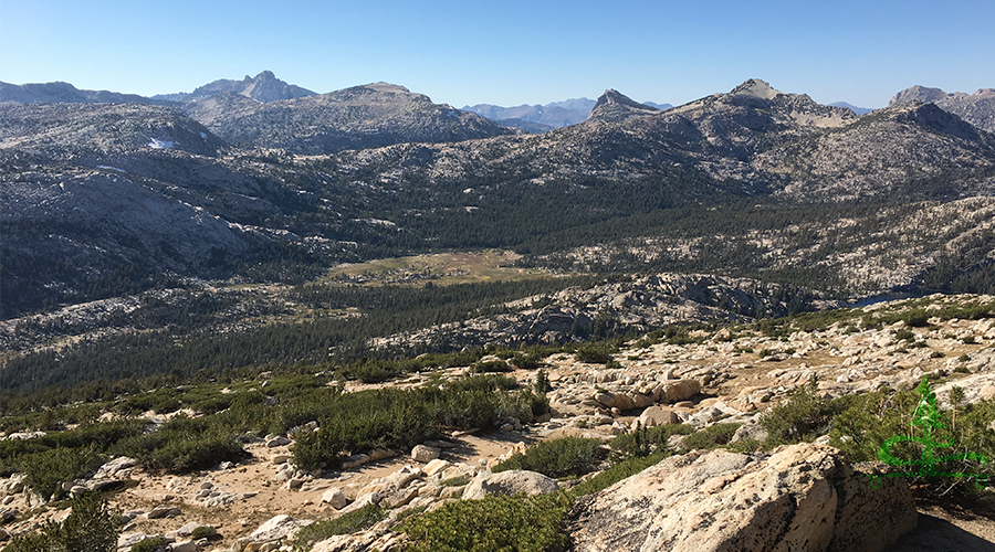
But we made it up to the crest and we were in awe of the views from the top. It was absolutely gorgeous in every direction! Seeing such a beautiful sight always brings such a deep feeling of happiness, appreciation and almost a weightlessness that I can feel in my soul. There’s nothing quiet like it in my opinion.
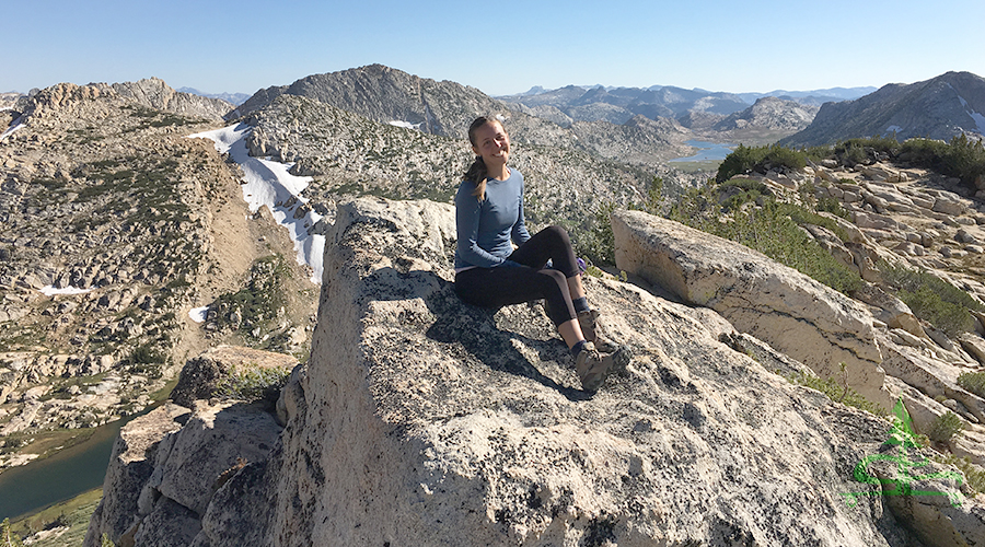
It was cool to look down on Peeler Lake (where we came from earlier this morning) and on Snow Lake (where we just left our packs). We could see Crown Lake and Benson Lake in the distance as well as endless granite!
We decided climbing up and over Crown Point probably would have been
the much faster route from Peeler Lake but then we wouldn’t have gotten to see all the beauty we saw along the trail on the way. After we said “wow”, “beautiful” and “amazing” about a thousand times, we made our way back down the mountainside.
Keep on keeping on!
After our incredible side adventure up Crown Point, we grabbed our packs and continued on our backpacking Peeler Lake loop adventure. From Snow Lake we went down, down, down, and more down a bunch of switchbacks into an absolutely gorgeous valley of granite to Crown Lake. It was a very beautiful descent, a killer on the toes though.
At the base of the switchbacks was a cute meandering stream and the impressive Crown Lake. We thought we’d sleep near Crown Lake but there were a number of people with camp set up here already. And we had more gas in the tank so we pushed on.
From Snow Lake, we went about 2.3 miles before we found a nice campspot near Robinson Lakes. It seemed as though we had the whole lake to ourselves. After we set up camp we realized that there were two lakes just a short walk from each other. And they were both beautiful with rugged granite encompassing them. We ate dinner up on a massive boulder overlooking the lake. It felt like we were completely alone in the wilderness.
7.2 mile day (not including our side trip up Crown Point); lots of elevation loss/gains!
Peeler Lake: 9,489 feet
Kerrick Meadow: 9,300 feet
Rock Island Pass: 10,150 feet
Crown Point Peak: 11,346 feet
Robinson Lakes: 9,300 feet
Day Three
For our last day, we ate our breakfast with the bees atop our rock overlooking Robinson Lake. Then we packed up and passed several amazing lakes through beautiful sections of woods surrounded by huge peaks of granite.
It was only about a half mile until we reached the intersection that created the lollipop. This was the same intersection that two days ago, we took towards Peeler Lake. We turned right at the intersection and headed back towards Twin Lakes.
From here it was another 6.8 beautiful miles back to where we parked at the Twin Lakes Resort. Although it was still a very scenic walk back, it always feels more right when you’re walking towards the granite wonderland, not away from it.
7.3 mile day
Robinson Lakes: 9,300 feet
Twin Lakes: 7,095 feet
What an Adventure!
Our Peeler Lake lollipop adventure was even more beautiful than we could have imagined! Rugged, vast, diverse, gorgeous and so much more. The Hoover Wilderness is an incredible place to experience! We look forward to returning and seeing more and more of this magical area.
The Peeler Lake lollipop adventure was one of the most beautiful places that I’ve ever had the opportunity to explore. This trip provided a glimpse of true peace that can only be found in nature and it sparked the appreciation, happiness and joy radiating from within – doesn’t get much better than that.
Hike it Later – Pin it Now!
Thanks for Reading!
If you’d like to read about more of The Lost Longboarder’s adventures, check out our articles below:
- Backpacking to Ediza and Iceburg Lakes
- Mystic and Island Lake Overnight Adventure
- Backpacking Beartooth High Lakes Trail
Let us know in the comments below where you experienced your favorite backpacking adventure!
If you like one of a kind art and would like to help support The Lost Longboarder, head over to our Lost Coast Longboarding Shop to see our latest lineup of hand painted longboards! We also design and screen print our own t-shirts as well.

Do you shop on Amazon? If so, please use our Amazon link to get to Amazon. Then shop as you normally would! It won’t change your shopping experience but it’ll help us out. Thank you!


One Comment
Fred Bewersdorf
Enjoyed reading your Peeler Lake loop hike. I made my first trip to Peeler inn 1970 & my 99th trip in 2019. Great trout fishing. On three of those trips, we reven ice fish the lake in late April. Had the misfortune of watching a CHP helicopter crash into the lake on 7/5/1984. We saved the pilot & co-pilot but an injured backpacker they picked up drowned. A 5-day ordeal that we’ll never forget. One of my favorite lakes in N/E Yosemite area by far.