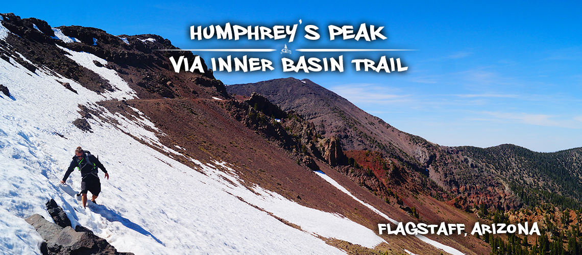
Hiking Humphreys Peak via Inner Basin Trail
If you’re in Flagstaff and looking at the hiking opportunities no doubt you’ll come across hiking Humphreys Peak. Humphreys Peak is located in the Kachina Peaks Wilderness and is one of the San Francisco Peaks. The San Francisco Peaks are actually the remains of an extinct volcano, which exploded millions of years ago forming four of the highest individual peaks in Arizona. That said, Humphreys Peak is the tallest point in Arizona – 12,633 feet. Being that it is a state high point, this hike is on a lot of hikers radars.
There are several trail options for hiking Humphreys Peak. The shortest and most popular trail is fittingly named Humphreys Trail. The trailhead is located at Snowbowl Ski Area and is about 10.5 miles roundtrip. Then there’s Weatherford Trail that is about 22 miles roundtrip and is also a less traveled option.
But we were intrigued by the middle trail option – Inner Basin Trail which is about 16 miles roundtrip. Hiking Humphreys Peak via Inner Basin Trail sounded like a gorgeous but less traveled option. And so it was decided – we set out hiking Humphreys Peak via Inner Basin Trail from Lockett Meadow!
Quick Info: Hiking Humphreys Peak via Inner Basin Trail
Directions: From Flagstaff, head north on AZ-89 for about 12.5 miles. Turn left onto Forest Road 545. After 0.6 miles turn right onto Shultz Pass Road for 1.2 miles before turning right onto Forest Road 553. Go another 2.9 miles and turn right to get to the Inner Basin Trail parking area.
Difficulty: Moderately strenuous
Distance: 16 miles roundtrip
Trailhead Elevation: 8,634 feet
Destination Elevation: 12,633 feet
Net Elevation Change (one way): About 4,400 feet
Inner Basin Trailhead at Lockett Meadow: Large parking area, inner basin campground info, vault toilets, map of area trails/mileages
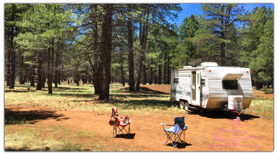
Quick Note About Camping Options in the Area:
- Camping for a Fee: The Lockett Meadow Campground is located right before the Inner Basin Trailhead. There are 17 single unit sites that have fire rings, picnic tables, and vault toilets. These sites cost $18 per night.
- Camping for FREE: There are numerous options for dispersed camping along the forest roads once you turn off of the AZ-89. While checking out the area, we noticed dispersed camping on Schultz Pass Road, FR 420, and FR 553. We found an amazing spot – peaceful, roomy, and secluded with a view! You can find out more about our spot and our experience camping off of FR 553 here.
Our Experience Hiking Humphreys Peak from Inner Basin Trailhead
We were so excited to finally be hiking Humphreys Peak!! And we were excited that we were going to be sharing the experience with our new friend Analeise! There were only a few other vehicles in the parking lot when we arrived at 8 am. We checked out the trail sign/information board and then hit the trail.
Inner Basin Trail Segment
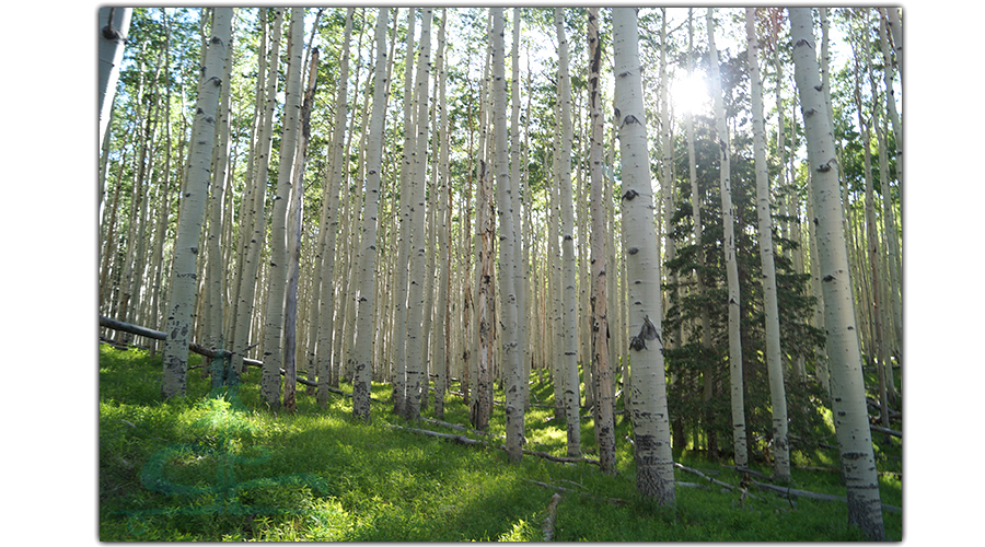
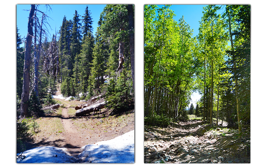
Inner Basin Trail begins by wandering through a ABSOLUTELY GORGEOUS Aspen forest. The bright green of the forest floor and the tree tops contrast so beautifully with the tall white trunks of the Aspen trees. Already, the beauty mixed with the excitement of the adventure ahead created a sense of euphoria!
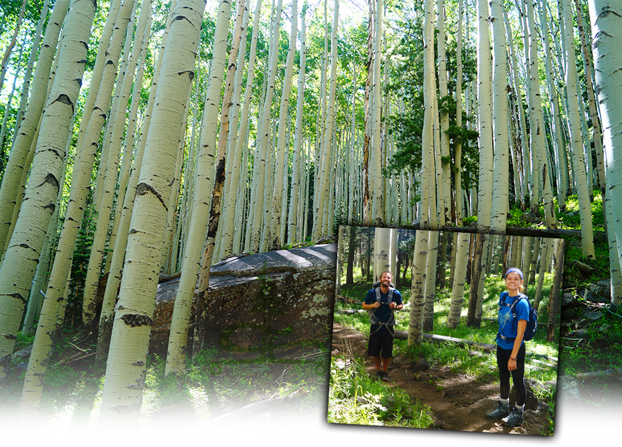
We meandered through the Aspens and followed some switchbacks for about 1.7 miles before we reached Waterline Road. This part of the trail is a brief, short segment of forested gravel access road. There are several structures that make up the waterline system that transports water from the San Fransisco Peaks to Flagstaff.
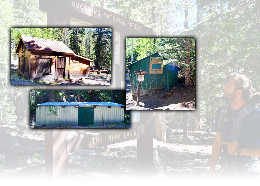
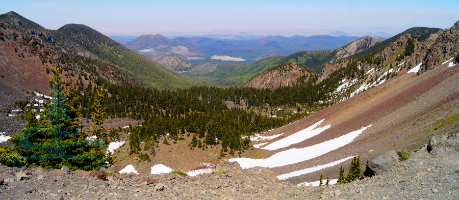
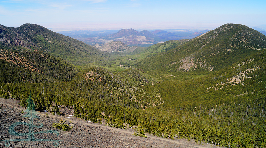
After the buildings, the trail continues as a service road through the trees. Then, it opens up to Inner Basin – a more open area with gorgeous views of the surrounding mountains towering all around!
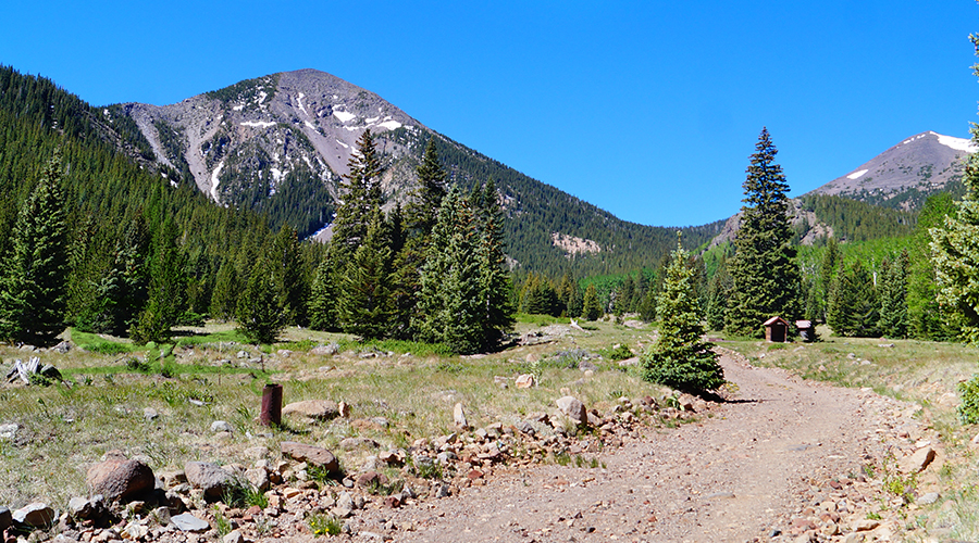
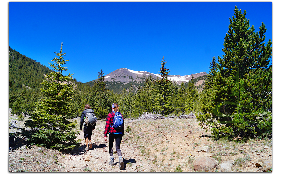
From here, we followed the road past a few well buildings. The road/trail conditions get rough and begin to narrow to a single track trail climbing up through the woods. We continued on Inner Basin Trail and started making some elevation gains!
Weatherford Trail Segment
After climbing the rocky trail steeply through the woods, we reached our next junction – Weatherford Trail! At this point, we’ve hiked about four miles and continued on our hiking Humphreys Peak adventure by turning right on Weatherford Trail.
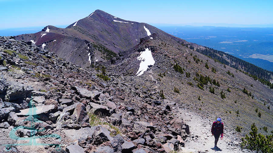
From here, we encountered some snow piles on this beautiful trail segment through the lush conifers. Between the breaks in conifers, we caught some glimpses of the gorgeous scenery in the distance!
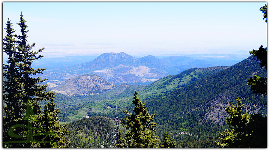
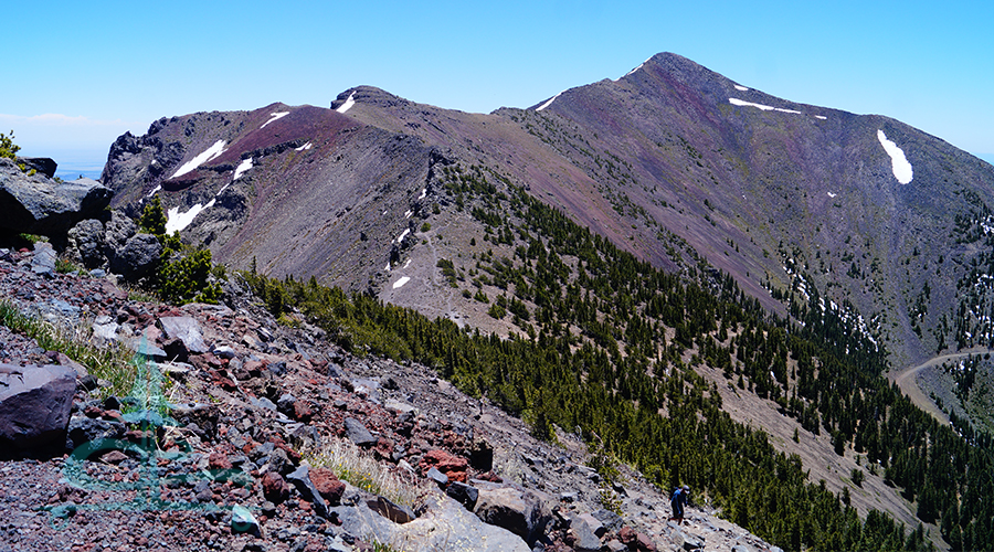
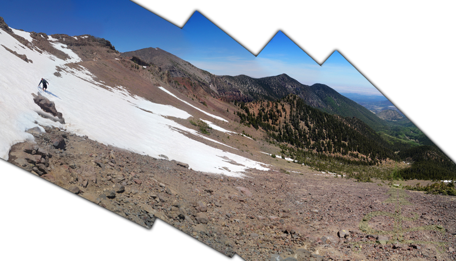
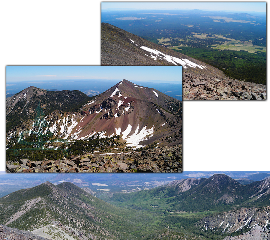
Eventually, we ascended up above the tree line and were taken aback by the high elevation beauty all around us! Luckily, the switchbacks were relatively free of obstacles because it was hard to keep our eyes on the trail!
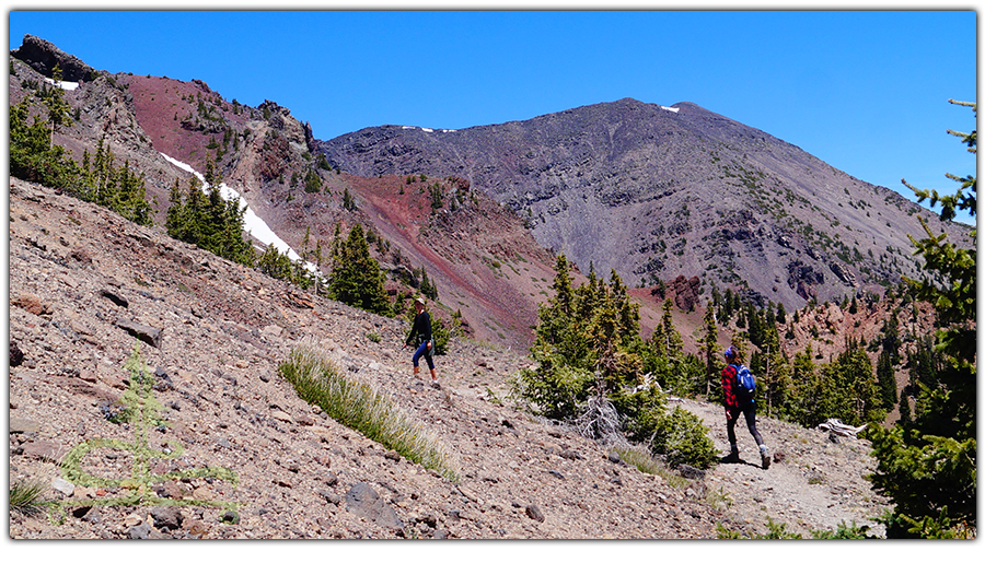
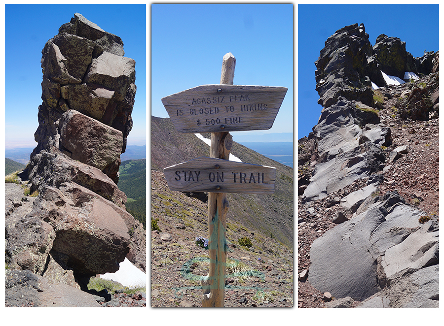
As we were hiking Humphreys Peak we neared the Fremont Saddle. That’s when we noticed the cool color changes and rock formations of the scenery up ahead.
Hike it later – Pin it now!
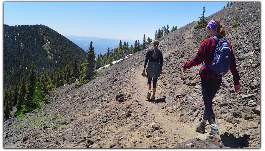
And we also noticed the section of trail that we were approaching was still covered in snow. It was a little intimidating as we walked very carefully along this slippery and steep slope on the mountainside! But we made it safe so of course it felt pretty exhilarating.
Once on the other side of the snow, we took in the impressive views of the vast expanse of valley below, towering mountain peaks all around, and the cool rock formations. We also noticed numerous crows hanging out by the snow. It was a lot of beauty to take in, already extremely rewarding!
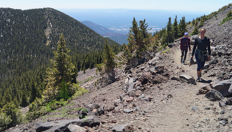
We crossed another shorter and safer snowy section before reaching the saddle near Agassiz Peak. From the saddle, we were granted the vast views overlooking the other side. Hiking Humphreys Peak from Snowbowl on this side is a shorter and much more popular summit option. From the saddle, we hiked just a little further before descending down a bit to meet up with Humphreys Trail.
Humphreys Peak Trail Segment
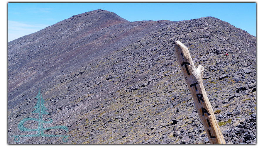
We took in the incredible views seen from the junction then continued hiking Humphreys Peak via Humphreys Trail for another mile. This mile section of Humphreys Trail was a little rough and rocky, very windy and much busier. But the beautiful views along the way kept a smile on our faces!
Finally, there it was! The little wooden sign shaking with the wind indicating that we just made it to the highest point in Arizona – Humphreys Peak: 12,633 feet!
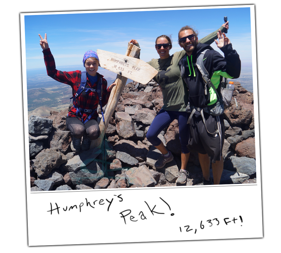
It felt like such an accomplishment! And it also felt extremely windy so we took shelter in a rocky cove that protected us from the cold wind. We took in the beautiful, vast panoramic views, soaked up the warmth from the sun and refueled. It took us awhile to pull our eyes away from the vast beauty, to stand back up, brave the winds, and make the hike back to Lockett Meadow. The hike back was just as beautiful and just a bit faster!
An Amazing Adventure
Hiking Humphreys Peak was an incredible experience! We really enjoyed the beauty that we encountered along the trail and of course, the views and sense of accomplishment at the top. And hiking Humphreys Peak via Inner Basin Trail was great, it felt like we had the trail all to ourselves!
Having spent the about six months over winter in Arizona, making it to 12,633 feet was much higher than we’d been in quite awhile! We’ve really enjoyed exploring Arizona and have seen some serious beauty. Check out the links below to see some of our favorite Arizona adventures!
There are also a lot of great opportunities for dispersed camping in Arizona. Here are some of the boondocking spots that we’ve loved calling home:
Thanks for keeping up with The Lost Longboarder!
We hope you enjoyed this article about our adventure hiking Humphreys Peak via Inner Basin Trail! And stay tuned for our article about hiking to the plane crash on Humphreys. Let us know in the comments below about a memorable hike that you’ve been on.
If you’d like to see our latest lineup of hand painted longboards, head over to our Lost Coast Longboarding Shop! We also have t-shirts and long sleeve shirts that are designed and screenprinted by us!

And if you shop on Amazon, please use our Amazon link to get to Amazon. Then shop as you normally would. It won’t change your shopping experience but it’ll help us out a bit! Thank you!