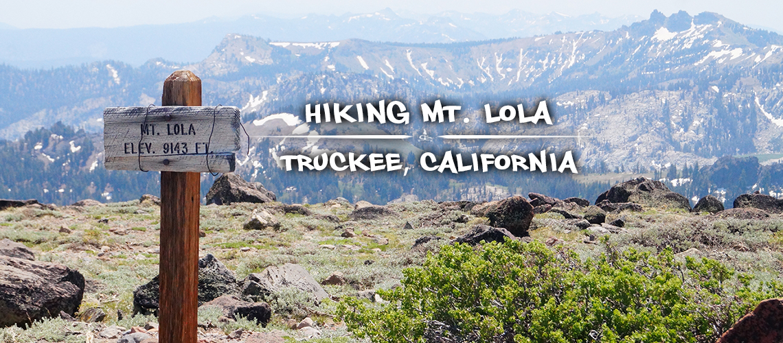
Hiking Mt Lola Trail | Tahoe National Forest
Hiking Mt Lola Trail is among the many great adventures to choose from along Jackson Meadows Road. And this hike is a great choice for those looking to bag a peak and catch incredible panoramic views of the surrounding area! Mount Lola is the highest peak in Tahoe National Forest (9,143 feet) and a beautiful adventure.
Shane’s brother came out to visit us from Florida so we were excited to share a peak hiking experience with him! Hiking Mt Lola is unlike anything in Florida so it was cool to reach 9,143 feet with him, to see amazing vast mountaintop views and to experience a bit of snow along the way.
Quick Info: Hiking Mt Lola Trail
Distance: About 10 miles round trip
Difficulty: Moderate
Directions: From Truckee, follow the CA-89 N for 14 miles. Then turn left onto Jackson Meadows Road/Forest Road 07 and follow that west for about 1.4 miles. Turn left on the Independence Lake Road, drive south approximately 0.5 mile to the junction with Sierra County Road S301. Turn right at the first intersection and continue west for approximately 3 to the trailhead. Click here to get directions to Mount Lola Trailhead.
Elevation: 6,640 feet to 9,143 feet
Check out our quick video of our adventure hiking Mt Lola Trail!
Our Experience Hiking Mt Lola
From Jackson Meadows Road, the gravel road to the trailhead was mild and in pretty good condition. Once at the trailhead there is a large parking area and a small trail sign. When we arrived there were about seven other cars there.
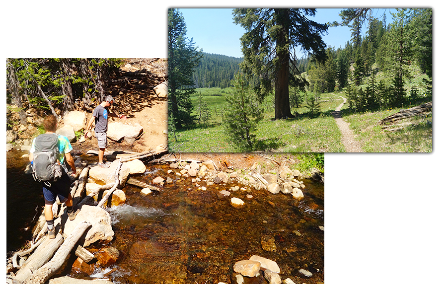
From the parking area, hiking Mt Lola Trail begins with a climb through the woods. And before we knew it we were able to see the stream, Cold Stream, that we’d been hearing below. This section of the stream looked like it’d be fun to rock hop on.
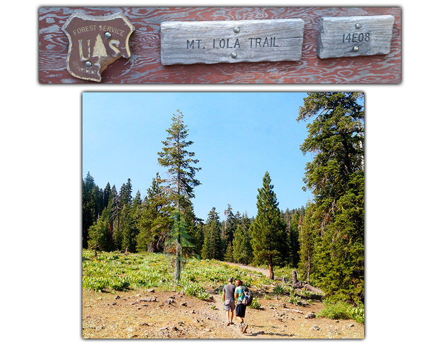
The trail continued to climb through the trees and lush green sections and pretty yellow wildflowers.
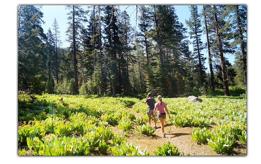
Eventually the trail looked like a road but shortly after we turned towards the water crossing. We crossed the water, hiked another section of woods and then the views opened up. Here we took a snack break while we looked out over the large vivid green meadow. And the stream was much smaller here as it snaked through the meadow.
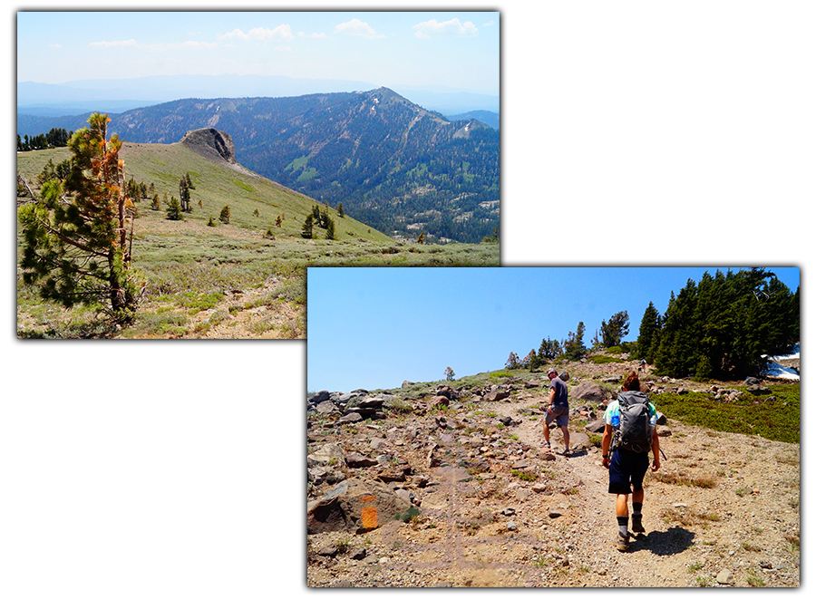
We continued hiking up Mt Lola Trail and next we encountered a pretty wooded area with snow! And we now had views of the treeline and the peak up ahead.
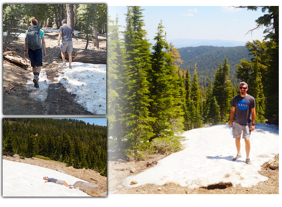
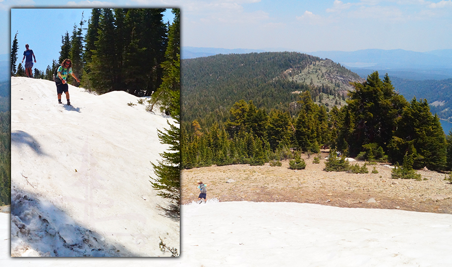
From here up was my favorite part of hiking Mt Lola Trail. The trail steepened as the trees became more gnarled and the views made an appearance. There were also more sections of trail that was covered in snow patches. As the views became more vast and revealing, we couldn’t wait to the top to take a peak of what beauty surrounded us.
Liking this Article? Pin it!
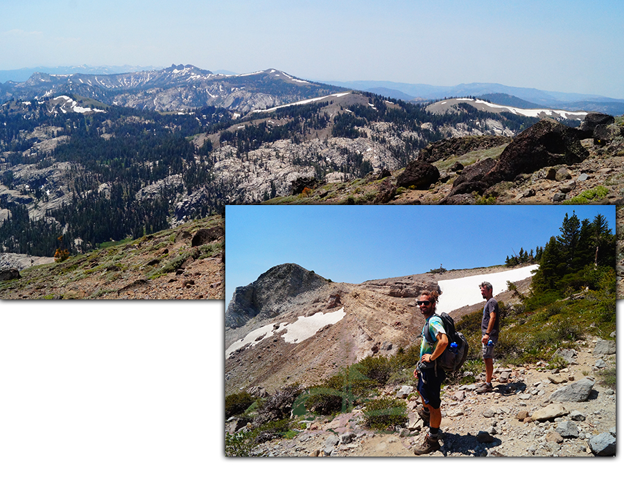
After a couple breathtaking breaks we climbed the final steep but beautiful ascent to the peak! We made it to 9,143 feet elevation – which was impressive considering Jason was visiting from sea level.
From the top we had gorgeous views in every direction. We could see a couple reservoirs below, enticing granite playgrounds and other surrounding mountain peaks. It was a bit hazy the day we were hiking Mt Lola Trail but the views were still worthwhile and then some.
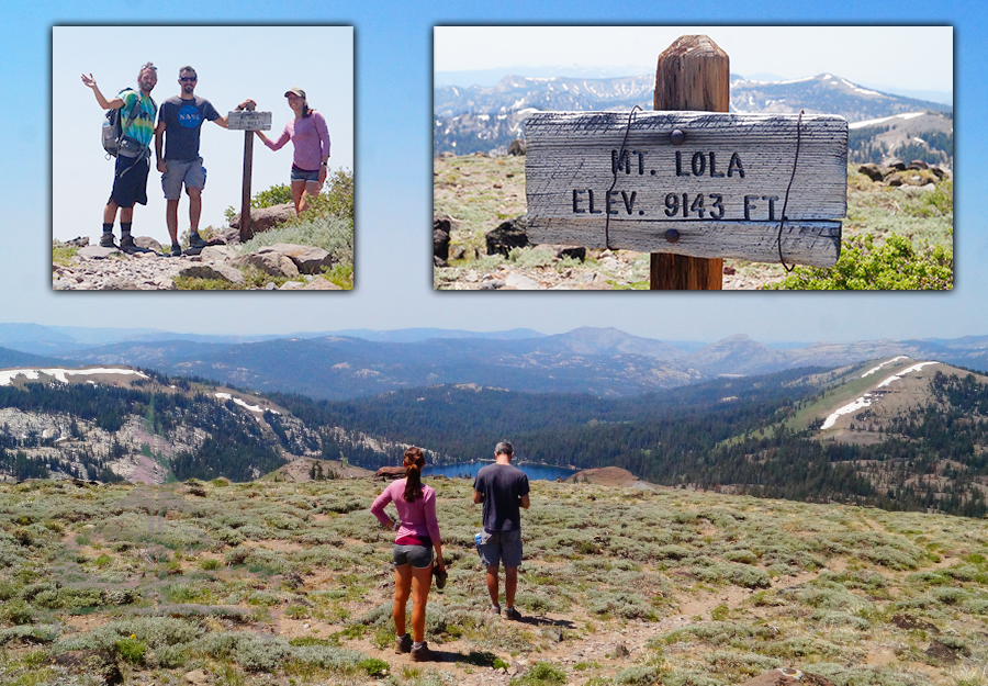
Besides the rewarding views, the top of Mount Lola had a couple odd red/orange brick formations as well as two wind shelters. There was one large wind shelter that had a fireplace built into it. And the smaller shelter had a peak keepsake box with hiker check ins and whatnot. We read through some old entries and added to it.
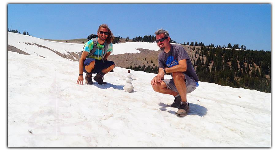
After taking in the views, we headed back down. And the views on the way down continued to impress. Once we reached the snow patches, Shane and Jason made a little snow man.
The snow patches were challenging to walk down so we ended up sliding down on our feet either by choice or by chance haha. Needless to say, the way down was much faster.
Thanks for Keeping Up with The Lost Longboarder!
We hope you enjoyed our hiking Mt Lola article. If you’d like to read about some more cool adventures, check out the links below:
- Backpacking Fall Creek Trail
- Black Rock Canyon Oasis
- Brokeoff Mountain in Lassen Volcanic National Park
- North Halfmoon Lakes Trail and Mount Massive
When we’re not adventuring, we’re working on our hand painted Lost Coast Longboarding longboards! To check out our latest lineup, head over to our Lost Coast Longboarding Shop. We also design and screen print our own t-shirts!

And if you’d like to show your support for The Lost Longboarder another way – whenever you shop on Amazon, just use our Amazon link to get to Amazon. Then shop as you normally would! It won’t change your shopping experience but it helps us out a bit. We appreciate it!