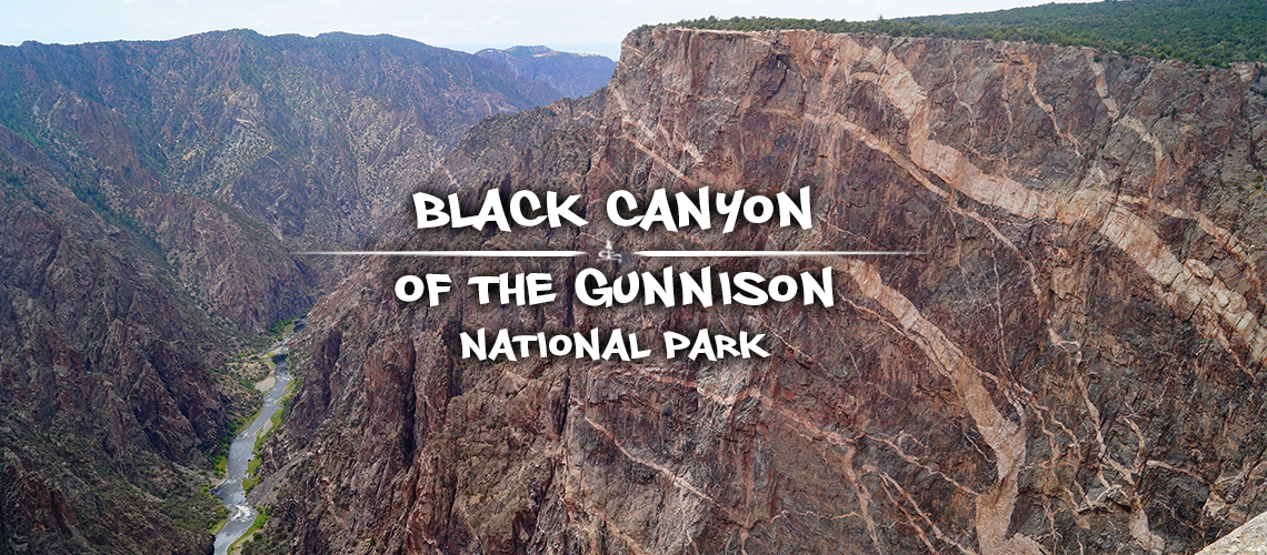
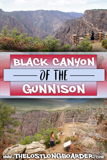
Things to Do in Black Canyon of the Gunnison National Park | South Entrance
There are a variety of things to do in Black Canyon of the Gunnison National Park that provide an opportunity to experience a truly incredible geologic beauty. This spectacular canyon is a dramatic and beautiful result of the Gunnison River carving and shaping the Earth over a two million year span. It is definitely a sight to see and appreciate.
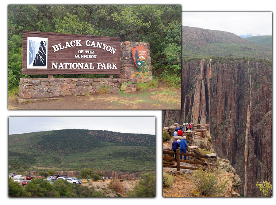
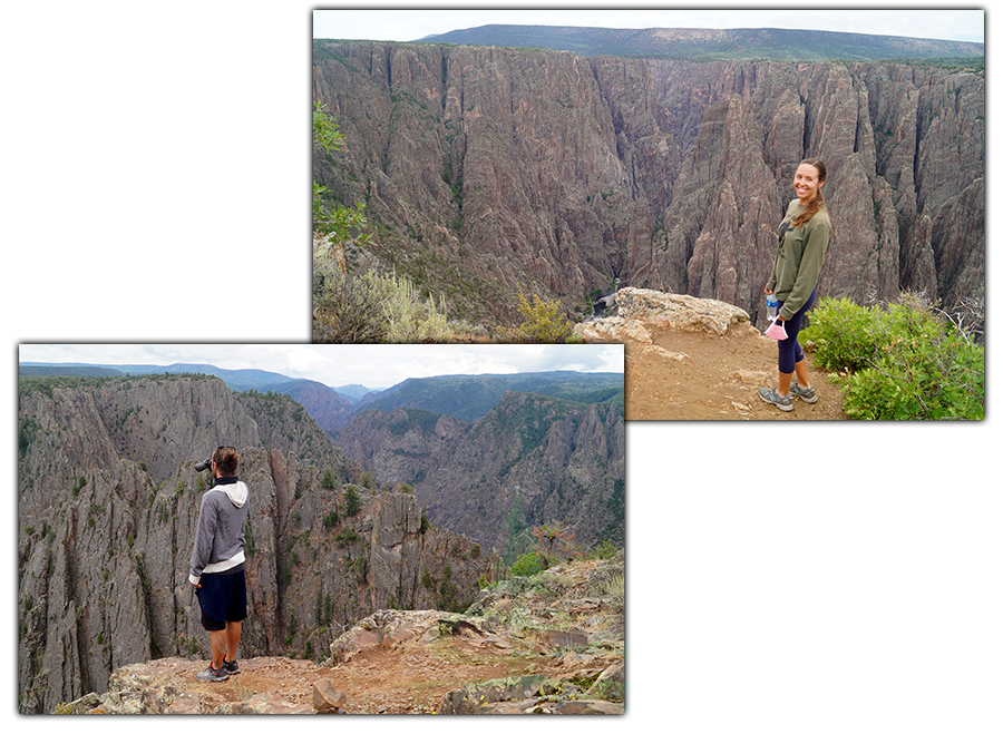
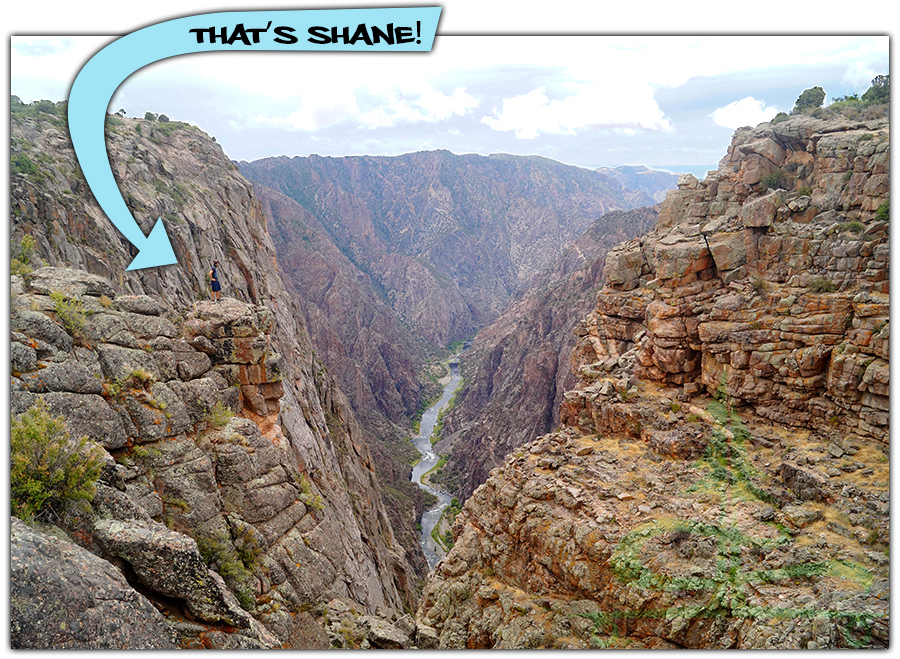
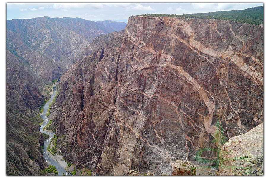
Black Canyon of the Gunnison is a very impressive geologic feature. At the area deemed Painted Wall, the canyon is 2,250 feet deep. Down below at the base of the canyon is a section called The Narrows. Here the canyon is only 40 feet wide. Whereas Black Canyon of the Gunnison reaches 1,100 feet wide at the point named Chasm View.
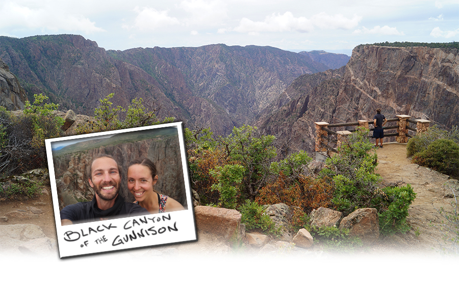
There is something fascinating to see at each and every trail and overlook. A new angle or view point reveals more and more beauty of the canyon below. And getting a glimpse of the carver itself, the Gunnison River, always adds to the vista. The color of the river way down below as it snakes through the canyon is mesmerizing. If you get the opportunity to see the Black Canyon of the Gunnison, don’t pass it up!
Black Canyon of the Gunnison National Park Entrance Fees
Per Vehicle: $25
America the Beautiful National Park Pass is accepted here. ($80 for annual pass) During our visit, there was no entrance fee. Possibly due to COVID-19..
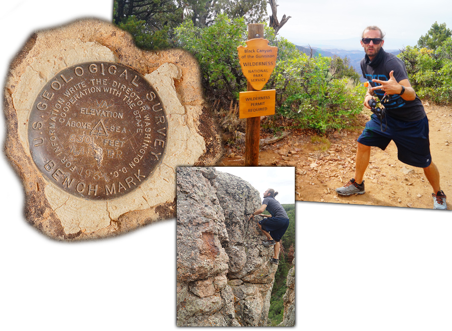
Getting to Black Canyon of the Gunnison National Park
*Since we were camping nearby on the Uncompaghre Plateau, we only visited the South Rim of Black Canyon of the Gunnison National Park. And that is what we will primarily cover in this article.
- From Montrose to the South Rim Visitor Center
The South Rim is about 15 miles from Montrose. Follow US-50 east for about 6 miles before turning left onto CO-347 N. After six miles on the CO-347 N you will reach the entrance station. - East Portal of Black Canyon of the Gunnison
The East Portal can be reached by turning right onto East Portal Road immediately after the South Rim Entrance Station. Vehicles longer than 22 feet are prohibited on East Portal Road. According to the national park publication, the road is extremely steep with hairpin curves and 16% grades. - From Crawford to the North Rim Ranger Station
The North Rim is about 11 miles south of Crawford. Follow CO 92 to the junction with Fruitland Mesa Drive and head east. After 3.3 miles, continue straight to get on 7745 Road. Continue another 1.2 miles, turn right onto A Road/Black Canyon Road. Then, after 8 miles on Black Canyon Road you will reach the North Rim.
Things to Do in Black Canyon of the Gunnison: South Rim
There are many things to do in Black Canyon of the Gunnison National Park, especially on the South Rim. South Rim of the national park is the busier, more accessible and more developed area. Here you will find the South Rim Campground, South Rim Visitor Center, restrooms, numerous overlooks, picnic areas and several trails. And of course, incredible views! Find out more about each of these things to do in Black Canyon of the Gunnison National Park on the South Rim below.
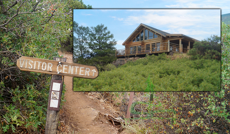
South Rim Visitor Center
We visited South Rim of Black Canyon of the Gunnison in July of 2020 and the visitor center was still closed due to Covid. There was a booth set up outside of the Visitor Center with a ranger or two to answer any questions and give any information you may need. You can also obtain a Wilderness Permit here at the booth/Visitor Center.
South Rim Campground
The only lodging available in Black Canyon of the Gunnison National Park are the three campgrounds. There is one campground on the North Rim, one at East Portal and the South Rim Campground. The only sites that are reservable in the national park are some sites within the South Rim Campground. You can make a reservation at www.recreation.gov. There are no water hookups or dump stations. Loop A and C are $16/night. Loop B has electric hookups during summer only and these sites are $22/night.
Overlooks
- Tomichi Point
- Restrooms
- Tomichi Point is accessed off of the main road just before the South Rim Visitor Center or via Rim Rock Trail which connects the visitor center and the campground. This overlook provides views looking upstream into the canyon though the stream itself is hidden within the staggered cliffs it runs through.
- Gunnison Point
- Restrooms, Visitor Center
- Gunnison Point Overlook is accessible from the South Rim Visitor Center. There are two different viewing platforms providing breathtaking views into the depths below. Because this overlook is accessed from the visitor center, it is most park visitors’ first stop and can get quite busy. The canyon walls here are already a bit more dramatic and there are cool dikes across the way.
- Pulpit Rock Overlook
- Restrooms, Picnic Area
- Pulpit Rock Overlook is a short walk to a rock outcropping that overlooks the beautiful gorge below. From here, there is a good view of the river curving up ahead and of the steep canyon walls.
- Cross Fissures View Point
- Another short, level path to a mesmerizing overlook! The view from Cross Fissures Viewpoint allows for viewing down into the depths of the canyon. Although the river is hidden, the colors and patterns in the dramatic canyon walls are very elaborate here.
Liking this article? Pin it!
- Rock Point
- The short path to Rock Point Overlook passes some cool rocks which we climbed around on to get additional views than those just from the viewing platform. From this overlook, there are intriguing markings on the rock wall across the way and steep, deep views of the canyon as well as a view down on the pillar-like rocks nearby.
- Devils Lookout
- Just a short distance further along from Rock Point Overlook, the trail to Devils Lookout is a bit longer than the others. It is about 0.5 miles round trip and leads to the edge of the rim. From the lookout platform you can enjoy some views of the river below. This area of Black Canyon of the Gunnison is near its narrowest.
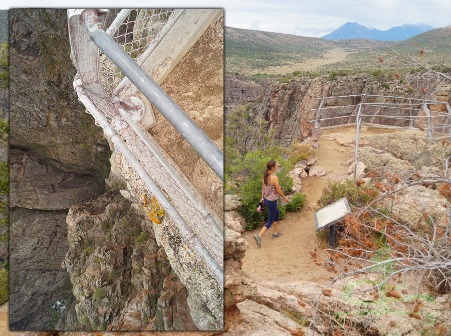
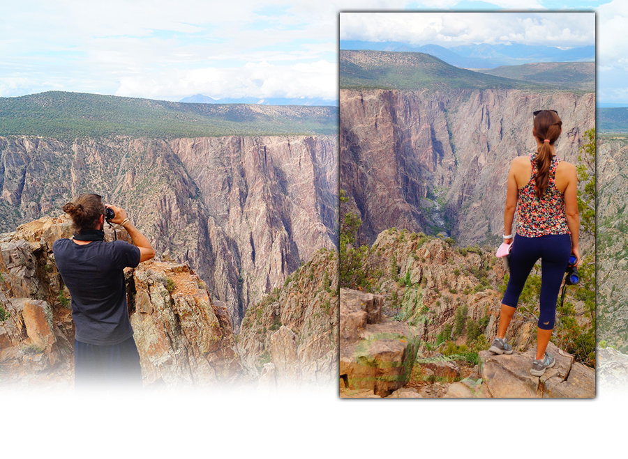
- Chasm View
- After a very short walk, Chasm view is a rewarding viewpoint of Black Canyon of the Gunnison where the cliffs are the steepest! The river can be seen bending below and the stripes, or volcanic dikes, are very prominent from here.
- Painted Wall View
- Painted Wall View is very close to Chasm View. As you can gather from the name, the cliff walls have nice, elaborate designs from the volcanic dikes branching throughout.
Hike it Later – Pin it Now!
- Cedar Point
- Self Guided Trail
- Cedar Point Overlook grants fantastic views looking down at the Gunnison River flowing through the towering canyon walls. We really enjoyed this view – looking straight on through the canyon and a great, easy vantage point of the canyon bottom. There are two different viewing platforms and more cool striping on the canyon walls across the way.
- Dragon Point
- The view from Dragon Point is very similar to Cedar Point Overlook. The beautiful green Gunnison River can be seen meandering below.
- Sunset View
- Restrooms, Picnic Area
- Sunset View has an astounding vantage point of the Gunnison River as it makes it way towards the end of the canyon. From here you can see much of the river as it flows through the canyon out to the Uncompahgre River Valley in the distance.
- High Point
- Restrooms, Picnic Area
- High Point Overlook is located at the end of South Rim Road at a dramatic 8,289 feet. The views of the Gunnison River flowing through the canyon below are great from here as well. This overlook is near the start of Warner Trail, which leads to the southernmost viewpoint in Black Canyon of the Gunnison National Park.
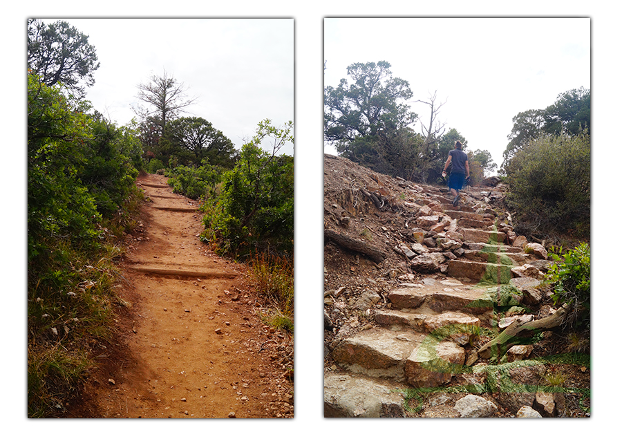
Trails
- Rim Rock Trail
- Rim Rock Trail connects the Visitor Center, Tomichi Point and the South Rim Campground. It’s a one mile walk on an easy to moderate trail from the Visitor Center to the campground (2 miles roundtrip). The trail parallels the canyon rim allowing for several opportunities to get a glimpse of the canyon, looking upstream nearly 2,000 feet below.
- Uplands Trail
- Uplands Trail leads away from the rim of the Black Canyon of the Gunnison. And instead this trail is a 2 mile roundtrip walk through the oak brush environment.
- Oak Flat Loop Trail
- Oak Flat Loop Trail is accessible from the South Rim Visitor Center. It is a more difficult, steep 2 mile loop. This trail drops 400 feet elevation through Aspen and Douglas-fir exposing great canyon views.
- Warner Point
- Warner Point Trail is an interpretive trail that leads through pinons and junipers. Some of these being among the oldest of their species! Be sure to pick up a walking guide at the Warner Point Trailhead. The information is interesting and it keeps the trail engaging. Follow along in the walking guide as it explains several features at the numbered signs along the trail. The views in both directions from the trail are beautiful and very scenic, but contrast dramatically. Some sections of the trail get steep and some sections are a bit rocky. But reaching the vista at Warner Point makes it all worthwhile. The views of Black Canyon of the Gunnison from here are just stunning and made the perfect finale for us on our trip through the national park.
Hiking Down to the Gunnison River
While you’re visiting Black Canyon of the Gunnison National Park, chances are you’ll be impressed by the beautiful Gunnison River flowing through the canyon. The good news is that if you’re up for it, you can embark on a rugged adventure into the canyons depths! There are actually several approved routes of varying lengths and difficulties. Find out more about each of them on the Black Canyon of the Gunnison National Park website.
The inner canyon of Black Canyon of the Gunnison is a wilderness area. To climb, kayak or hike in the inner canyon a free wilderness permit is required. A wilderness permit can be obtained at both the north rim and the south rim visitor centers. To find out more about how to obtain these free permits, click here.
Bonus Things to Do in Black Canyon of the Gunnison
Star Gazing at Black Canyon of the Gunnison National Park
Black Canyon of the Gunnison National Park is an international Dark Sky Park. The South Rim Campground has powerful telescopes year-round astronomy programs are offered year-round. They are led by park rangers and expert volunteer astronomers. To find out more about these opportunities, check the national park website.
Ranger Guided Programs
Ranger guided programs are offered from Memorial Day weekend through September. The activities include ranger led walks, talks, evening programs in the amphitheater, astronomy programs and an annual astronomy festival. For information on scheduled ranger guided programs check out the South Rim Visitor Center, campground bulletin boards, or the national park website.
Interested in more of the recreation opportunities in the area?
Visiting Black Canyon of the Gunnison National Park is an awesome experience. There are three main areas of the national park to fully experience the canyon: South Rim, North Rim and East Portal. Taking the time to descend into the Black Canyon of the Gunnison seems like an amazing way to experience the canyon – from the top, lowering yourself down its depth, and reaching the carver itself, the Gunnison River.
If you’re looking for even more recreation opportunities in the immediate vicinity, check out the Gunnison Gorge National Conservation Area or Curecanti National Recreation Area. Find out more about the hiking, camping, and boating opportunities at the respective websites. Or the Public Lands Center in Montrose is a good place to get information about the areas recreation opportunities.
Thanks for Reading!
Looking for more guides like this one?
- Anza Borrego State Park: Camping, Hiking and Longboarding
- Joshua Tree National Park Hiking Guide + More
- Best Hikes in Pinnacles National Park
And if you’d like to see some of our other adventures, check out the links below:
- Bumpass Hell + Cold Boiling Lake and Crumbaugh Lake
- Hiking in the Badlands
- Hayford Peak and A Cabin in the Woods
While we are on the road we stay busy creating hand painted longboards! If you’d like to pick up a unique new longboard, head over to our Lost Coast Longboarding Shop to see our latest lineup. We also design and screen print our own t-shirts and long sleeve shirts.

Thank you for your support! If you shop on Amazon, you can help us out by using our link to get to Amazon. Then shop as you normally would! It won’t affect your shopping experience but it helps us out. Thank you!