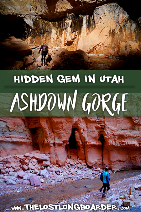
Ashdown Gorge Adventure
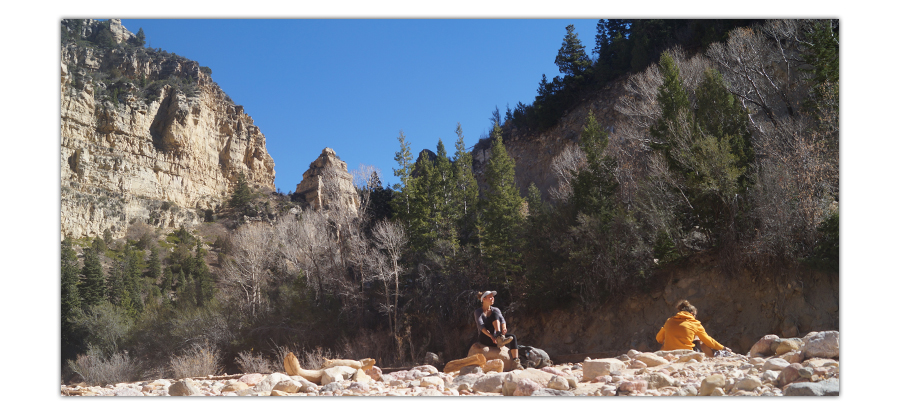
While in the Cedar City, Utah area we found plenty of adventures to keep us busy! One of our favorite places that we were able to experience was a hike in the Ashdown Gorge Wilderness. We’re a big fan of gorges and canyons so we were excited to explore! If you’re looking for a hike with some stream hopping, towering canyon walls, cool geology and new scenery around every bend then hiking Ashdown Gorge is a must!
Quick Info: Hiking Ashdown Gorge
Distance: About 6 miles
Difficulty: Moderate; lots of stream crossings and rocky areas
Directions: From Cedar City, follow Route 14 E for about 8 miles and park at the large dirt turn out. Follow an easement down into the gorge.
Our Experience Hiking Ashdown Gorge
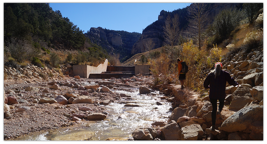
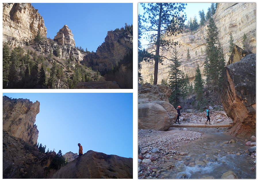
From Cedar City, we drove east on Route 14 for about 8 miles and parked at a large dirt turnout. We found something like an easement to get us down from the road into the gorge. Once we were down in it, we found two or three dam structures and headed east alongside the stream. This hike was not on a defined trail, but rather involved following the stream through the gorge.
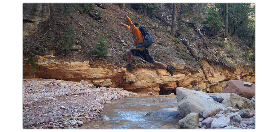
And by following, I mean criss-crossing it countless times throughout the entire hike. Initially, we decided it was hard to not get your feet wet so we took our boots off and walked through the stream.
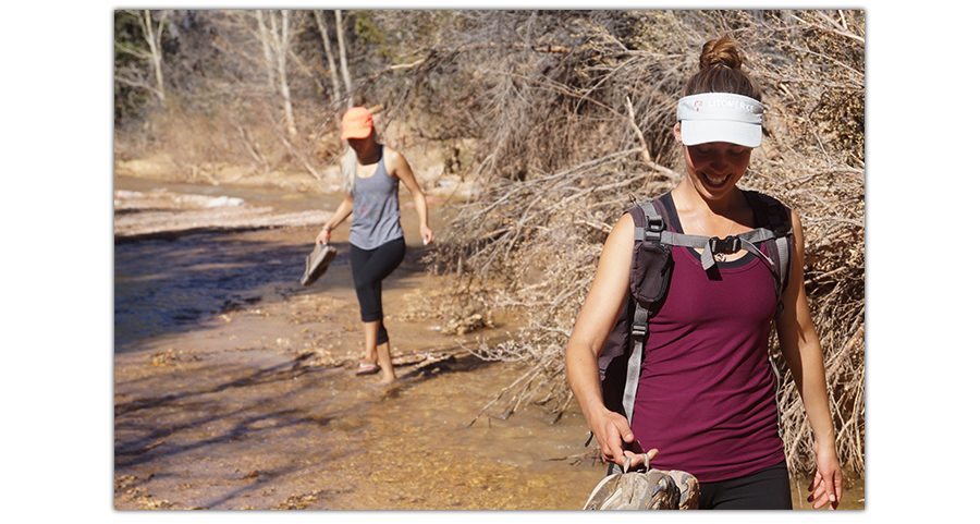
The water was so cold and we weren’t getting anywhere fast that way, so we decided to put our boots back on.
From there, we decided to carefully choose our routes and our hops back and forth across the stream. Another method we observed a couple hikers doing was just walking through the water not trying to avoid wet feet. We weren’t that brave, the water in late October was not the good kind of refreshing.
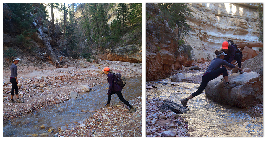
All of the leaping, balancing and strategizing made the hike that much more unique and memorable!
Liking this article? Pin it!
Getting creative with our route was fun and congratulating each other on a jump well executed was also a fun aspect.
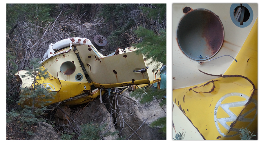
We found a few vehicles that had tumbled all the way down the canyon into the gorge from the highway above.
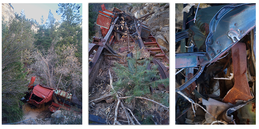
There was a large old lumber truck, a car that was so mangled we couldn’t tell what it was, as well as an old VW van.
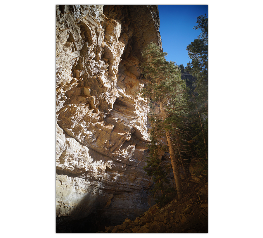
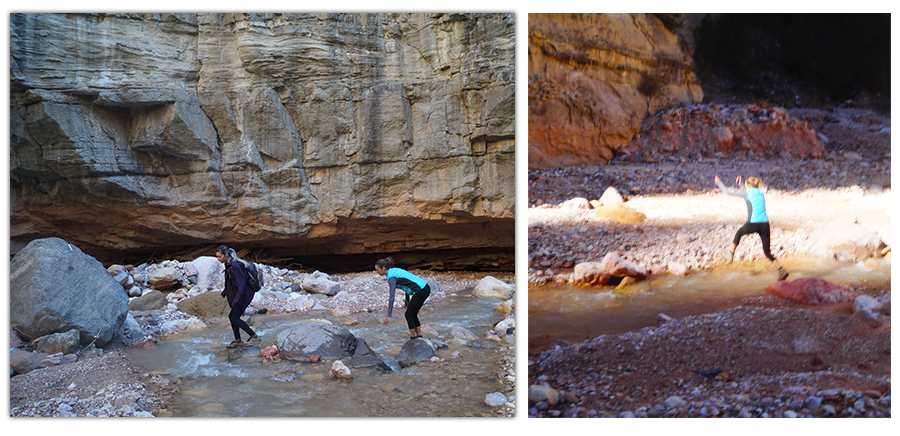
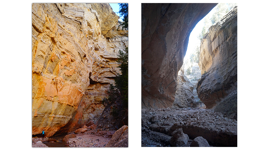
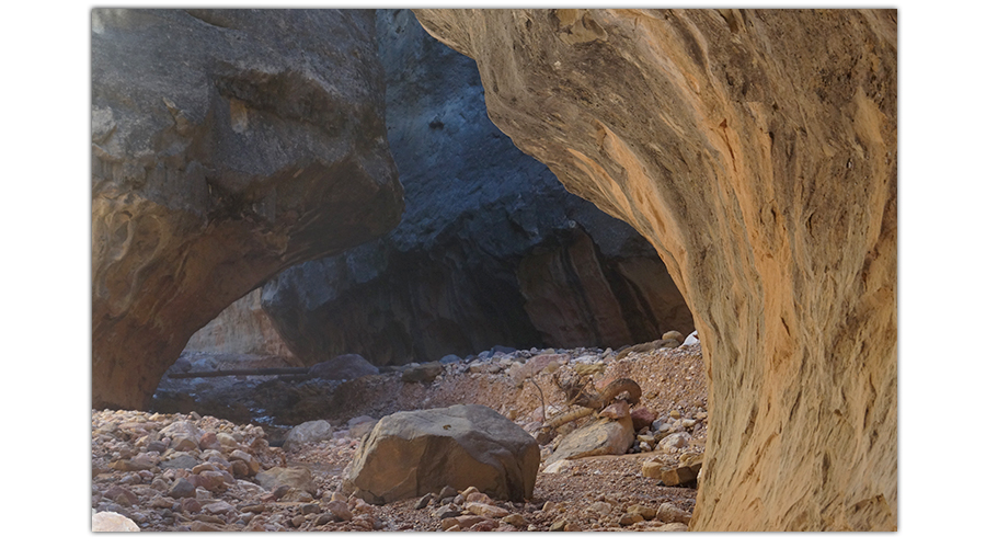
The gorge itself was breathtaking! The walls towered above us and the stream running through was beautiful. There seemed to always be a new obstacle, opportunity or beautiful sight at every curve of the gorge.
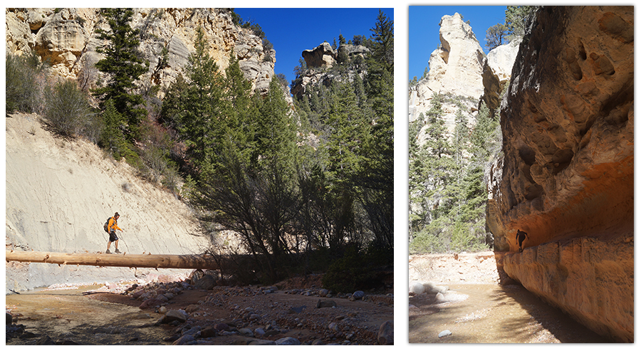
Eventually, the canyon started to narrow. The walls got closer together and the erosion at the bottoms of them got more apparent as the tops tapered out over our heads.
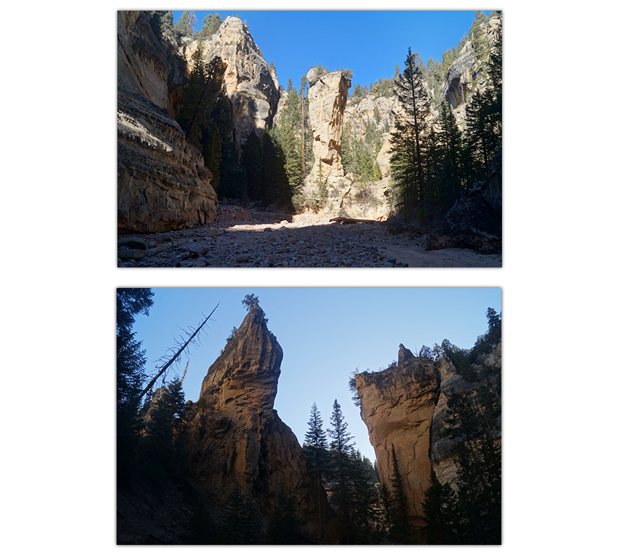
Then, the canyon opened back up and we saw a stunning monolith called “Tom’s Thumb”. Pretty neat formation!
Continuing Left at the Junction
Here marks a junction. To go right is to follow Ashdown Gorge and left is Rattlesnake Creek. This is where we went left.
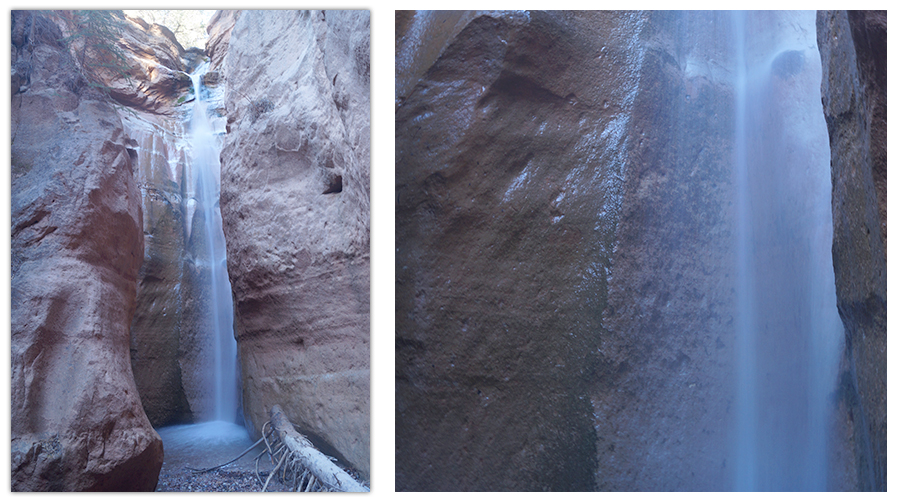
From here, the creek narrows again and winds through the canyon. Then, the canyon splits again. Left is Lake Creek and right is Rattlesnake Creek. We went left here as well. After a few minutes, the stream dead ends at a waterfall! It was beautiful and created icicles on the log which the water was falling onto.
Then we turned back the way we came. The first junction that you reach on the way back that goes toward Rattlesnake Creek also leads you to a waterfall. But we did not have time because we wanted to get back before dark. We followed the stream back and got back to our vehicle right as dusk was falling.
Hiking Ashdown Gorge was an amazing adventure with a lot of excitement! The trail kept the hike engaging and the scenery along the way was stunning. If you have any questions or comments about this hike or about this area please leave them in the comment section below!
Thanks for Keeping Up With The Lost Longboarder!
If you’d like to read about some of our other adventurous experiences check out the articles below:
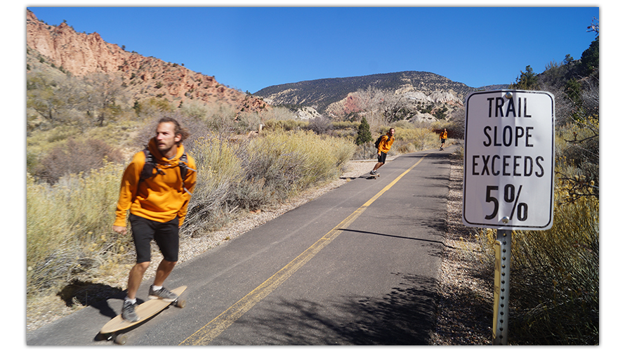
Or if you’d like to read about some of the longboarding in the area check out Coal Creek, an awesome longboarding trail running the length of the city!
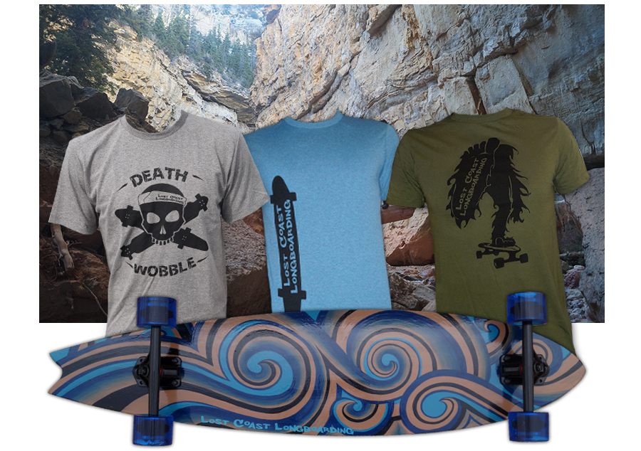
Thanks for reading this article and thanks for your support of The Lost Longboarder! Check out our hand painted longboards and t-shirts that are designed and screen printed by us at our Lost Coast Longboarding Shop!
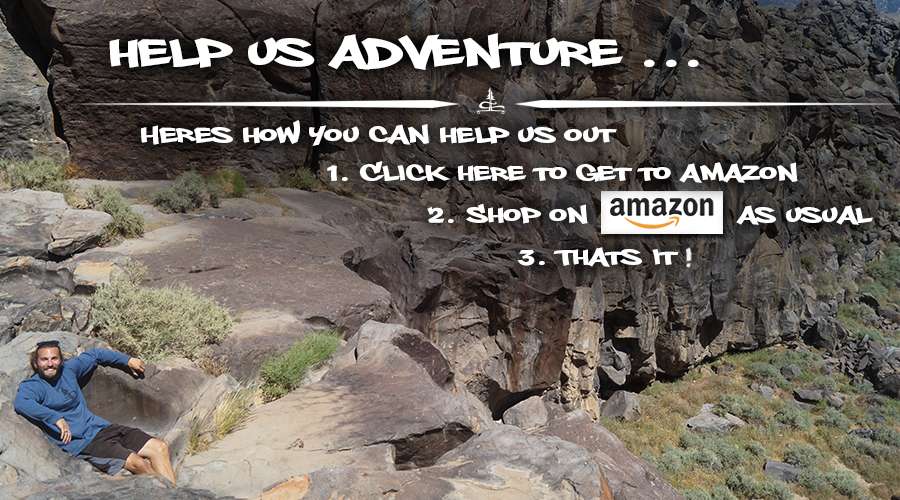
Do you shop on Amazon? If so, please use our link to get to Amazon and then shop as usual. It won’t affect your shopping experience but it will help us out! We appreciate it 🙂

2 Comments
Christine
This sounds so exciting! I live in Louisana and husband and I want to visit Utah after our old “best friend” crosses the Rainbow Bridge. “We are approaching mid seventies and as of now in relative good shape. Is this doable without having to hop up and over boulders?
Lost Coast Longboarding
Hi there! Yes, this is a pretty exciting hike! If you look at the photos and think that it’s something you guys can do – that tells me you’re in pretty good shape! I would definitely say it’s doable without hopping the boulders. Most of the obstacles that we played on we did to avoid walking in the water/getting our feet wet, plus they’re fun haha. But if you prepare and accept that you’re going to be walking in the water at times then there’s no need to do any jumping or anything. I hope you enjoy every last moment with your “best friend” and when the time comes, I hope you have a wonderful time in Utah! It is truly a beautiful, adventurous state.