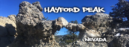
Hiking Hayford Peak
While exploring the Las Vegas area of Nevada, we spent some time at the Desert National Wildlife Refuge. The Refuge is about a half hour north of Las Vegas and is the largest Wildlife Refuge in the United States, outside of Alaska.
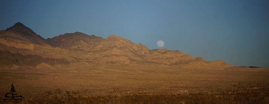
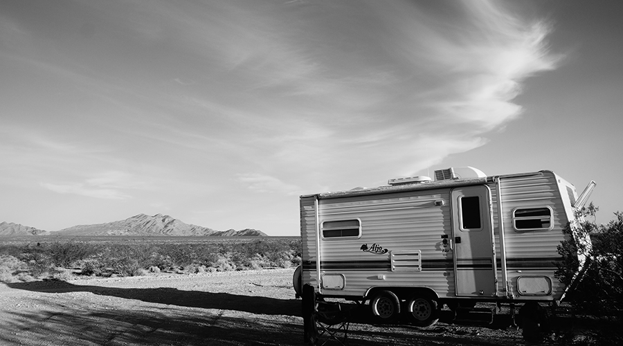
There are awesome adventures, like hiking to Hayford Peak, throughout Desert National Wildlife Refuge so it was really convenient to be able to camp here as well. During our stay at the wildlife refuge we camped in one of the designated camping areas relatively close to the Visitor Center. There are a few areas that are designated for camping and there are also dispersed camping opportunities as well. The dispersed camping requires more time on slow going bumpy roads and the road conditions vary. We had a great view of the surrounding mountains in every direction. The full moon made an appearance during our stay.
We really enjoyed our spot near the visitor center which surprisingly had very little traffic and even less fellow campers. There was plenty of peace and solitude as well as several small trails within walking distance of the designated camping area we were staying at.
The visitor center had restrooms and a water bottle refill station which came in handy. And of course, the visitor center had informative displays as well as knowledgeable rangers to help you experience the area.
During our stay here we hiked a cool peak called Gass Peak that was both challenging and rewarding. We took advantage of the relatively close proximity to the Las Vegas area to explore as well. A bit of a trip but we drove a ways to check out Mountain Ridge Skatepark, Arroyo Grande BMX Park, Goldstrike Hot Spring and Wetlands Park.
Hiking Hayford Peak
One of the most memorable adventures we did though was right here in the Desert National Wildlife Refuge. We knew that while were here we had to tackle the highest peak in the refuge, Hayford Peak. Hayford Peak tops out at 9,924 ft and is in the Sheep Mountain Range. Not only was it the highest peak in the refuge but it was a beautiful, diverse and unforgettable adventure.
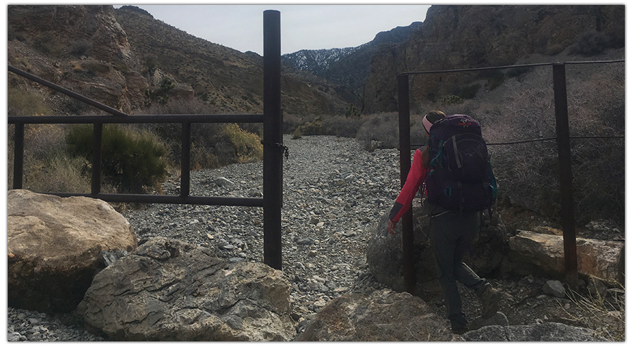
To get to Hayford Peak, travel North (left past visitor center) for 16 miles until you reach Hidden Forest Road. Then take Hidden Forest Road until it ends at the trailhead. There will be a information sign and a metal gate at the trailhead. The metal gate has a sign for Deadman’s Canyon on it.
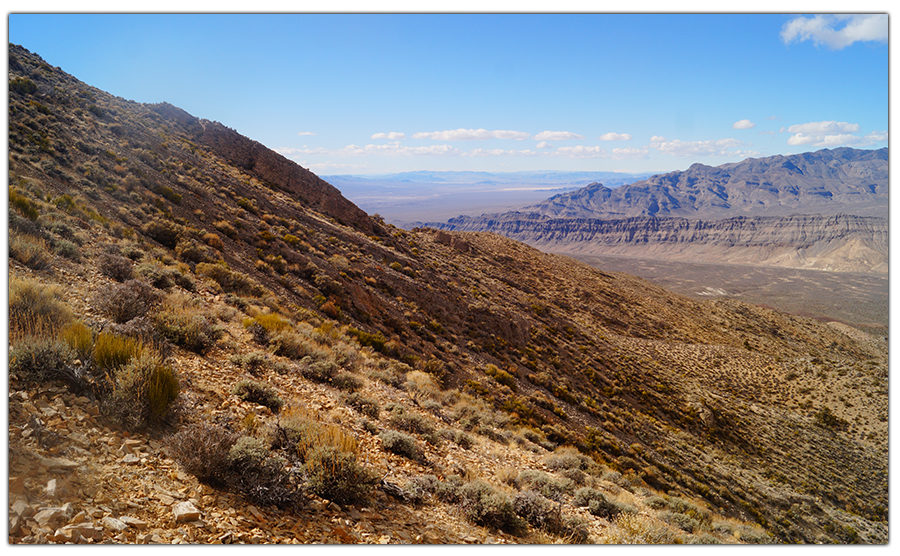
The trail follows Deadman’s Canyon all the way to Hidden Forest. The start of the trail is mostly gravel. The gravel is of variable sizes, mixes up its difficulty as you go. The surrounding canyon walls are rocky, tall, and beautiful!
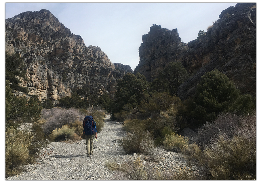
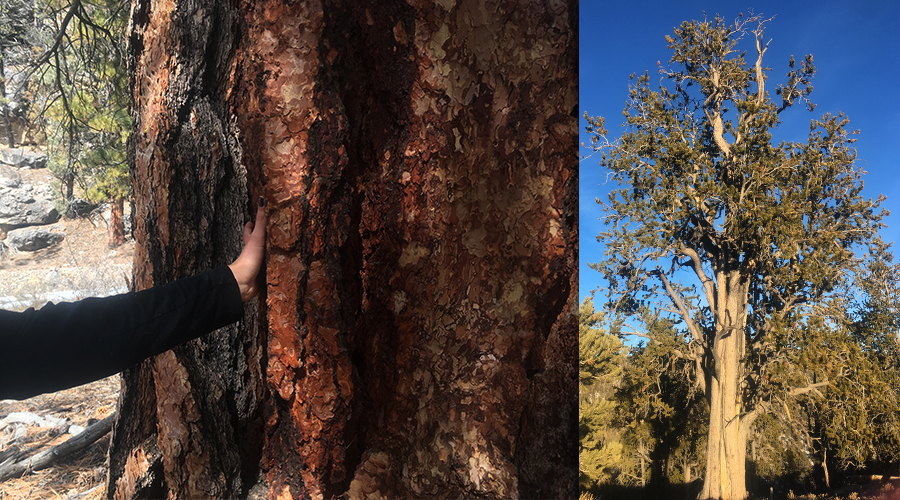
As we were hiking to Hayford Peak, the plant life started to change from Joshua Trees, Yuccas, and cactus to Pinyons, firs, and Ponderosas.
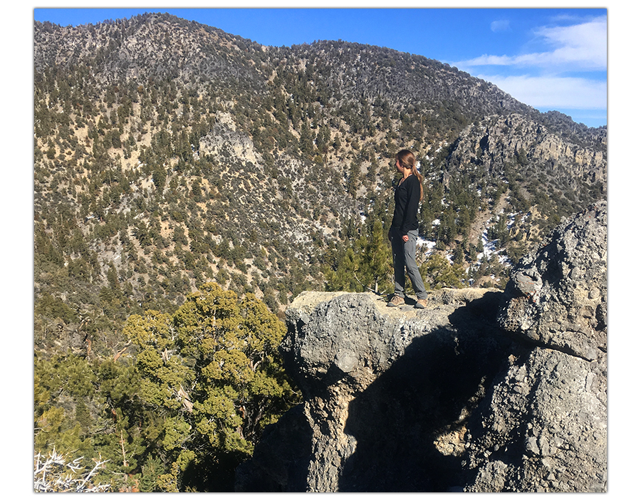
As the trail meanders through the canyon, you’ll see cliff faces, rock pinnacles, caves and arches. We eventually started to see and hike through snow!
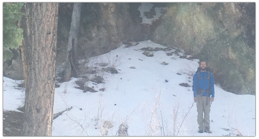
This was awesome because just an hour or two earlier we were on the hot dry desert floor! After 5.5 miles and 2,000 feet elevation gain, we reached the historic log cabin.
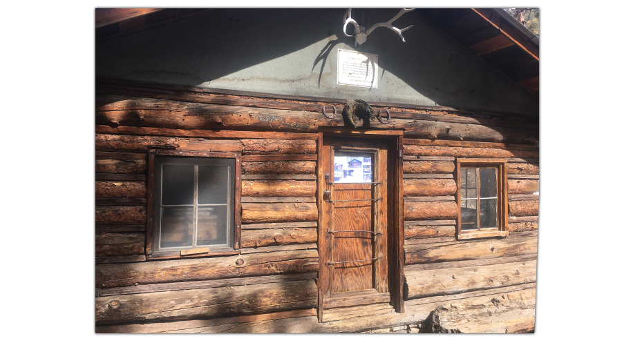
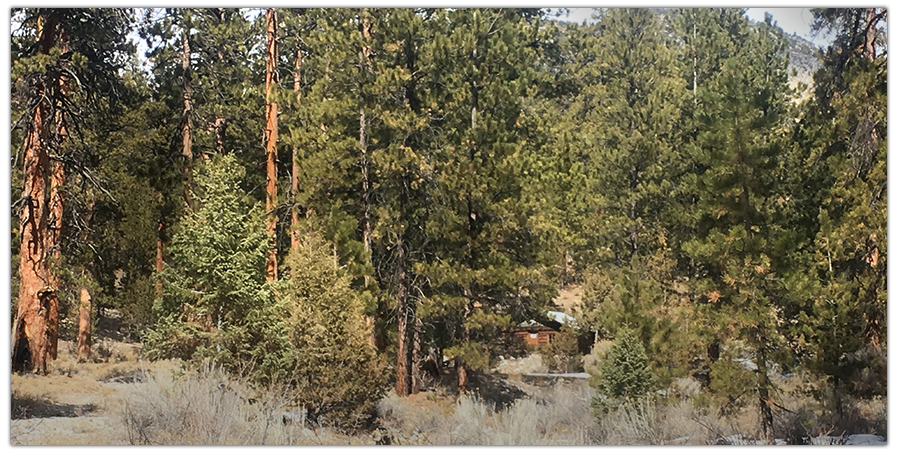
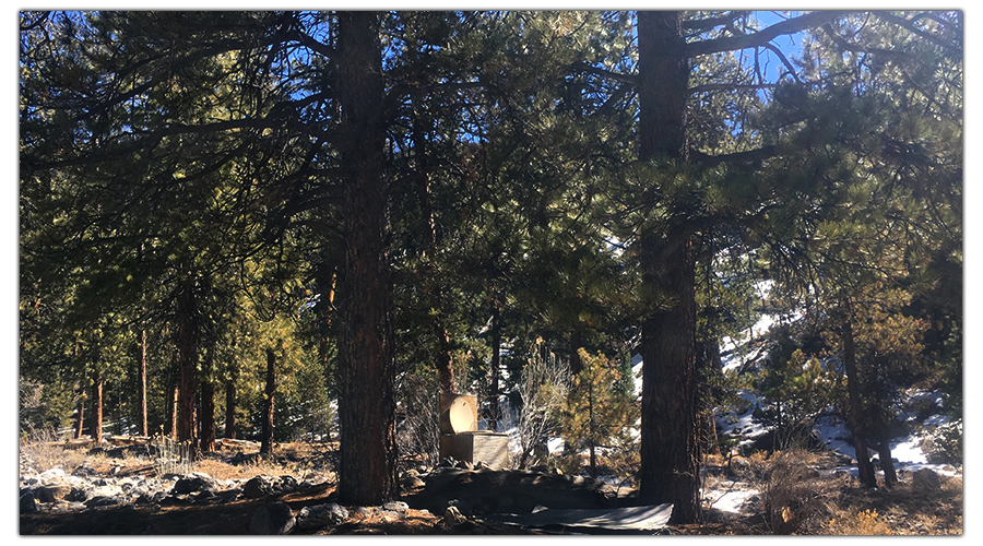
The cabin is nestled among tall Ponderosa Pines, surrounded by picnic tables, fire rings, and canyon walls. There is also a spring with running water. The cabin is left unlocked for all to use. When we arrived we found a sort of log book, firewood already cut and some snacks left behind by other hikers. Enjoy this little retreat in the woods and be sure to leave the cabin better than you found it, the next ones in will appreciate your efforts!
The cabin was built in the 1930’s, has been used for several purposes, is now protected and has had some restorations done. We found the remnants of a 1920’s era car nearby! Walking the trail was difficult enough, but taking a car back there seems like a challenge! The cabin does not have a toilet in it, but if for some reason you felt the need to use one, your in luck! There is a pooper with a view, located just outside the cabin.
We dropped our packs off at the cabin and headed out to conquer the peak. The trail for hiking to Hayford Peak starts northwest of the cabin. About five minutes into it, the trail passes by a spring. From here, the path is a little unclear. There are cairns (stacks of rocks) throughout a lot of the trail but very sporadic at the beginning.
Like this Article? Pin It!
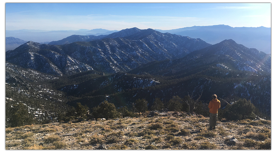
This part of the hike is steep, and when in doubt, go up! Eventually, you make it to a ridge where the path is more defined and the peak comes into view. From this vantage point, it’s hard to tell which mountain is the tallest. Aim for the peak with the weather station tower on it.
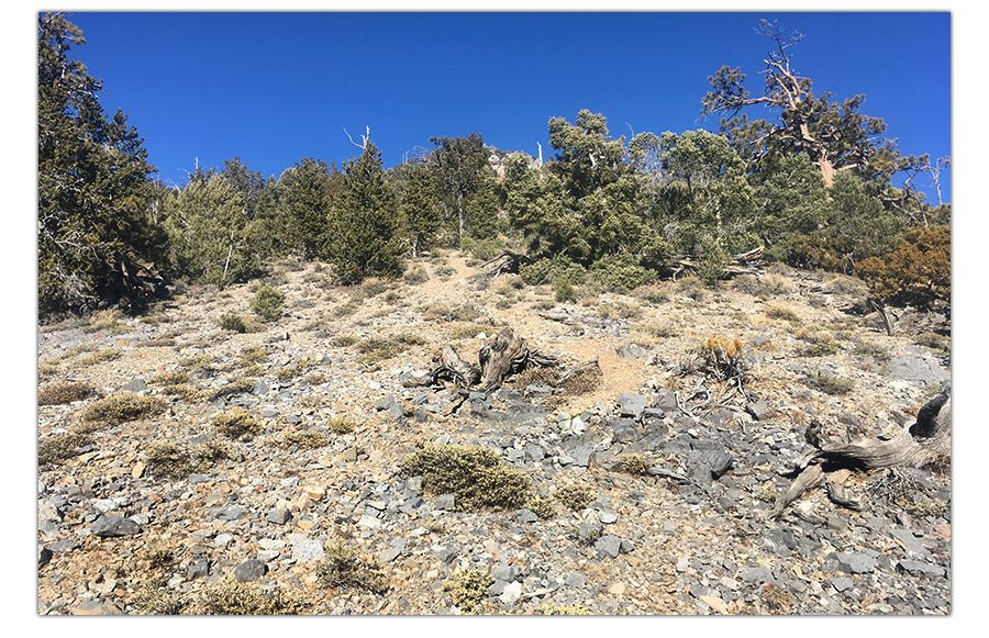
Now the trail has reached an elevation suitable for the Bristlecone Pines. It was awesome to be among some of the oldest trees on Earth! Looking around at the snowy peaks covered in conifers, it seemed crazy we were in the desert just earlier today! Follow the path up the ridge and back down the saddle.
The final ascent gets steep and the trail becomes more snowy, more rocky, and more difficult but the views already breathtaking! Finally, after 8 miles and 4,000 feet of elevation gain, we made it from the desert floor to the top of the highest mountain in the refuge! The views were incredible and the visibility was great! Near the geosurvey marker there was a registry with peoples sign-ins dated back to the 60’s! Pretty neat.
After taking in the views, we began the descent. We cut it pretty close with daylight since it got dark by 5:30 that time of year. The cairns were pretty helpful on our way down. But the closer to the cabin we got, the more sparse they were. Also, the trail can get tricky in the woods so bring a compass!
We made it back to the cabin right at nightfall. Afterwards, we made excellent use of the wood burner and enjoyed a cozy, restful night in the cabin in the woods after a long hike. The next day we hiked back down the canyon and returned to our campsite in the desert.
Thanks so much for reading!
For another rewarding (but shorter) hike in the Desert National Wildlife Refuge, check out our Hiking Gass Peak article!
Be sure to stay tuned to The Lost Longboarder for more adventures near Vegas and beyond! Thanks for reading! You can show some support by picking up some longboarding gear at our Lost Coast Longboarding shop.