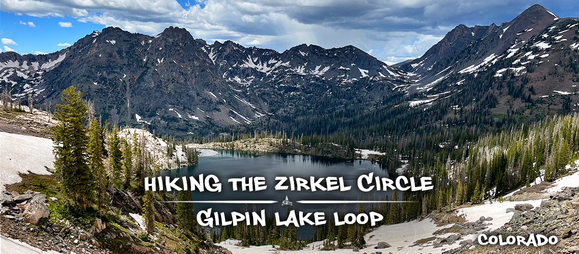
Hiking the Zirkel Circle | Amazing Scenery On Gilpin Lake Loop
Hiking the Zirkel Circle is a gorgeous day hike and a great place to start exploring Mount Zirkel Wilderness. This hike combines Gilpin Lake Trail #1161 and Gold Creek Lake Trail #1150 to create a very scenic loop. Hiking the Zirkel Circle ends up being almost the same distance as the Gilpin Lake out and back but instead allows for new scenery the entire way. After a gorgeous adventure to two lakes and up a beautiful saddle, hiking in Mount Zirkel Wilderness will leave a lasting impression! And this is only the beginning of the incredible glacial landscapes to discover in the area. Read on to find out more about hiking the Zirkel Circle.
Also in Mt Zirkel Wilderness: Hiking to Lake Katherine
A Little About Mount Zirkel Wilderness
Mount Zirkel Wilderness is located within Routt National Forest in norther Colorado. It was designated a
wilderness area in 1964 and is named after the highest point – the 12,180 foot-tall Mount Zirkel. This wilderness encompasses nearly 160,000 acres and straddles the Continental Divide. Here you’ll find several river headwaters – Elk, Encampment, and North Platte rivers – and over 70 lakes. And of course numerous rugged, high mountain peaks of the Sawtooth Range and portions of the Park and Sierra
Madre Ranges. There are 15 peaks over 12,000 feet in Mount Zirkel Wilderness and over 150 miles of trails. So much to see, so little time!
Quick Info: Hiking the Zirkel Circle Loop
Distance: 11 mile loop
Difficulty: Moderate
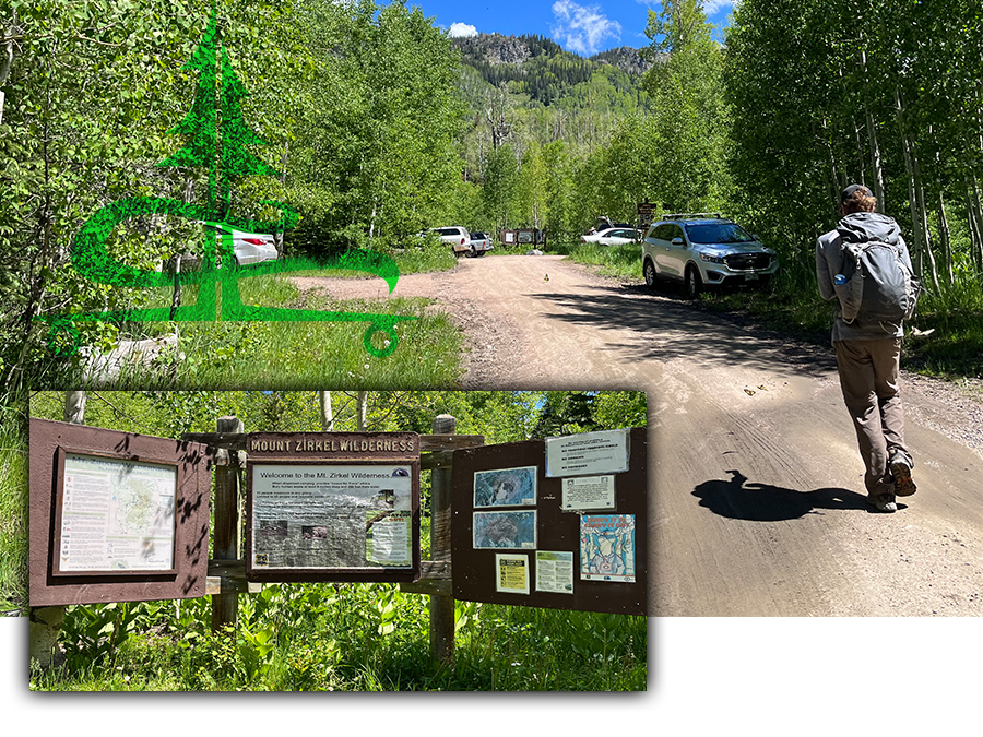
Directions: From Steamboat Springs, follow County Road 129 north for about 18 miles to Clark. Continue north then turn right onto Seedhouse Road. Continue along Seedhouse Road for another 12.3 miles to the roads end at the Slavonia Trailhead.
Trailhead Amenities: Vault toilet, information board with trail map
Good to Know: There are a few forest service campgrounds in the area as well as a designated dispersed camping area along Seedhouse Road.
Our Experience Hiking the Zirkel Circle Loop
After a beautiful drive along Seedhouse Road, we reached the Slavonia Trailhead. And though we knew that Gilpin Lake Trail and Gold Lake Trail were two of the more popular trails in Mount Zirkel Wilderness, we were a little surprised to see the parking area full on a Monday. Nevertheless, we geared up and began our adventure hiking the Zirkel Circle loop.
We chose to hike the Zirkel Circle loop clockwise. After reading reviews about the snow covered trail up to the saddle, we weren’t sure we were going to be able to complete the whole loop. I was particularly interested in seeing Gilpin Lake so by following the loop clockwise, we were able to guarantee that we would get to see it. So first segment of our Zirkel Circle loop was Gilpin Lake Trail #1161.
Gilpin Lake Trail
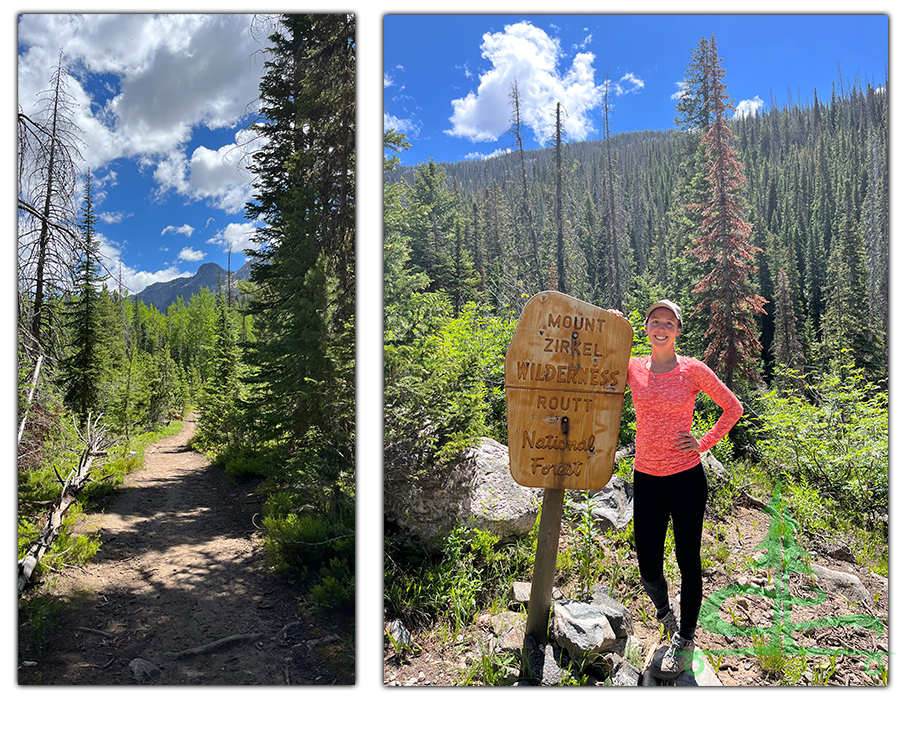
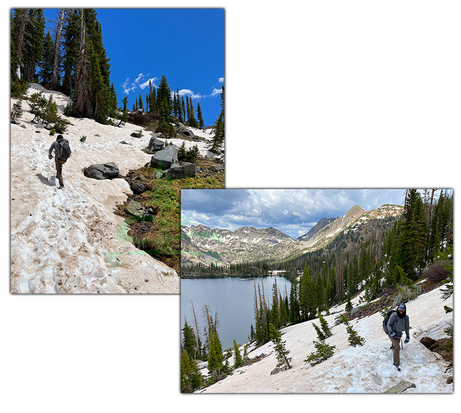
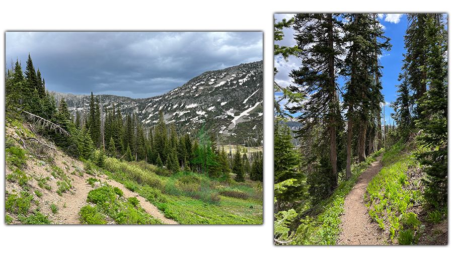
As we began hiking Gilpin Lake Trail it was easy to follow with a couple signs to keep you headed in the right direction at the intersections. The trail leads up through mixed aspen and conifer forest to the Mount Zirkel Wilderness boundary sign. So far, there were some muddy sections of trail and the air was filled with floating cotton whisps.
The trail continued to gently climb, bringing the peaks in the distance closer and revealing a few more.
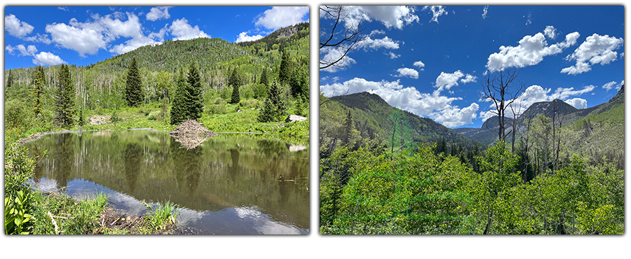
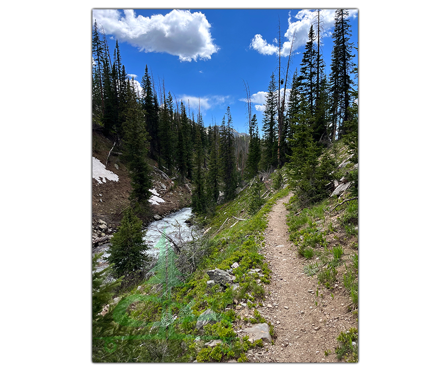
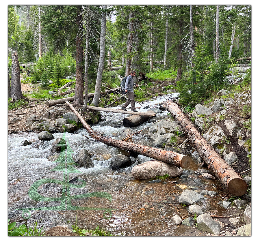
Along the way, there were a couple not too difficult water crossings and several places to view the rushing water from the trail.
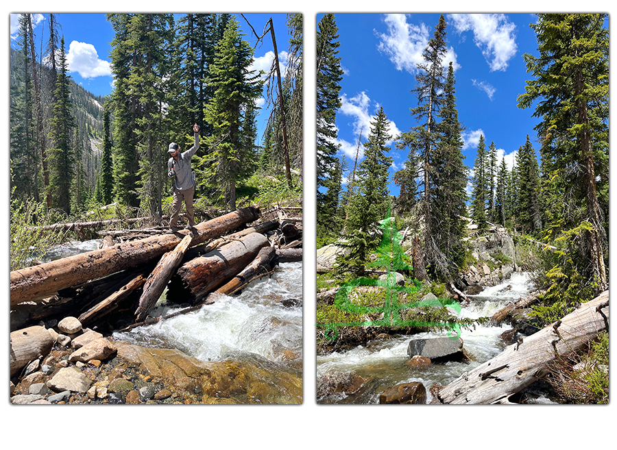
And the trail through the woods started to open up allowing for wider views of the lush mountain landscape.
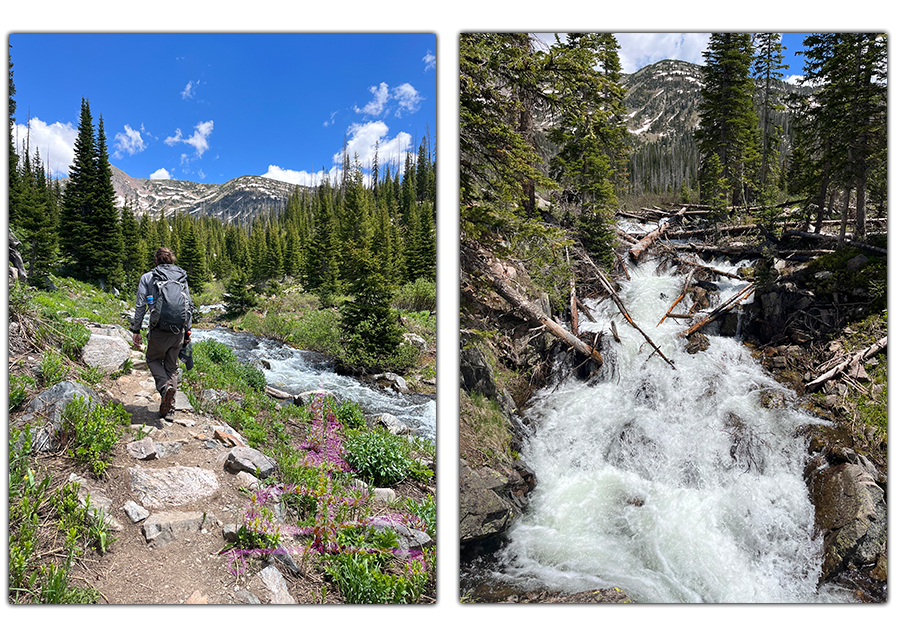
To add to the already beautiful scenery, more and more wildflowers bordered the trail and decorated the meadows. So far hiking the Zirkel Circle has proved itself to be an excellent choice!
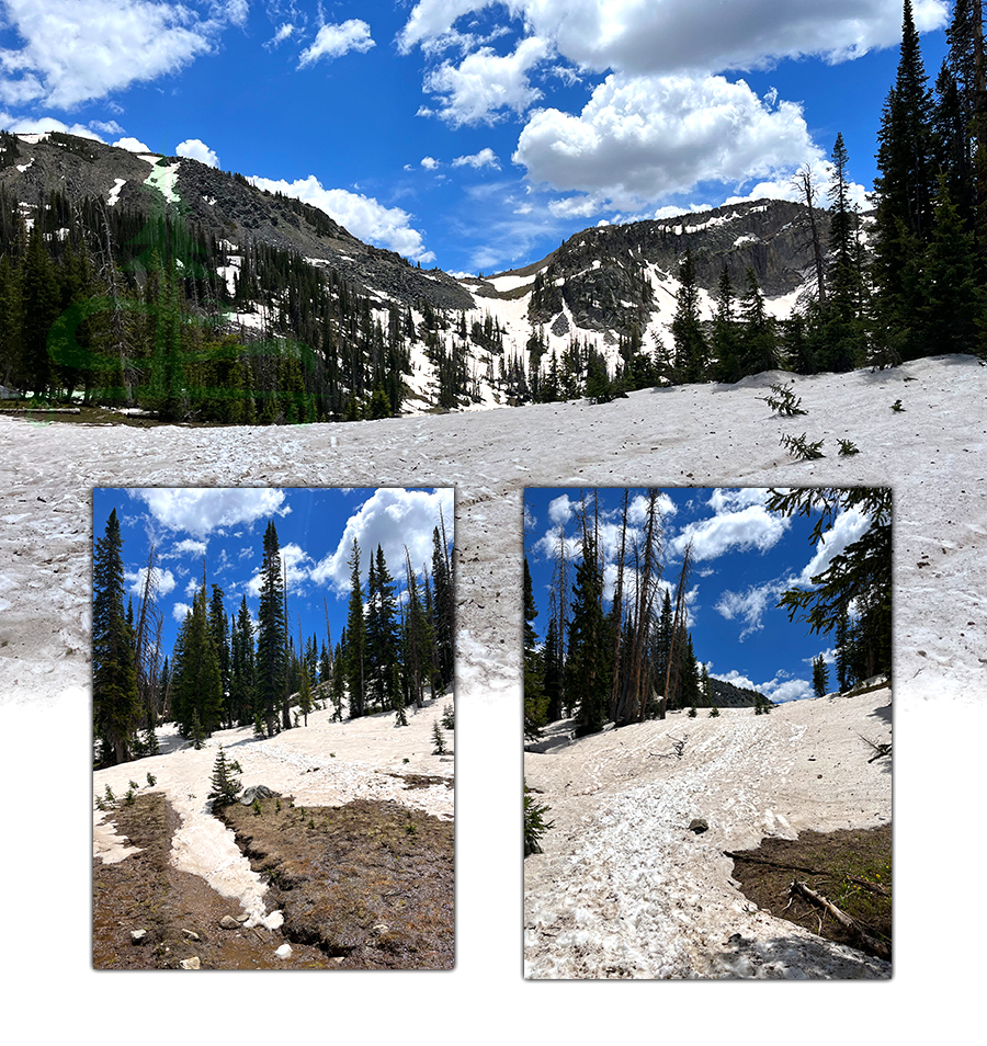
When we were about 4 miles in, there were incredible views of the sheer and dramatic mountains that shaped the glacial valley. But as we neared Gilpin Lake, the trail began curving away from the peaks and started to climb the hillside through the woods. And the snow!
This section of hiking the Zirkel Circle was just following the tracks in the snow the rest of the way up to the shore of Gilpin Lake.
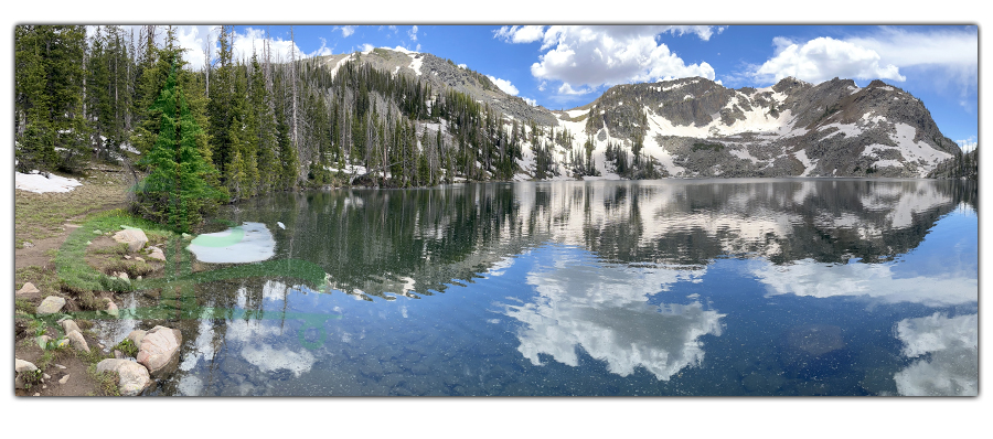
Arriving at Gilpin Lake
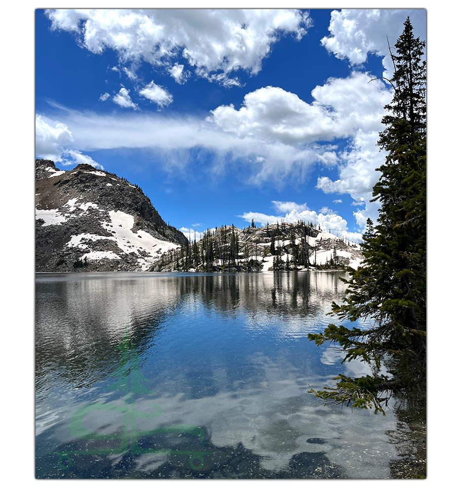
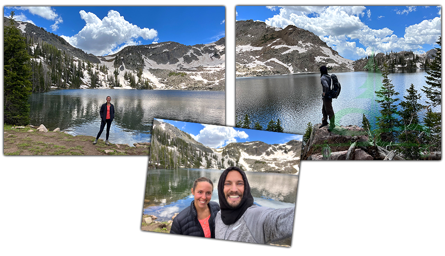
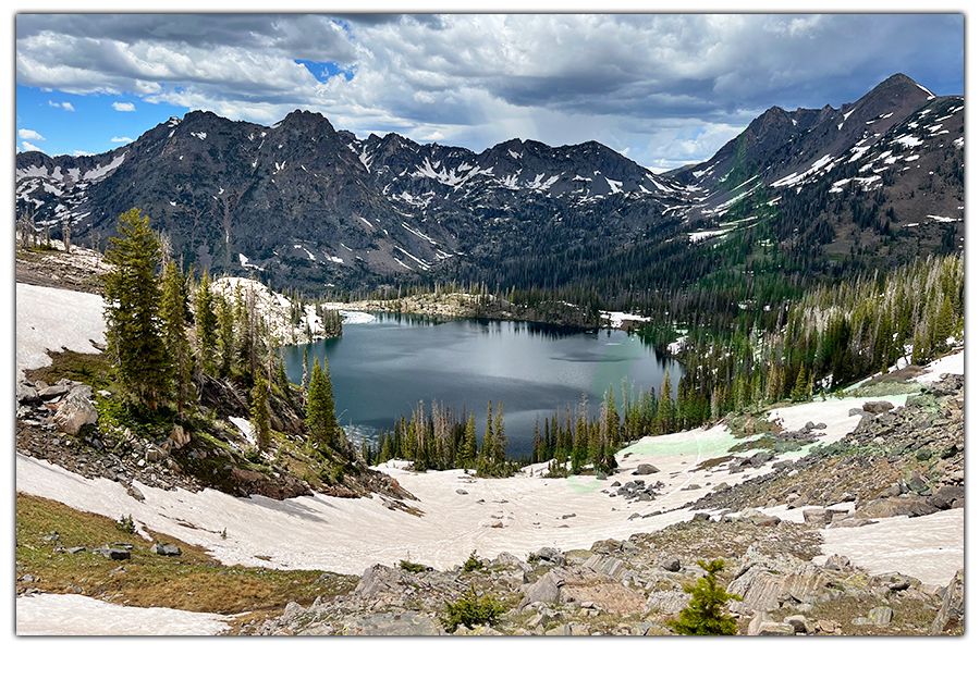
Gilpin Lake was even more beautiful than I had anticipated! The rocky mountain backdrop had the perfect amount of snow, matching the fluffy white clouds in the beautiful blue sky. And the reflection of all this beauty in the lake itself was incredible.
We took a bunch of pictures then ate lunch and watched the fish jumping in the lake. The trail up to the saddle across the lake looked steep and completely covered in snow. So we were debating continuing the loop or just heading back the way we came.
While we were debating we met two pairs of hikers that had just come down from the saddle. The first guy told us that there was about 2 more hours of hiking in the snow on the other side as well as a waist deep water crossing. So we were leaning towards heading back. But the second guy told us that the snow wasn’t bad at all and the water crossing was ankle deep. Luckily story number two was a more honest
account. It was decided – we were going to continue hiking the Zirkel Circle loop.
Hike it Later – Pin it Now!
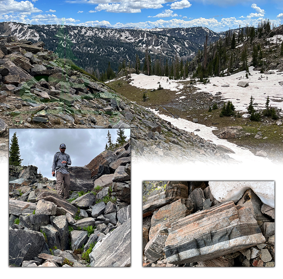
From Gilpin Lake, we followed the trail along the shore then began following the footprints in the snow all the way up to the saddle. It was quite steep, slippery and every now and then we sunk into the snow a bit. But overall the snow was pretty compact.
The views of Gilpin Lake continuously changed as we gained elevation and it was a stunning everchanging sight every step of the way!
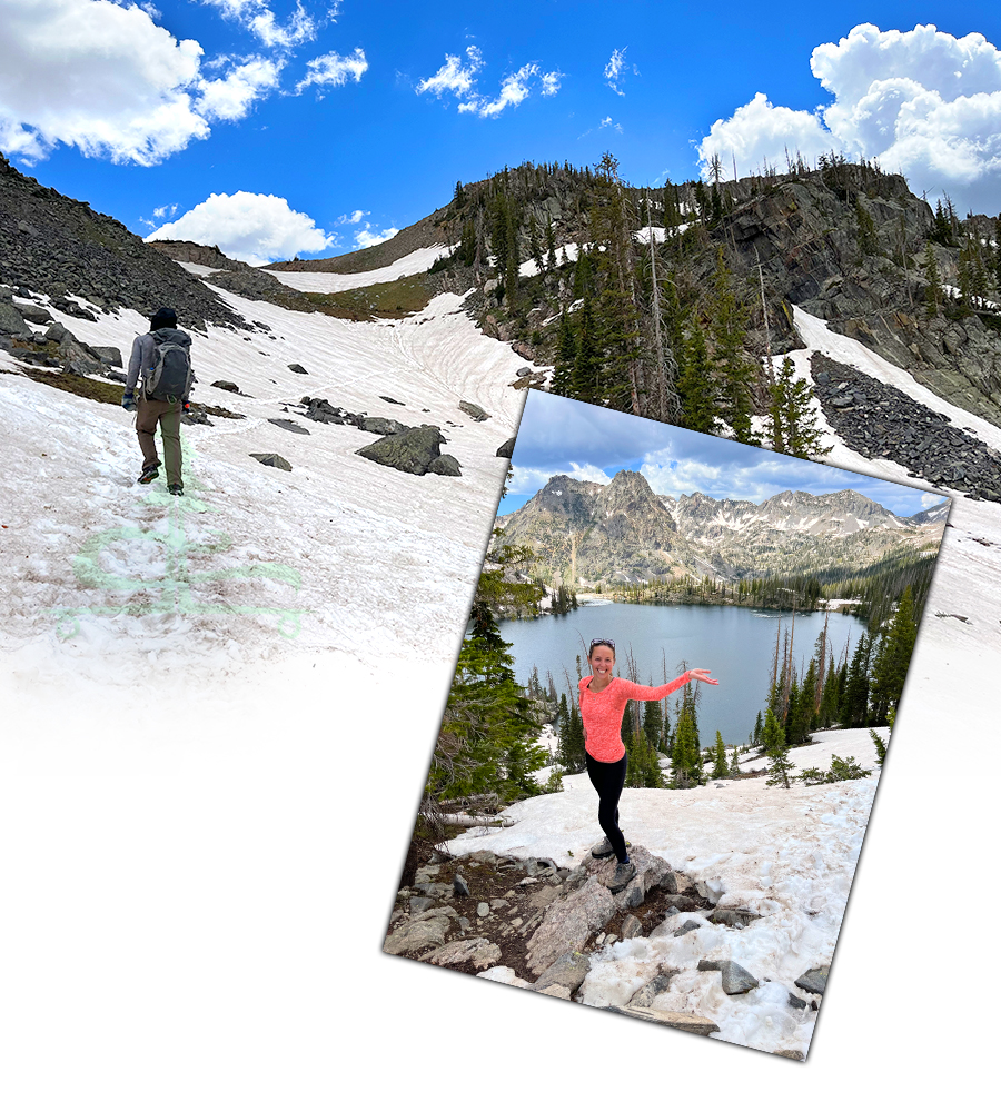
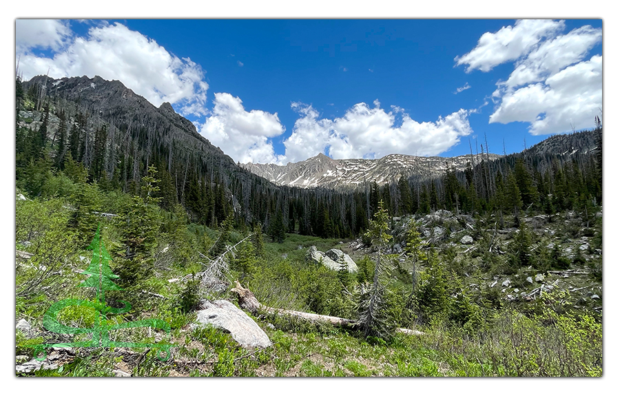
After a steep ascent, we reached the saddle. From the saddle we could see into the next valley and we could also see that we had another lengthy stretch of snow to tackle. We could also see some threatening gray clouds heading our way and could hear the rumbling thunder.
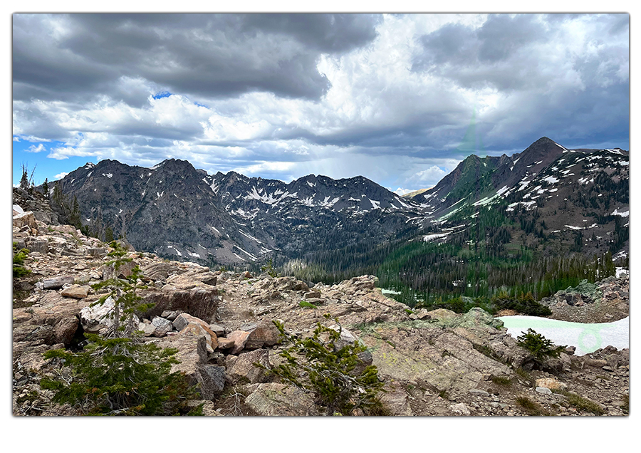
And here’s one last look at Gilpin Lake below. It was definitely getting more cloudy.
The way down involved some slipping, sliding and sledding as well as a muddy trail. So we tried taking the rocks until we finally reached some drier switchbacks.
We followed the switchbacks as they snaked through the woods until we reached an intersection and picked up the Gold Creek Lake Trail.
Gold Creek Lake Trail
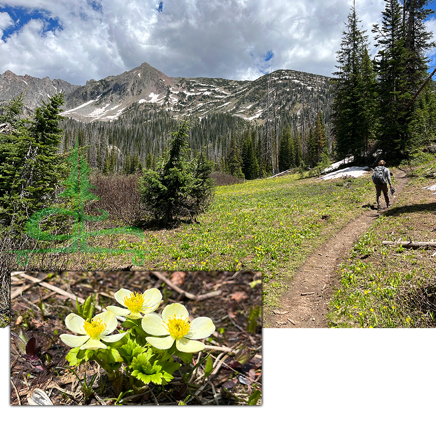
Gold Creek Lake Trail continues to descend along switchbacks into the beautiful valley until it levels out near the stream. We hoped that we were leaving the dark skies behind us as we continued hiking the Zirkel Circle loop.
The trail paralleled the rushing stream for awhile before we reached a water crossing. At this crossing, we were able to use a log to get half way across but then I took my shoes off to cross the rest of the way. It was indeed only ankle deep.
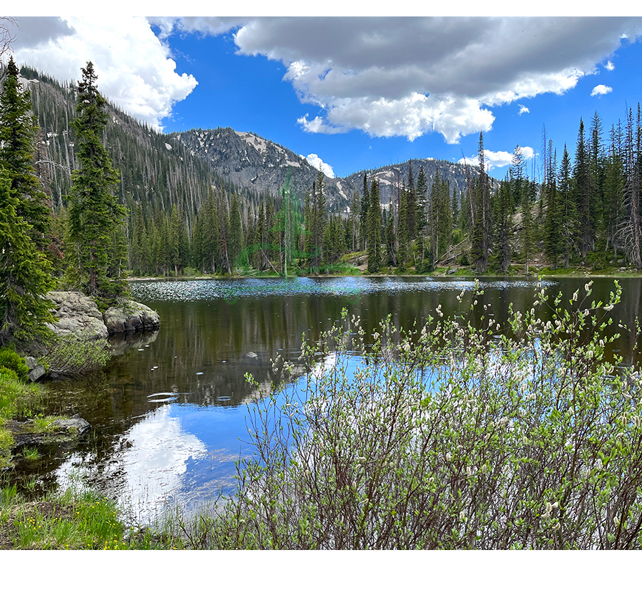
We continued along the trail in a bit of a hurry, thunder rumbling behind us and big rain drop falling on us. The trail was pretty mellow and brought us to Gold Creek Lake. Gold Creek Lake is a pretty lake mostly
surrounded in rounded mountains covered in conifers. Though many of the conifers appeared to be dead. We stopped just long enough for pictures and to skip some rocks that Shane had been collecting along the way. The rain and swarming mosquitoes were enough to encourage us to keep on keepin on.
Liking this Article? Pin it!
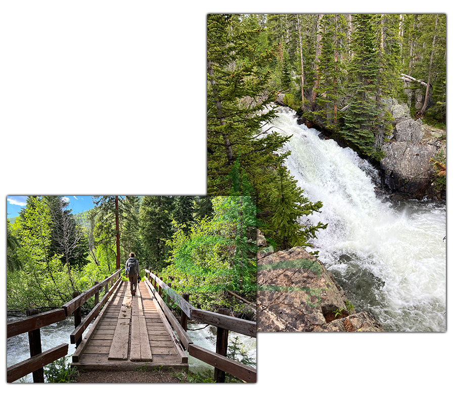
From Gold Creek Lake, the trail continued to descend through the woods with views of the nearby green mountains. At the next river crossing we were able to cross along a couple downed logs.
As we were finishing up hiking the Zirkel Circle we enjoyed green mountain views, a thundering waterfall and eventually crossed over a wooden bridge. The trail passed through a beautiful aspen grove and reconnected with the initial stem of trail that led us back to the parking area.
Wow, what a hike! And what an introduction to the Mount Zirkel Wilderness. We really enjoyed seeing the tall dramatic mountain peaks, incredible views of Gilpin Lake and working through the challenge of the snow covered pass together. And we were grateful that we avoided a downpour. Can’t wait to return and see more of this amazing area of Colorado.
Thanks for Keeping Up with The Lost Longboarder!
We hope you enjoyed our article about hiking the Zirkel Circle. If you’d like to see some other beautiful hikes, feel free to check out the links below:
- Hiking Lassen Peak
- Hiking McDonald Creek Canyon
- Devils Causeway and Mosquito Lake Loop
- Big Loop Hike in Chiricahua National Monument
We love getting out, hiking and seeing new places as often as we can! And when we’re not adventuring, we’re working on our hand painted one of a kind longboards! If you’d like to check out our latest lineup, head over to our Lost Coast Longboarding Shop!

Do you shop on Amazon? If so, please use our Amazon link to get to Amazon. Then shop as you normally would. It won’t change your shopping experience but it helps us out a bit. We appreciate it!