Hiking North Schell Peak: 11,883′ Highest Point in High Schells Wilderness
Hiking North Schell Peak is a rewarding experience where you’ll find many aspen, a flowing creek, great panoramic views and likely, complete solitude. It’s also a great change of scenery and an opportunity to beat the heat at lower elevation. North Schell Peak reaches 11,883 feet elevation with a prominence of 5,404 feet. These impressive numbers make it both a high point and an “ultraprominent” peak in the High Schells Wilderness near Ely, Nevada. The North Schells Wilderness is a long, skinny mountain range stretching about 140 miles encompassing a beautiful landscape and several beckoning peaks.

Quick Info:
Distance: About 6-8 miles round trip depending on where you park.
Difficulty: Moderate
Directions: From Ely, follow US-93 N for about 16 miles. Turn right onto SR 486 and continue 8.5 miles then turn left onto Forest Road 425. Here you’ll see a sign for Timber Creek Campground and the road will turn to dirt. After about 4 miles you’ll reach a parking area and then the campground. You can park here in the parking area or continue about another mile to the actual trailhead parking area. Click here to get directions to the trailhead for North Schell Peak.
Good to Know: The dirt forest service road is in good shape to the campground though a bit rough – rocky/bumpy. When we visited, it was passable in typical passenger vehicles. Past the campground it got a little worse before getting better where it then ends at a parking area.
Our Experience Hiking North Schell Peak
While camping in the Ward Mountain area, we set our sights on hiking North Schell Peak. It was about an hour drive from our camp spot. On the way we spotted elk along the base of the nearby mountains! We followed the bumpy dirt road to Timber Creek Campground and since we didn’t know the road conditions passed the campground we decided to park in the parking area. We noticed the campground was completely empty, but the camp spots were amazing. Each spot was tucked into the trees with access to the flowing creek.
From the parking area, we walked about .75 mile before reaching the actual trailhead parking. Luckily the walk along the road was still pretty scenic. Now that we know though, there were several other places to park had we gone further up the road.

Hiking North Schell Peak Trail
At the trailhead, there is an information sign with no information. The dirt road continues left and there is a foot trail to the right. Follow the road left here to begin hiking North Schell Peak.

The road turns to a slightly overgrown trail with tall grasses and numerous types and colors of wildflowers. The trail passes through a beautiful aspen forest and follows a rushing stream up through the ravine. We continued following the ravine and the faint foot rail through the plants, crossing the stream a couple times.

Eventually we reached the first patch of snow! We were pretty excited to see snow after being in a heat wave for the last week or so. The snow patches covered much of the trail but we just continued along the ravine.

The views began opening up, the faint foot trail ended and we knew it was time to leave the snow and creek behind as we began the steep talus ascent. From here, there is no trail but the direction is pretty easy – up. This section of hiking North Schell Peak was pretty tough as far as getting good footing and breathing haha. But easy too, as it’s just putting one foot in front of the other and expecting unstable rocks underfoot. The views were already beautiful looking back.

Hike it Later – Pin it Now!

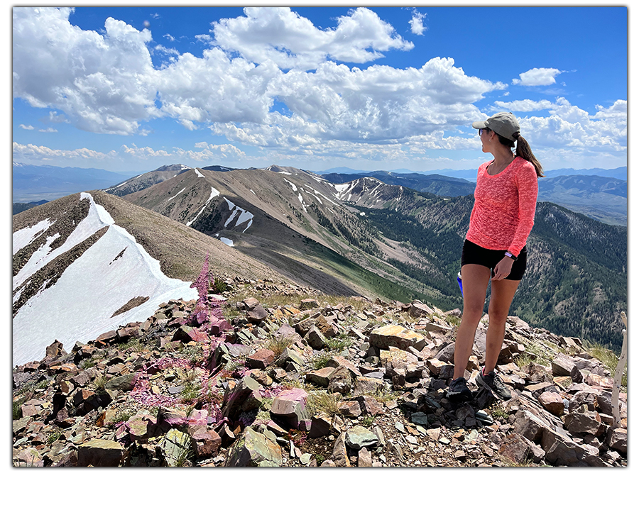
Finally, we reached a ridge of sorts and noticed two large cairns a bit to our left. So we headed that direction but mostly shot up towards the ridge. This area was also rocky but eventually a foot path was visible again. We walked along the ridge, checking out the views down below while working our way higher.

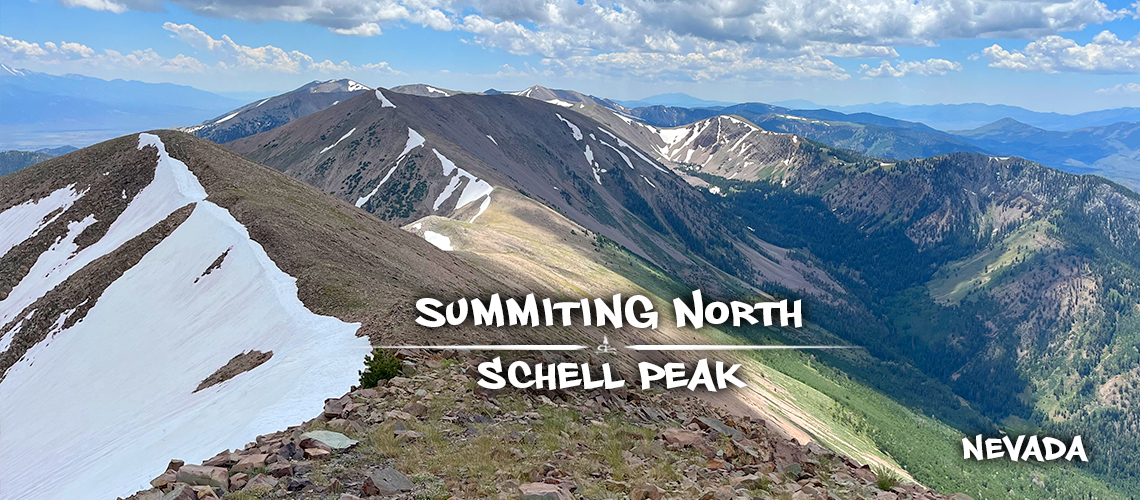
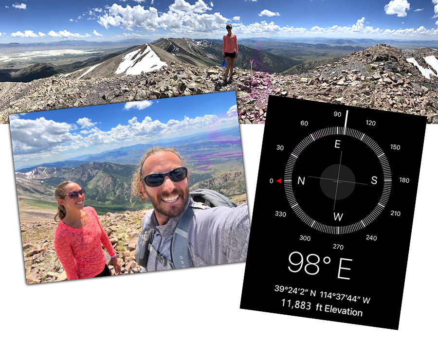
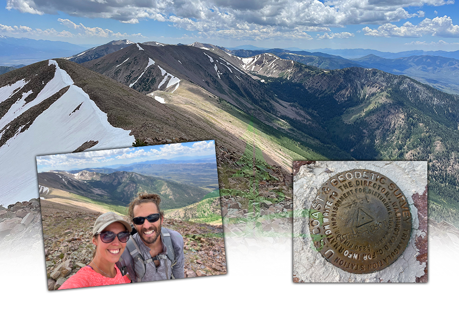
We made it! At the summit, there was a stick stuck in the ground near the geo marker. And of course, the whole point of hiking North Schell Peak, there were great views in every direction! I especially enjoyed the views looking out at the other peaks, the beautiful cirque and valleys in this particular range. But we could also see across the basin to Mt. Moriah and Wheeler Peak.
After taking in the views and trying to capture the beauty in photos we ate our well deserved lunch and signed the summit log. It was pretty chilly up at the top so we were ready to keep moving. We contemplated following the ridge over to Middle Schell Peak but decided to just head back down.
The way back was the same route as the way up. Coming down the loose rocks was a bit wobbly to say the least. So to take a break from the rocks, Shane took the snow. Still a bit unsound underfoot but falling on the snow seemed a better risk.
On the way back, we knew we were leaving the beauty of the high elevation wilderness behind us. That made it so we appreciated the rushing water, the beautiful aspen and green valley climbing up the cirque plus the wildflowers all around even more. By the time we finished hiking North Schell Peak trail, my toes had had enough downhill and I found myself wishing for some uphill!
Thanks for Reading!
We hope you enjoyed our hiking North Schell Peak article. If you’d like to read about some more cool adventures, check out the links below:
- Black Rock Canyon Oasis
- Bumpass Hell + Cold Boiling Lake and Crumbaugh Lake
- Hiking Mt. Shavano
- Exploring Gold Butte National Monument
When we’re not adventuring, we’re working on our hand painted Lost Coast Longboarding longboards! To check out our latest lineup, head over to our Lost Coast Longboarding Shop. We also design and screen print our own t-shirts!

And if you’d like to show your support for The Lost Longboarder another way – whenever you shop on Amazon, just use our Amazon link to get to Amazon. Then shop as you normally would! It won’t change your shopping experience but it helps us out a bit. We appreciate it!